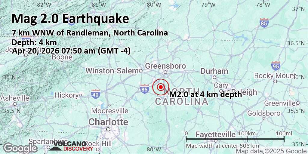
On November 21, 2021, a minor seismic event was recorded in the Piedmont Triad region of North Carolina, specifically near the border between Guilford and Randolph counties. According to data from the United States Geological Survey (USGS), the earthquake registered a magnitude of 2.0 on the Richter scale and occurred at approximately 9:58 a.m. Eastern Standard Time. The epicenter was located roughly 26 kilometers south of Greensboro and about 6 kilometers southwest of Winston-Salem, placing it in a rural section of Randolph County close to the Davidson County line.
Though classified as a very low-intensity tremor, the event was notable for the number of public reports it generated. The USGS “Did You Feel It?” system logged 228 individual responses from residents who perceived the shaking, primarily concentrated in and around Winston-Salem, High Point and surrounding communities in Forsyth and Guilford counties. Most reports described weak shaking, consistent with an intensity level of II to III on the Modified Mercalli Intensity Scale, meaning it was felt only by a few people at rest, particularly on upper floors of buildings.
Such minor seismic activity, while uncommon in public discourse, is not unusual for the broader region. North Carolina lies within the stable interior of the North American tectonic plate, far from active plate boundaries, yet experiences occasional low-magnitude earthquakes due to ancient faults and residual tectonic stress. The Eastern Tennessee Seismic Zone, one of the most active in the southeastern United States, extends into parts of western North Carolina, though the 2021 event occurred well east of this primary zone.
Historical records indicate that the Piedmont region has experienced similar tremors over the past century. A magnitude 2.9 quake was recorded near Lake Norman in 2018, and a 2.1 magnitude event occurred near Salisbury in 2020. None of these events caused structural damage or injuries, consistent with the general pattern that earthquakes below magnitude 3.0 rarely result in measurable harm to infrastructure.
The USGS continues to monitor seismic activity across the eastern United States through its Advanced National Seismic Network (ANSS), which includes seismograph stations in North Carolina operated in partnership with academic and state agencies. Data from these stations contribute to national hazard assessments and help scientists better understand intraplate seismicity—earthquakes occurring within tectonic plates rather than at their edges.
For residents seeking real-time updates on seismic events, the USGS Earthquake Hazards Program provides an interactive map and notification system accessible via earthquake.usgs.gov. The platform allows users to filter by magnitude, location, and time, offering transparent access to both recent and historical data. Local emergency management offices in Guilford, Randolph, and Forsyth counties also maintain public alert systems, though no warnings were issued for this event due to its minimal impact.
While the tremor itself posed no risk, it serves as a reminder of the subtle geological processes constantly shaping the Earth’s crust, even in regions not typically associated with seismic activity. Experts emphasize that public awareness and access to accurate information are key to preventing unnecessary alarm during such events. The 2021 Randolph County quake, though minor, contributed valuable data to the ongoing study of eastern U.S. Seismology.
As of the latest available records, there have been no follow-up seismic events of comparable magnitude in the immediate vicinity since November 2021. The USGS maintains that while future small tremors remain possible, the likelihood of a damaging earthquake in central North Carolina remains extremely low. Residents are encouraged to stay informed through official channels rather than social media speculation.
Understanding the difference between hazard and actual risk is essential in contextualizing events like this one. Hazard refers to the possibility of an event occurring, while risk incorporates both probability and potential consequences. In this case, although the hazard of minor seismic activity exists, the actual risk to life and property was negligible.
For readers interested in learning more about earthquake preparedness, even in low-risk areas, the Federal Emergency Management Agency (FEMA) offers guidelines on basic safety measures, such as securing heavy furniture and knowing how to protect oneself during shaking. These recommendations apply universally, regardless of location.
To date, no official investigations or geological surveys have been launched specifically in response to the 2021 event, as it fell well within the expected range of background seismicity for the region. Academic institutions such as Appalachian State University and the University of North Carolina system continue to study regional ground motion through long-term monitoring projects.
Looking ahead, the next routine update to the USGS National Seismic Hazard Map is expected in the coming years, which will incorporate the latest data from events like the 2021 Randolph County tremor. These maps inform building codes, insurance models, and emergency planning across the United States.
We encourage our readers to share their experiences if they felt the tremor and to rely on verified sources for information about natural phenomena. Stay informed, stay curious, and remember that even the smallest events can contribute to our collective understanding of the planet we inhabit.
Related reading
- Empowering Youth: China’s Community-Based Summer Public Welfare Programs and Creative Classrooms
- Best USA Travel Experiences & Destinations
- Nvidia Reports Record Revenue Amid Debate Over Stock Valuation Multiples (archyworldys.com)
- Adecco Reports Organic Growth and Market Gains Despite Lower Net Profit (time.news)