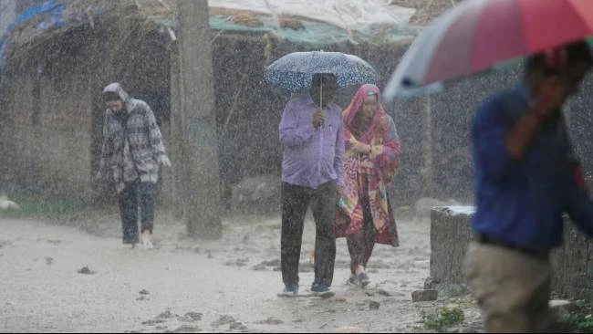
The Indonesian Agency for Meteorology, Climatology, and Geophysics (BMKG) issued an early warning for heavy rainfall and potential flooding in two provinces on July 7 and 8, 2026. This alert follows the detection of Tropical Cyclone Bavi, which meteorologists say is driving significant moisture and instability across the Sumatra region, increasing the risk of extreme weather events.
The BMKG alert specifically places two provinces on “siaga” (alert) status, warning residents of intense rainfall that could trigger landslides and flash floods. While other regions of Indonesia are expected to experience light rain or cloudy conditions, the concentration of the storm’s influence remains centered on the western islands. This weather pattern is a direct result of the atmospheric pressure changes associated with the movement of Cyclone Bavi.
The BMKG continues to track the cyclone's trajectory to determine if the alert status needs to be upgraded for neighboring regions.
Why is Tropical Cyclone Bavi causing heavy rain in Sumatra?
Tropical Cyclone Bavi acts as a primary driver for the current weather instability in Indonesia. According to data from the BMKG, cyclones in the surrounding oceans can pull moisture-rich air toward the archipelago, creating conveyor belts of humidity that result in prolonged, heavy precipitation. In this instance, the cyclone’s interaction with local wind patterns has intensified rainfall specifically over Sumatra.

This phenomenon is not isolated. Previous reports from MetroTV and other regional outlets indicate that the presence of such systems often leads to a “siaga” status when rainfall totals are expected to exceed safe thresholds for soil stability. When moisture is trapped against the mountainous terrain of Sumatra, it often leads to rapid runoff and increased river levels.
Which provinces are under the BMKG alert?
The BMKG has designated two specific provinces as being under alert status for July 7 and 8, 2026. While the agency’s broad forecast for the rest of the country suggests light rain and thick clouds—as noted in reports from Harian Jogja and ANTARA News Jambi—the risk is concentrated in the westernmost sectors of the country.
The “siaga” status is a formal designation used by the Indonesian government to signal that emergency services should be on standby. This level of alert is typically triggered when weather models predict rainfall intensity that could overwhelm urban drainage systems or cause rural riverbanks to overflow.
How does this compare to other recent weather patterns?
The current situation differs from the broader national forecast. For example, while CNN Indonesia reported that 16 different regions were potentially facing rain on previous dates, the July 7-8 window is more localized and severe due to the specific influence of Cyclone Bavi. Most of the archipelago is experiencing a transition toward lighter rain, whereas the two affected provinces are facing a localized spike in intensity.

This contrast highlights the difference between general seasonal rain and storm-driven events. Seasonal rain is often distributed and predictable, but cyclone-driven rain is characterized by higher volume in shorter durations, which increases the immediate risk of flash flooding.