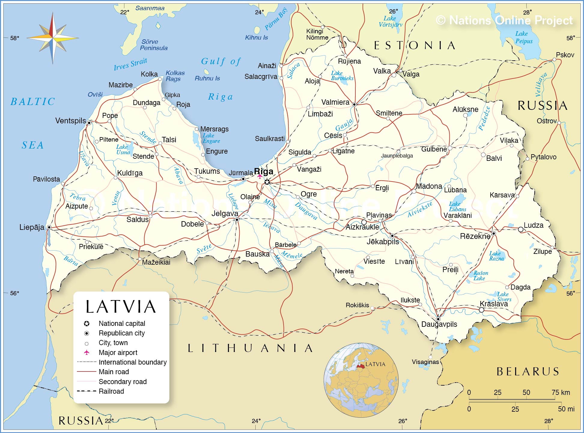
Latvia is under a yellow weather warning following forecasts of severe thunderstorms and heavy rainfall, specifically targeting the northern parts of Kurzeme and Vidzeme. According to the Latvian Environment, Geology and Climate Centre (LVKC), these conditions are expected to bring intense precipitation and lightning strikes to isolated areas of the country.
The yellow warning indicates that while the weather may not be extreme for the entire nation, specific regions face a heightened risk of localized flooding and wind damage. Residents in the affected northern districts are advised to monitor real-time updates as the storm fronts move across the Baltic region.
Meteorological data suggests a volatile mid-week pattern. While heavy rain is the primary concern for Wednesday and Thursday, forecasts indicate a transition toward more stable, warmer conditions by the weekend. This shift is typical for the current seasonal transition, where contrasting air masses create instability over the Baltic plains.
Which regions in Latvia are most affected by the yellow warning?
The most critical alerts are concentrated in northern Kurzeme and northern Vidzeme. These areas are identified as the primary zones for the most intense thunderstorm activity. According to reports from local news outlets including Liepajniekiem.lv, the atmospheric conditions in these regions are most conducive to the development of powerful convective cells, which lead to sudden, heavy downpours.
The LVKC uses the yellow warning level to signal that the weather may be hazardous. This typically means that the expected wind speeds or rainfall totals exceed the normal thresholds for the season, potentially disrupting local transport and outdoor activities. The center encourages citizens to check the official LVKC weather portal for the most precise regional maps and timing of the storm cells.
How will the weather evolve through the weekend?
The current instability is expected to persist through the middle of the week, with heavy rainfall remaining the dominant feature. However, data from Delfi and LSM indicates a warming trend toward the end of the following week. This suggests that the current low-pressure system will be replaced by a higher-pressure ridge, bringing clearer skies and higher temperatures.
The transition from storm-heavy weekdays to a warmer weekend is expected to provide a window of improved weather for the general population. While the immediate threat is the thunderstorms in the north, the broader forecast suggests a gradual climb in temperature, moving away from the damp, unsettled conditions currently affecting the Baltic states.
What safety precautions should residents take during a yellow warning?
During a yellow warning for thunderstorms, the LVKC and emergency services generally recommend several safety protocols to mitigate risk from lightning and flash flooding. Because these storms can develop rapidly, residents in Kurzeme and Vidzeme are urged to secure loose outdoor objects that could be displaced by sudden wind gusts.

Key safety guidelines for these conditions include:
- Seeking shelter in sturdy buildings or vehicles during active lightning.
- Avoiding open fields, forests, and bodies of water when thunder is audible.
- Clearing drainage gutters to prevent localized street flooding during intense rainfall.
- Monitoring official government channels for any escalation from a yellow to an orange or red warning.
The impact of such storms often manifests in short-term power outages and traffic delays due to reduced visibility and water accumulation on primary roads. Drivers are cautioned to exercise extreme vigilance, particularly on regional highways in the north where visibility can drop significantly during a heavy downpour.
For the most current updates and official meteorological alerts, residents should refer to the State Fire and Rescue Service of Latvia for emergency guidance and the LVKC for updated weather maps.
The next scheduled weather update from the LVKC is expected tomorrow morning to determine if the warning zones need to be expanded or downgraded based on the movement of the storm system.