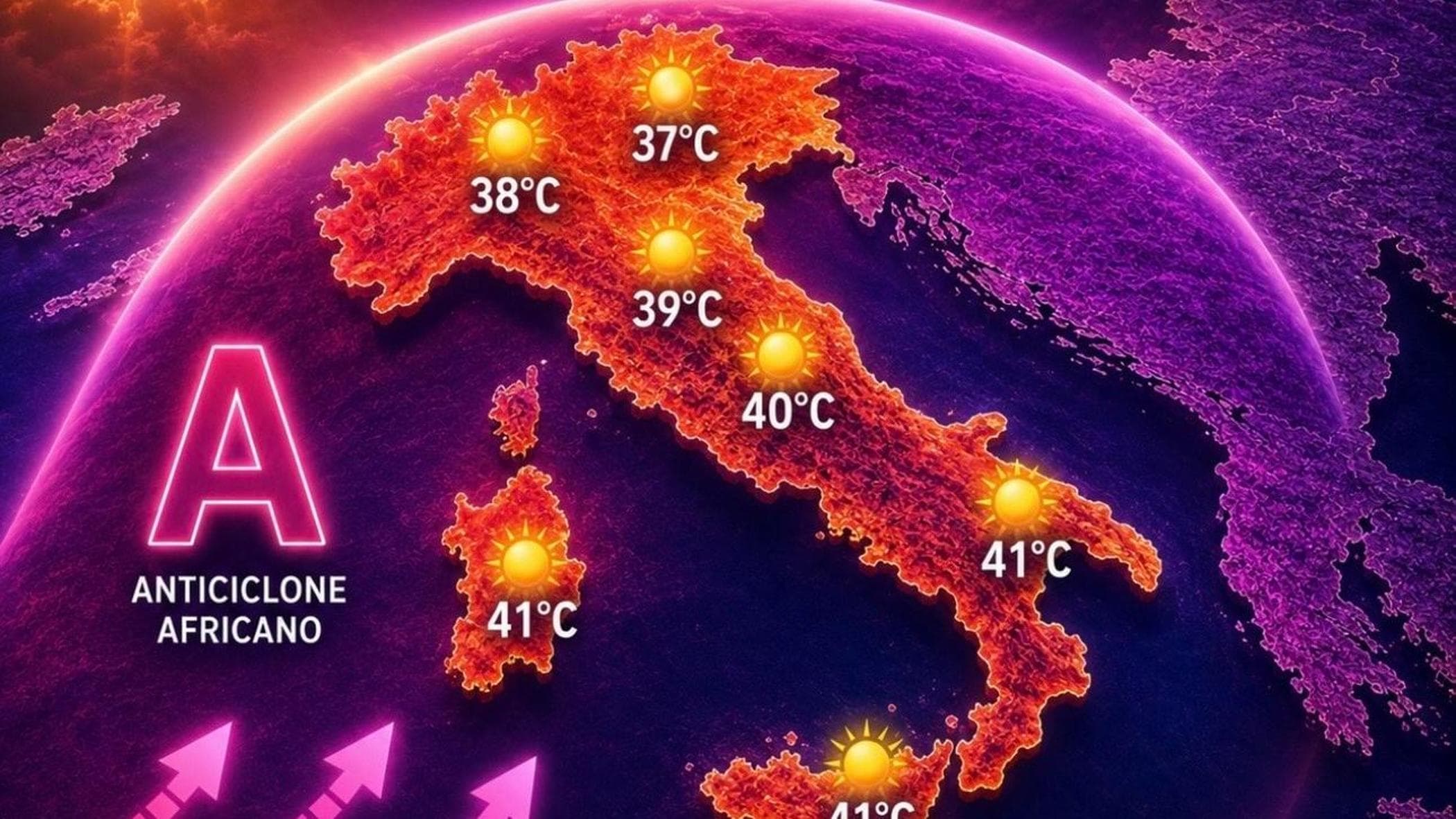
Meteorologists are tracking a significant heatwave across Southern Europe, with forecasts indicating that temperatures will reach extreme levels throughout the coming week. According to data from the Italian Air Force Meteorological Service (Servizio Meteorologico dell’Aeronautica Militare), a high-pressure system of African origin is set to envelop the Mediterranean, driving mercury levels to peak values near 40°C in several regions. This atmospheric configuration is expected to result in stable, dry conditions with minimal precipitation, heightening concerns regarding heat-related health risks and environmental strain.
Atmospheric Dynamics and Rising Temperatures
The core of this heat anomaly is driven by a massive anticyclone pushing warm air masses northward from the Sahara. At the reference altitude of 1,500 meters—a standard level for meteorological analysis—temperatures are expected to reach approximately 30°C. This is significantly above the seasonal average for this time of year, according to reports from the European Centre for Medium-Range Weather Forecasts (ECMWF). The intensity of this warming is compressing the atmosphere, which in turn acts to trap heat at lower altitudes, preventing the cooling effects typically provided by convective thunderstorm activity.
The impact will be most pronounced in the islands and southern peninsular areas. Sardinia and Sicily are currently identified as the epicenters of this spike, where the combination of high humidity and elevated ambient temperatures will likely push the “perceived temperature” even higher than the thermometer readings. Meteorological agencies across the region, including the Centro Meteo Italiano, have noted that the lack of significant cloud cover will allow for maximum solar radiation absorption, sustaining the heat throughout the night and preventing natural nocturnal recovery.
Health Advisories and Public Safety
As temperatures climb toward the 40°C threshold, health authorities are advising the public to exercise caution. The Italian Ministry of Health (Ministero della Salute) maintains an active heat-health warning system that monitors urban centers for heat-related illness. Officials suggest that vulnerable populations—specifically the elderly, children, and those with pre-existing respiratory or cardiovascular conditions—should limit outdoor activities during the peak hours of 11:00 AM to 6:00 PM.
Hydration and the maintenance of cool indoor environments are the primary defense strategies recommended by medical professionals. In areas where the heat is most persistent, local municipalities often open cooling centers or extend the operating hours of public facilities with air conditioning. Residents are encouraged to monitor local municipal websites for specific civil protection alerts, as the severity of the heatwave can vary significantly depending on local topography and proximity to the coastline.
The Outlook for Precipitation
One of the defining characteristics of this heatwave is the notable absence of cooling rainfall. Atmospheric stability created by the anticyclone effectively suppresses the formation of clouds that would otherwise trigger afternoon thunderstorms. While mountainous areas often act as natural catalysts for convective rain, the current dry air mass makes even isolated, high-altitude showers unlikely in the short term. According to the latest Copernicus Climate Change Service reports, prolonged periods of such stability are becoming more frequent, complicating water resource management for agricultural sectors that rely on late-summer rainfall.
The current forecast model shows this stable, hot pattern persisting for at least the next five to seven days. Meteorologists will continue to monitor the potential for a “break” in the heat, which typically occurs when a low-pressure system from the Atlantic interacts with the high-pressure ridge, potentially forcing a shift in wind direction and introducing cooler, more unstable air. As of now, the most reliable indicators suggest that the high-temperature trend will remain the dominant feature of the regional climate for the immediate future.
For the most accurate and localized updates, residents should consult the official Department of Civil Protection (Dipartimento della Protezione Civile), which issues daily bulletins regarding weather alerts and potential hydro-geological risks. We will continue to track these developments throughout the week as new data becomes available from regional meteorological stations. Please share your local observations in the comments section below to help your community stay informed.