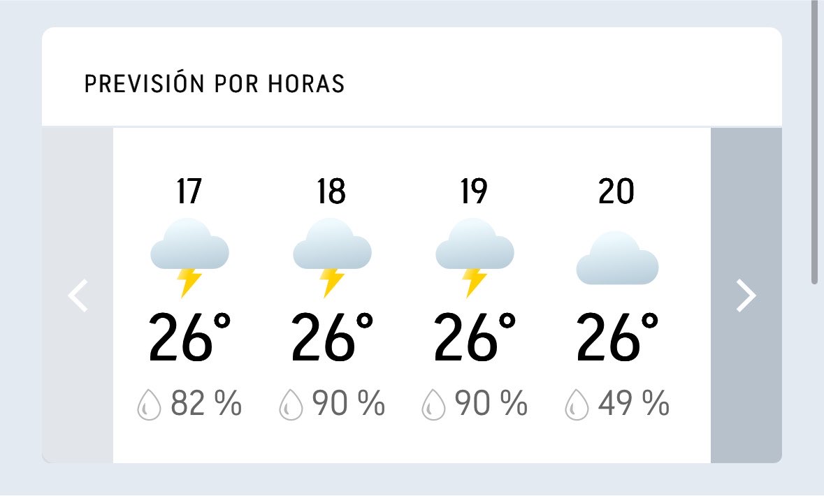
Rain continued to fall across Washington, D.C., accompanied by frequent lightning and heavy downpours, according to forecasts from the National Weather Service. The active weather system prompted local authorities to monitor urban drainage systems and urged commuters to exercise caution on regional roadways as precipitation rates intensified during the afternoon hours.
Meteorologists tracking the regional radar reported that heavy convective activity and associated thunderstorms would persist through the evening, with radar indicators pointing toward clearing conditions after 20:00 local time. The sudden onset of severe weather disrupted late-afternoon transit schedules across the District of Columbia, Maryland, and Virginia corridor.
According to updates issued by the National Weather Service Baltimore/Washington forecast office, saturated ground conditions from previous rainfall increased the potential for localized standing water in low-lying urban areas. Transportation officials advised motorists to reduce speeds and maintain safe following distances as visibility dropped significantly during the peak intensity periods.
Weather Service Tracking and Radar Analysis
Radar imagery shared by federal meteorologists displayed clusters of heavy showers moving steadily across the mid-Atlantic region. The storm cells carried high concentrations of cloud-to-ground lightning and brief gusts of wind that accompanied the heavier precipitation bands over downtown Washington.
Emergency management agencies in the National Capital Region utilized automated sensor networks to monitor stream levels and urban stormwater infrastructure. While major river flooding was not immediately anticipated, municipal works crews responded to localized reports of blocked storm drains and temporary street-level pooling.
Impact on Regional Commuters and Aviation
Airlines operating out of Ronald Reagan Washington National Airport, Washington Dulles International Airport, and Baltimore/Washington International Thurgood Marshall Airport implemented ground delays as the thunderstorm cells traversed the flight paths. Federal Aviation Administration data showed average arrival delays fluctuating as air traffic controllers vectored aircraft around active cells.
Public transit riders experienced minor schedule adjustments on regional bus lines and metro routes as heavy rain reduced outdoor transfer speeds. Commuters seeking real-time transit updates were directed to consult the Washington Metropolitan Area Transit Authority service status portal for specific line delays.
Road maintenance crews remained on standby throughout the afternoon to clear debris and respond to localized hazards reported by the Metropolitan Police Department. Drivers planning evening travel were encouraged to check updated forecasts through the National Weather Service official web portal before departing.
Keep reading