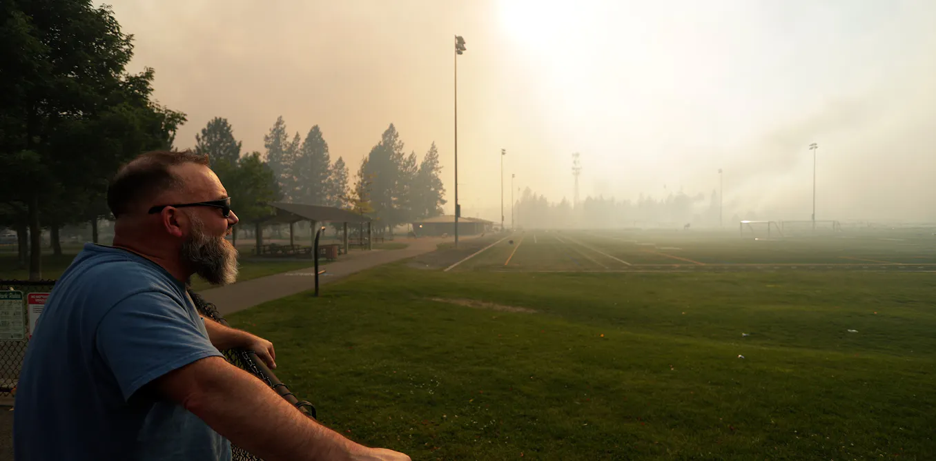
The Spokane Complex Fire tore through neighborhoods in and around Spokane, Washington, over the weekend of Aug. 1, 2026, destroying at least 600 homes and other structures while forcing tens of thousands of residents to evacuate. According to reports from the National Interagency Fire Center, the blazes consumed more than 8,000 acres—equal to roughly 12.5 square miles—within the wildland-urban interface where residential developments intersect with dense forests, shrublands, and grasslands.
Evacuations impacted broad segments of the community, including patients at the local Veterans Affairs medical center, as emergency crews from across both Washington and Idaho rushed to establish containment lines. The destructive scale of the Spokane emergency mirrors a broader national crisis, with the National Interagency Fire Center noting that more than 44,000 wildfires had burned over 5 million acres across the United States by Aug. 3, 2026, tracking well above the typical 10-year average for early August.
Meteorologists and fire behavior analysts had anticipated extreme hazards prior to the ignition. One day before the flames broke out, the National Weather Service issued a rare “particularly dangerous situation” warning for the Spokane region—marking the first time such an alert had been declared in Washington state. Traditional red flag warnings signal critical fire weather conditions like low humidity and gusty winds, but the elevated alert indicated an exceptionally hazardous event capable of catastrophic property damage.
Weather and Climate Drivers Behind the Spokane Complex Fire
The explosive growth of the Old Trails, Fairview, and Autumn Lane fires stemmed from a rare convergence of severe climate pressures and sudden weather shifts, according to regional climatologists. Eastern Washington had been suffering through moderate drought conditions, exacerbated heavily by a historic snow drought earlier in the year. Winter precipitation serves as a vital natural reservoir, releasing meltwater into the soil and forests as spring transitions to summer. Because the region experienced far below normal snowfall alongside unusually warm winter temperatures, local forests dried out weeks ahead of typical seasonal schedules.
This prolonged moisture deficit left timber under severe water stress, rendering trees and brush exceptionally combustible. Although spring rains triggered an abundant growth of grasses and shrubs across the Pacific Northwest, scorching summer temperatures quickly baked that vegetation into a continuous, highly flammable fuel bed. When a dry cold front crossed the Inland Northwest on Aug. 1, it brought sustained winds of 15 to 25 miles per hour with gusts reaching 45 mph, alongside critically low humidity that accelerated the fires’ spread.
Soil moisture data recorded by Drought.gov illustrated the depth of the regional dryness, showing exceptionally low soil moisture across eastern Washington down to 100 centimeters during the weekend of Aug. 1–2, 2026. These compounding variables created an environment where wind-driven embers easily jumped from wooded tracts into adjacent suburban developments.
The Growing Threat of the Wildland-Urban Interface
While massive blazes like the 300,000-acre Big Grass Fire along the Oregon–Idaho border demonstrated widespread Northwest fire activity, the Spokane disaster underscored the unique dangers of fires burning directly inside populated wildland-urban interface zones. Research conducted by fire scientists and climatologists indicates that exposure to wildfire risk has expanded dramatically across the United States over the past two decades.
A comprehensive study tracking contiguous U.S. wildfire data from 2001 to 2020 revealed that 462,069 homes were located directly within wildfire boundaries during that timeframe. Two-thirds of those exposed properties were concentrated in the western United States, where the number of homes falling inside large wildfire perimeters increased sixfold over the 20-year period. Over the same span, home survivability—defined as the percentage of homes within a fire boundary that escaped structural damage—declined by 12%.
Researchers attribute this rising vulnerability to three primary trends: an increase of roughly 15 million homes built in wildland-urban interface areas between 1990 and 2020, intensifying droughts driven by a warming climate, and a century-long legacy of successful fire suppression that allowed heavy fuel loads to accumulate in fire-adapted Western ecosystems.
Strategies for Reducing Wildfire Risk
Experts emphasize that while wildfires remain an inherent part of the North American landscape, communities and individual property owners can take concrete steps to minimize disaster risks. Historically, frequent low-intensity fires cleared out underbrush and dead litter naturally, but aggressive suppression policies combined with modern climate pressures have transformed those landscapes into high-hazard environments.
At the landscape level, forest management professionals advocate for targeted prescribed burning and forest thinning to clear out overgrown vegetation and prevent high-severity crown fires. On a community level, local governments, homeowner associations, and residents can establish community wildfire protection plans that map vulnerable neighborhoods, designate evacuation corridors, and prioritize fuel reduction zones.
Individual homeowners can also implement home hardening techniques to prevent wind-blown embers from igniting residential structures. Fixing vulnerable components such as roofs, windows and openings, alongside maintaining a defensible space—particularly keeping the immediate five-foot perimeter known as Zone 0 entirely free of combustible materials—significantly improves the likelihood of a structure surviving a passing wildfire.
Federal funding for ongoing research into these mitigation strategies is supported by agencies including the U.S. National Science Foundation, the Joint Fire Science Program, the U.S. Forest Service, NOAA, and NASA, according to project disclosures from researchers Mojtaba Sadegh and John Abatzoglou. Local emergency management agencies continue to monitor containment progress on the Spokane Complex Fire as firefighting crews work to secure perimeter lines.
Official updates, emergency advisories, and recovery resources for residents affected by the Spokane fires are available through local municipal portals and state emergency management agencies. Readers are encouraged to share this report and join the discussion in the comments section below.
Related reading