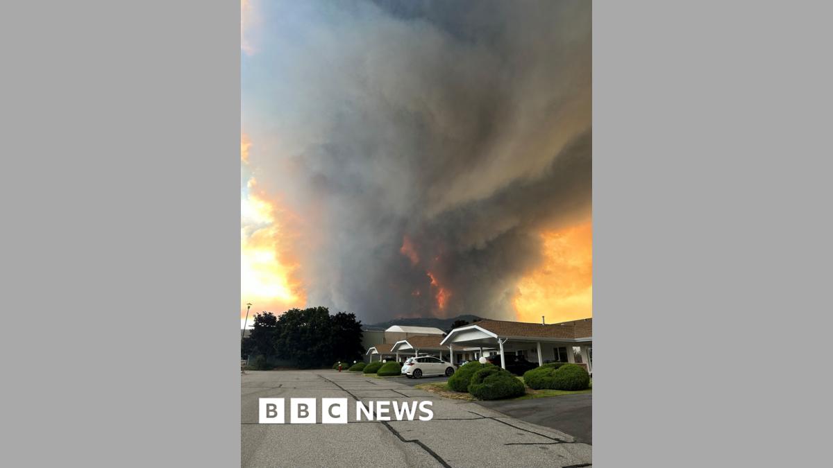
The Bald Range wildfire in British Columbia has more than doubled in size, expanding to cover over 36 square miles (95 square kilometers) and prompting urgent evacuation orders for residents in its path, according to provincial emergency officials. Driven by persistent dry conditions and shifting winds, the aggressive blaze remains classified as out of control, forcing thousands of people to flee their homes as ground crews and aerial firefighting units struggle to contain the rapidly advancing flames.
Provincial wildfire management agencies report that extreme fire behavior is severely hampering suppression efforts across the region. The dramatic surge in acreage over recent days highlights a severe early escalation in regional wildfire activity, catching local emergency response teams in a race against worsening meteorological forecasts. Authorities continue to issue immediate evacuation alerts and orders as smoke plumes darken skies and threaten critical infrastructure.
Emergency management officials stress that preserving human life remains the absolute priority as local responders coordinate tactical evacuations. Residents living within the designated threat zones are urged to monitor municipal alert systems closely and vacate immediately when orders are issued. Provincial support centers have been established to assist displaced individuals with emergency lodging, food, and essential resources.
Evacuation Orders and Affected Communities
Thousands of residents across the affected British Columbia districts face mandatory evacuation directives as the Bald Range wildfire marches closer to residential neighborhoods. Local authorities have established multiple reception centers to handle the influx of displaced families and livestock. Transport routes out of the danger zones experience heavy congestion as emergency services urge motorists to exercise caution and follow designated evacuation corridors.
Community leaders and emergency coordinators emphasize that failing to evacuate promptly puts both residents and first responders at grave risk. Local law enforcement agencies have deployed additional patrols to secure evacuated properties and manage traffic flow along critical arteries. Support services, including emergency financial assistance and temporary housing coordination, are actively being scaled up by provincial welfare agencies.
Regional school districts and community facilities within the alert zones remain closed until further notice. Healthcare providers in the area have also enacted emergency contingency plans, relocating vulnerable patients from regional clinics and care facilities to safer medical centers further away from the smoke and fire front.
Firefighting Strategies and Weather Challenges
Firefighting personnel deployed to the Bald Range incident face immense challenges due to steep terrain, limited ground access, and high ambient temperatures. Aerial tankers and helicopter bucket drops operate continuously when visibility permits, attempting to cool active fire edges and build containment lines. However, sudden wind shifts frequently breach established lines, forcing crews to pull back to safer anchor points.
Meteorologists collaborating with the provincial wildfire service indicate that relief in the form of substantial precipitation is not immediately expected. Low relative humidity and dry lightning risks continue to threaten the region, raising concerns that existing fires could flare up or spark new ignitions nearby. Command staff are reallocating heavy machinery and specialized hotshot crews from less active sectors to reinforce the perimeters threatening populated areas.
Interagency cooperation remains robust, bringing in specialized wildfire personnel from neighboring jurisdictions to bolster local ranks. Incident commanders hold regular operational briefings to realign strategy based on daily infrared mapping and predictive weather modeling.
Official Resources and Next Steps
Residents seeking real-time updates regarding evacuation boundaries, highway closures, and emergency support can consult the official British Columbia wildfire service portal and local municipal emergency dashboards. Authorities remind the public to rely exclusively on verified government channels for safety directives rather than unconfirmed reports circulating on social media.
The next formal operational briefing from provincial emergency management officials is scheduled for tomorrow morning, where updated acreage figures and containment percentages will be released. We invite our readers to share their thoughts or local observations in the comments below, and to share this report to help keep affected communities informed.