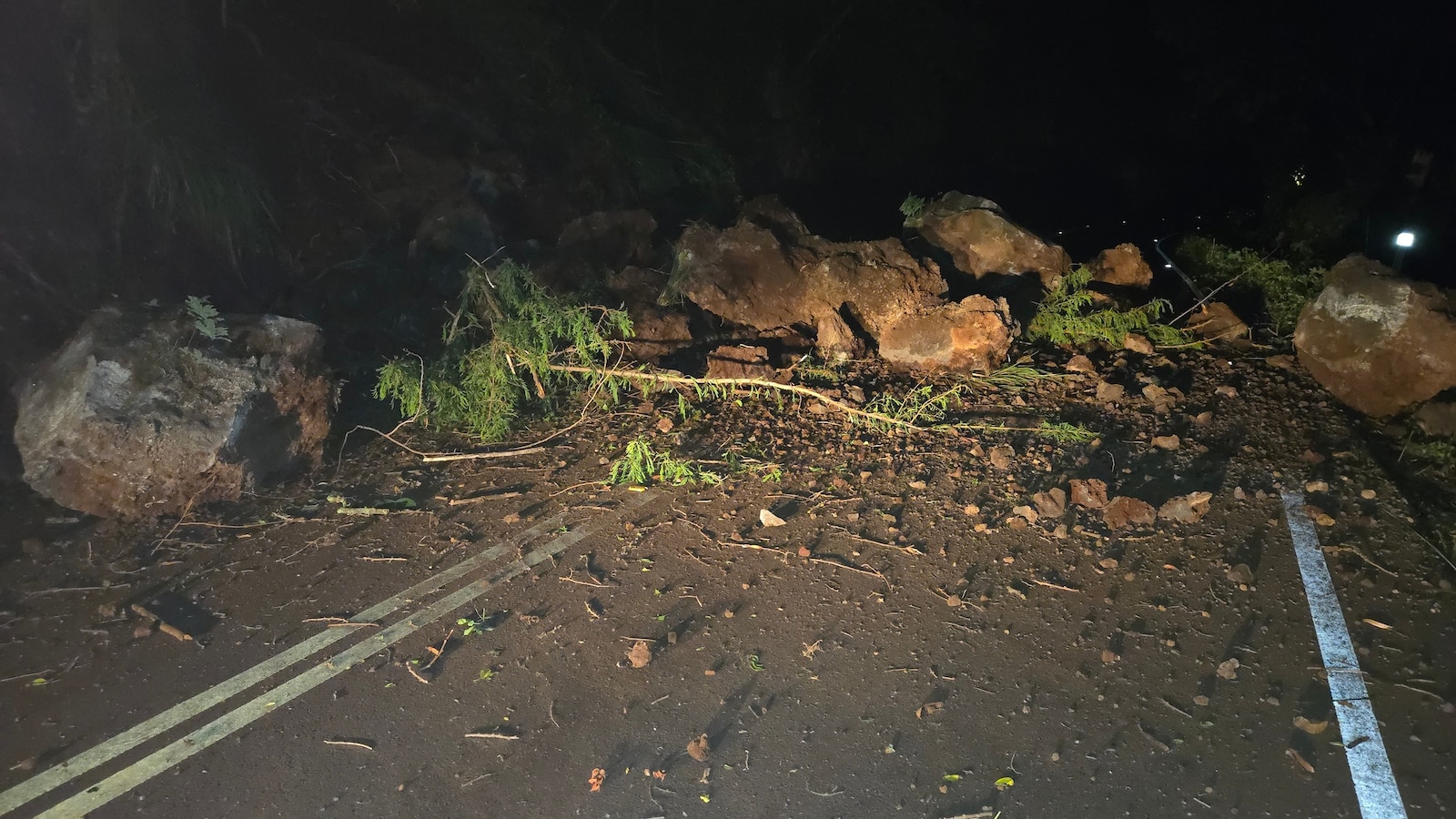
Reports of significant seismic activity off the coast of Hawaii have prompted close monitoring by geological agencies following a reported 6.0 magnitude earthquake south of Honaunau-Napoopoo. While the scale of the tremor is substantial, emergency management officials have indicated that there is no immediate danger of a tsunami resulting from this specific event.
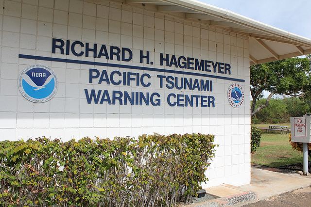
The earthquake, centered in the waters south of the Kona district on the Big Island, has sent ripples of concern through local communities. However, the Pacific Tsunami Warning Center (PTWC) has issued a status update confirming that there are currently no tsunami threats to the Hawaiian Islands or other Pacific territories. Residents are being advised to stay tuned to official channels for any changes in the situation.
As of this writing, seismic monitoring stations are continuing to collect data to determine the exact depth and precise epicenter of the tremor. For those in the affected region, the primary focus remains on assessing any potential local impacts and maintaining situational awareness through official government alerts.
Immediate Response and Tsunami Status
In the wake of a magnitude 6.0 earthquake, the primary concern for coastal populations is often the potential for a tsunami. Tsunamis are typically triggered by large-scale vertical displacements of the ocean floor, often caused by subduction zone earthquakes. Because this event occurred near the Kona coast, the Pacific Tsunami Warning Center immediately activated its monitoring protocols to evaluate sea-level changes.
The PTWC’s current assessment remains clear: no tsunami warning, advisory, or watch is in effect. This determination is based on real-time data from deep-ocean assessment and reporting (DART) buoys and coastal tide gauges, which monitor for the subtle pressure changes that signal an incoming wave. While the “no threat” status provides significant relief, seismologists note that in the early stages of a seismic event, data is continuously updated as more sensors report in.
Local authorities in Hawaii are working in coordination with the United States Geological Survey (USGS) to ensure that all seismic data is accurately processed. Residents in low-lying coastal areas near Honaunau-Napoopoo are encouraged to remain vigilant and follow the guidance of local emergency management agencies.
Understanding Magnitude: The Impact of a 6.0 Event
To understand the significance of this event, it is essential to distinguish between the different ways scientists measure earthquake intensity. A 6.0 magnitude earthquake is classified as “strong” on the Moment Magnitude Scale (MMS). This scale measures the total energy released at the source of the earthquake, rather than just the shaking felt at a specific location.
A magnitude 6.0 earthquake releases a vast amount of energy—significantly more than a magnitude 5.0 or a magnitude 4.0. On the logarithmic scale used by seismologists, each whole-number increase represents approximately 32 times more energy release. A 6.0 event is capable of causing moderate damage to buildings, particularly those that are not constructed to modern seismic standards, and can result in noticeable ground shaking over a wide area.
The intensity of the shaking felt by residents in Honaunau and surrounding areas will depend on several factors, including:
- Depth: Shorter, shallower earthquakes generally cause more intense surface shaking.
- Distance: The closer an individual is to the epicenter, the more violent the perceived motion.
- Local Geology: Areas with soft soil or sediment can amplify seismic waves, whereas solid bedrock tends to dampen them.
Geological Context: The Hawaii Hotspot and Seismic Activity
The occurrence of an earthquake of this magnitude near the Big Island is consistent with the complex geological setting of the Hawaiian archipelago. Unlike many other parts of the “Pacific Ring of Fire,” where earthquakes are primarily driven by the collision or subduction of tectonic plates, Hawaii is a volcanic hotspot. This means the islands are formed by a plume of intense heat rising from deep within the Earth’s mantle.
As the Pacific Plate moves slowly over this stationary hotspot, it creates a chain of volcanic islands. This movement and the resulting volcanic activity can lead to various types of seismic events. While many earthquakes in Hawaii are small and related to volcanic inflation or magma movement, larger events can occur due to crustal adjustments or faulting within the plate itself.
The region south of Honaunau-Napoopoo is part of a dynamic maritime environment where the Earth’s crust is under constant stress. Understanding these underlying tectonic and volcanic processes is vital for long-term hazard assessment and the development of resilient infrastructure in the Hawaiian Islands.
Tsunami Detection and the Role of the PTWC
The ability to quickly rule out a tsunami threat is a cornerstone of public safety in the Pacific. The Pacific Tsunami Warning Center utilizes a sophisticated network of tools to maintain this capability. This network includes:
Seismic Sensors: The first line of defense. When an earthquake occurs, seismometers worldwide detect the primary (P) and secondary (S) waves, allowing scientists to quickly estimate the magnitude and location.
DART Buoy System: Once a significant earthquake is detected, scientists look to the Deep-ocean Assessment and Reporting of Tsunamis (DART) system. These buoys sit on the ocean floor and detect minute changes in water pressure caused by a passing tsunami wave. This data is transmitted via satellite to warning centers, providing near-instantaneous verification of a wave’s existence.
Tide Gauges: Coastal tide gauges provide a final layer of verification by measuring the actual rise and fall of sea levels at the shoreline. This data is critical for determining the timing and height of any potential impact on coastal communities.
Key Takeaways for Residents
| Category | Status/Detail |
|---|---|
| Event Magnitude | Reported 6.0 |
| Primary Location | South of Honaunau-Napoopoo, HI |
| Tsunami Threat | None currently reported by PTWC |
| Official Agencies | USGS, PTWC, NOAA |
Safety and Preparedness: What to Do Next
Even when no tsunami threat is present, earthquakes can cause secondary hazards such as landslides, structural damage, or utility failures. Emergency management experts recommend a “Drop, Cover, and Hold On” approach during any active shaking to minimize injury from falling objects.
For residents of the Kona coast and the broader Hawaiian Islands, ongoing preparedness is essential. This includes maintaining an emergency supply kit, having a family communication plan, and staying informed through multiple reliable sources. In the event of a future tsunami warning, the standard protocol is to move inland or to higher ground immediately and stay there until an official “all clear” is issued by authorities.
Official updates regarding the seismic activity and any changes to the tsunami status will be released through the Pacific Tsunami Warning Center and local Hawaii emergency management offices. We will continue to monitor the situation as more data becomes available from the USGS.
Next Update: We are awaiting the next detailed seismic analysis from the USGS, which will provide more precise data on the earthquake’s depth and exact coordinates.
Stay informed on breaking global news. Please share this report with your community and leave your comments or questions below.