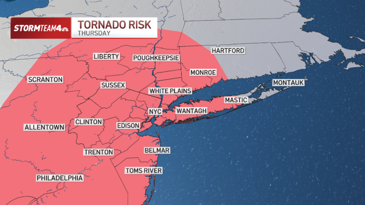
New York City and the surrounding tri-state area face a period of severe weather and extreme heat this week, with meteorologists warning of potential tornadoes, damaging winds, and localized flooding. The most significant risk arrives Thursday, when thunderstorms are expected to intensify, coinciding with heat index readings that could reach 102 degrees.
When will the severe weather hit the tri-state area?
Meteorological forecasts indicate that the period of calm weather across the region will transition into a volatile pattern starting Wednesday. While isolated storms are expected to impact the tri-state area through Friday, the intensity of these weather events is projected to peak on Thursday. Weather models suggest that late-day storms on Thursday will be more numerous and significantly stronger than those seen earlier in the week.
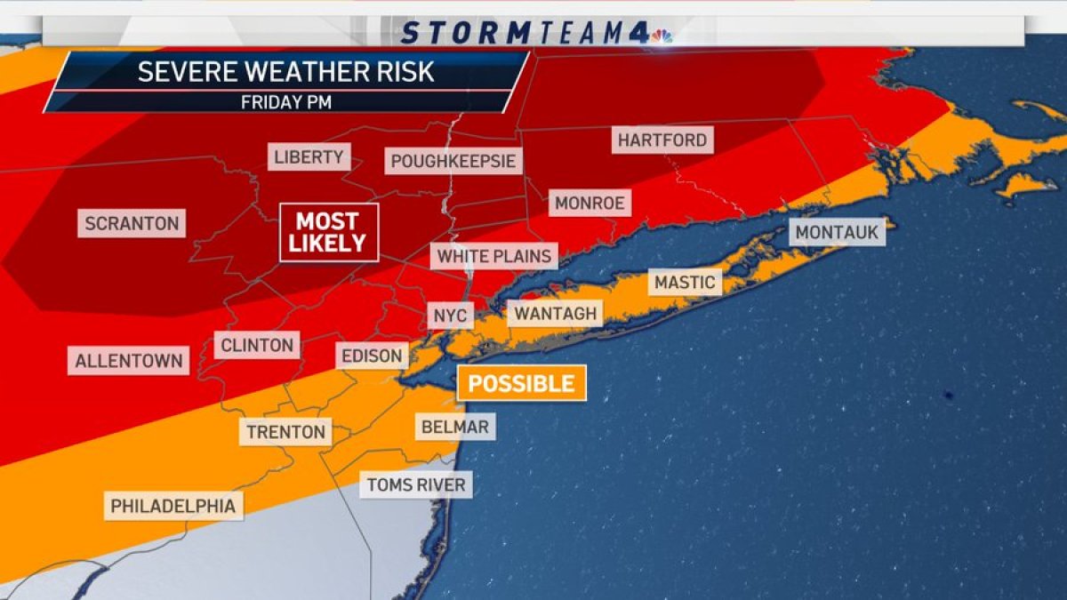
According to local weather advisories, the primary window for severe activity will occur during the evening hours from Wednesday through Friday. Forecasters note that while Wednesday may see scattered activity, Thursday remains the day of highest concern for residents and businesses across the region. The threat is not limited to a single borough but is expected to cover most of the tri-state area.
What are the primary threats during Thursday’s storms?
The severe weather forecast for Thursday includes several distinct hazards. Forecasters have identified the possibility of an isolated weak tornado or two, particularly during the evening hours. While the probability of a tornado is currently rated similarly to the risk of localized flooding, the threat of damaging straight-line winds remains the most prominent danger to the region.
In addition to wind and tornadic activity, residents should prepare for the following:
- Hail: Thunderstorms are expected to produce hail, which can damage vehicles, property, and landscaping.
- Localized Flooding: Heavy rainfall accompanying the storm cells may lead to flash flooding in low-lying areas and urban environments.
- Damaging Winds: Straight-line winds are cited as a primary threat, capable of causing power outages and structural damage.
Emergency management officials recommend that residents monitor local weather alerts closely. Utilizing mobile weather applications and having a way to receive instant notifications is critical during the Thursday evening window when storm cells are most active.
How will extreme heat affect the region?
Compounding the risk of severe storms is a significant heat wave expected to blanket the tri-state area on Thursday and Friday. High humidity levels combined with temperatures in the lower 90s are expected to create dangerous conditions for those outdoors. The National Weather Service utilizes the heat index to measure how temperature and humidity work together to affect human health.
On Thursday and Friday afternoons, heat index readings are projected to range between 95 and 102 degrees. This spike is driven by high dew points, which are expected to reach the 70-degree range. When dew points rise to these levels, the body’s ability to cool itself through perspiration is significantly diminished, increasing the risk of heat-related illnesses such as heat exhaustion and heat stroke.
From a business and infrastructure perspective, this extreme heat often leads to increased energy demand. Utility providers typically monitor grid stability closely during such periods as air conditioning usage spikes across metropolitan areas. Businesses operating in outdoor sectors or those managing large workforces should implement heat safety protocols to protect employees during the hottest parts of the day.
What is the weather outlook for the upcoming weekend?
Conditions are expected to improve as the weekend approaches. By Saturday, humidity levels are forecasted to drop, which will lead to a more moderate “feels-like” temperature. Furthermore, the probability of precipitation is expected to evaporate, providing a window of clearer weather for outdoor activities.
The transition to a drier, less humid pattern should provide relief for those planning outdoor events on Saturday and Sunday. While the severe threats of the mid-week period are expected to subside, residents should still remain aware of any shifting local conditions as the atmosphere stabilizes.
Weather Forecast Summary
| Day | Primary Weather Threat | Estimated Heat Index | Storm Intensity |
|---|---|---|---|
| Wednesday | Isolated storms (evening) | Moderate | Low to Moderate |
| Thursday | Tornado, wind, hail, flooding | 95°F – 102°F | High |
| Friday | Isolated storms & extreme heat | 95°F – 100°F | Moderate |
| Saturday | Clearer skies, lower humidity | Moderate | Low |
| Sunday | Fair weather | Moderate | Low |
Frequently Asked Questions
What should I do if a tornado warning is issued?
If a tornado warning is issued for your area, seek shelter immediately in a basement or an interior room on the lowest floor of a sturdy building. Stay away from windows and cover your head to protect against flying debris.

How can I stay safe during the extreme heat?
Stay hydrated by drinking plenty of water, even if you do not feel thirsty. Limit strenuous outdoor activities to the early morning or late evening hours, and seek air-conditioned environments whenever possible. If you feel dizzy, nauseated, or develop a headache, seek shade and cool water immediately.
Will the storms cause power outages?
While not guaranteed, the combination of damaging straight-line winds and heavy thunderstorms increases the risk of localized power outages due to downed tree limbs or equipment failure. It is advisable to have flashlights and charged portable power banks available.
The next official meteorological update is expected via the National Weather Service as storm systems develop. We will continue to monitor these developments closely.
Please share this update with your network to ensure friends and colleagues in the tri-state area are prepared for the coming weather. Leave your comments below regarding your local conditions.
Related reading