
A magnitude 4.6 earthquake struck near San Fernando in the Nazca province of Peru on Wednesday, according to data from the Instituto Geofísico del Perú (IGP). The seismic event, which occurred at 10:33 a.m. local time, was felt by residents in the surrounding coastal region, though local authorities have not reported significant structural damage or casualties as of Wednesday afternoon.
The epicenter of the tremor was located approximately 51 kilometers southwest of San Fernando, situated at a depth of 35 kilometers, as reported by the Instituto Geofísico del Perú (IGP). Seismic activity is a frequent occurrence in Peru due to the country’s position along the Pacific Ring of Fire, a major area in the basin of the Pacific Ocean where many earthquakes and volcanic eruptions occur. The Nazca Plate’s subduction beneath the South American Plate is the primary tectonic driver for the region’s high seismicity, a process studied extensively by geological agencies globally.
Emergency Response and Public Safety Protocols
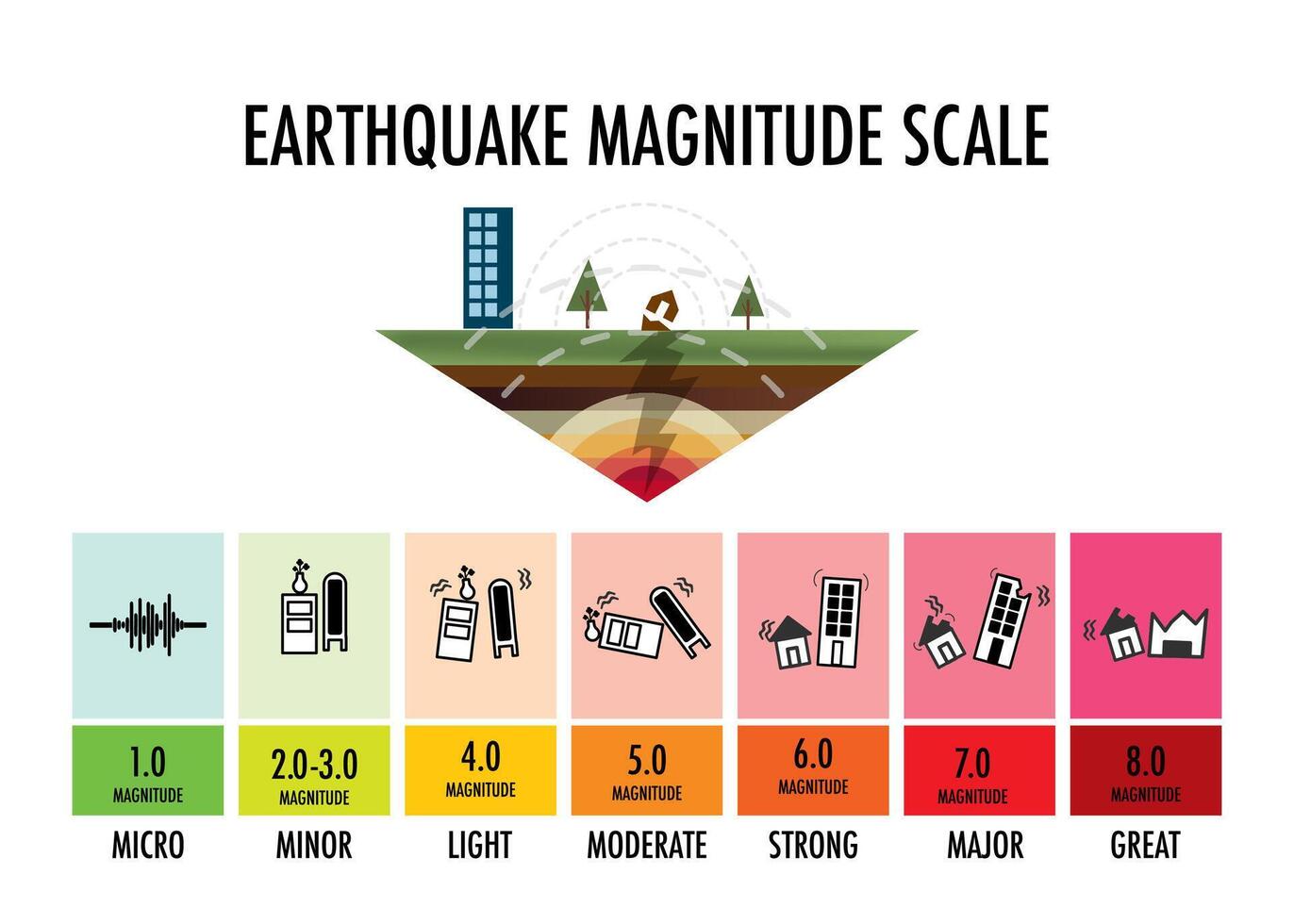
Following the event, the Instituto Nacional de Defensa Civil (INDECI) advised residents in the Ica region to remain calm and follow established evacuation procedures. While a magnitude 4.6 event is categorized as “light” to “moderate” on the moment magnitude scale, it is sufficient to cause alarm in populated areas. INDECI maintains a permanent monitoring system to evaluate potential risks after any seismic activity, particularly in coastal zones where infrastructure may be vulnerable to ground shaking.
Peruvian authorities consistently emphasize the importance of preparedness. Residents are encouraged to maintain a “mochila de emergencia” (emergency backpack) containing essential supplies such as water, non-perishable food, flashlights, and a first-aid kit. In the event of an earthquake, official guidelines suggest moving to designated safety zones and avoiding the use of elevators, as electrical systems may be compromised during or after the shaking.
Understanding Seismic Risk in the Nazca Region
The San Fernando area, located within the Ica Department, has historically been subject to significant seismic shifts. The Centro Sismológico Nacional provides real-time updates on all seismic activity across the country, allowing the public to track tremors as they are verified. Because Peru is highly prone to earthquakes, building codes have been progressively updated over the last two decades to require structures to meet higher resistance standards, particularly in regions identified as high-risk by the government.
Experts note that while a 4.6 magnitude tremor is not typically destructive, it serves as a reminder of the latent tectonic pressure in the Nazca subduction zone. The IGP continues to analyze the data from this morning’s event to determine if it is an isolated occurrence or part of a larger sequence of crustal adjustments. There have been no tsunami warnings issued by the Dirección de Hidrografía y Navegación de la Marina de Guerra del Perú, as the magnitude did not meet the criteria for generating a significant sea-level disturbance.
How to Access Official Earthquake Information
For those seeking verified information during future seismic events, the IGP’s official website and social media channels remain the most reliable sources. Relying on verified government data is essential to avoid the spread of misinformation that often circulates on social media platforms following a tremor. The IGP updates its seismic catalog continuously, providing precise coordinates and depths for every registered event.
Updates regarding infrastructure inspections or any delayed reports of damage will be provided by regional emergency management offices in the coming days. Residents are encouraged to check the official government portal for ongoing safety advice and to report any structural concerns to their local municipal authorities. If you have experienced this earthquake or have information regarding its impact in your specific area, we invite you to share your observations in the comments section below.