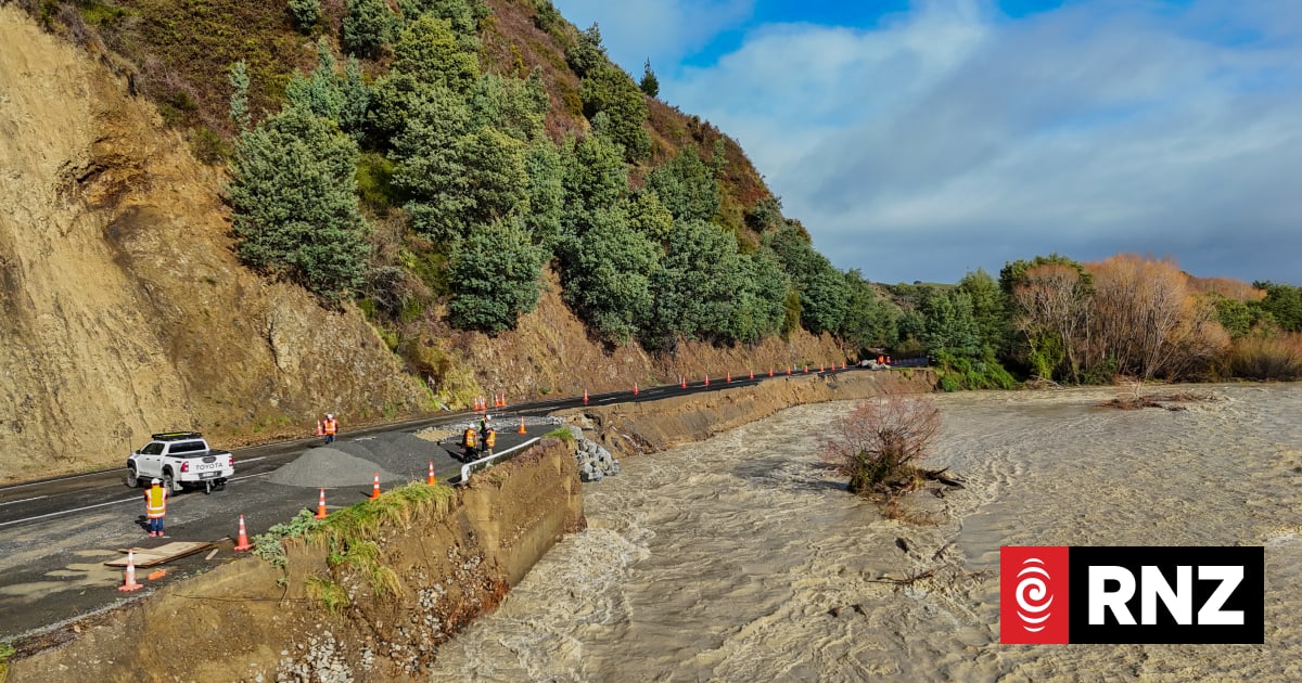
The Kaikōura District Council has issued a formal advisory warning residents and travelers of a continuing risk of landslides across the district following recent heavy rainfall. Local authorities have emphasized that the region’s topography remains saturated, significantly increasing the likelihood of debris movement on steep slopes and along key transport corridors.
The warning comes as the South Island region deals with the aftermath of severe weather systems that have impacted infrastructure and soil stability. According to official updates from the Kaikōura District Council, the public should exercise extreme caution when traveling, particularly on coastal roads and inland routes where the terrain is prone to shifting. The council noted that while recovery efforts are ongoing, the saturated ground means that even minor additional rainfall could trigger further slope failures.
Understanding the Geological Risks in Kaikōura
Kaikōura’s unique geological profile, characterized by steep, rugged ranges meeting the coastline, makes it inherently susceptible to seismic and weather-related instability. This risk profile was fundamentally altered by the 7.8 magnitude earthquake in 2016, which loosened vast amounts of rock and soil across the landscape. As documented by GeoNet, the official monitor for geological hazards in New Zealand, the recovery of these slopes remains a long-term process, and heavy rain events frequently reactivate these unstable areas.
The current advisory serves as a reminder that the landscape’s recovery from past seismic events is inextricably linked to current weather patterns. When significant rainfall occurs, it increases pore-water pressure within the soil, reducing the friction that holds debris in place. This mechanism is the primary driver behind the council’s ongoing warnings, as the risk is not limited to active storm windows but persists until the ground has sufficiently drained and stabilized.
Safety Guidance for Residents and Travelers
For those navigating the district, the council advises maintaining high situational awareness. Travelers are encouraged to check the New Zealand Transport Agency (NZTA) Waka Kotahi journey planner before setting out, as road closures can be implemented at short notice if debris is detected on major thoroughfares. The following precautions are recommended for those in high-risk zones:
- Monitor local weather forecasts and official council social media channels for real-time alerts.
- Avoid stopping or parking in areas where warning signs indicate a risk of rockfall or landslides.
- Report any signs of ground movement, such as cracking earth or unusual debris, to the Kaikōura District Council immediately.
- Ensure emergency kits are prepared, particularly for those living in isolated or high-altitude areas.
These measures are intended to mitigate the risk of injury and prevent motorists from becoming stranded in areas where road access could be severed by sudden slips. The council remains in a state of readiness to respond to further ground movement, with roading crews on standby to clear debris-affected areas as conditions allow.
Next Steps for Regional Monitoring
The district remains under observation as weather patterns continue to fluctuate. The Kaikōura District Council has stated that they will provide further updates as ground assessments are completed by geotechnical engineers. Residents are encouraged to monitor the official council news portal for the latest information regarding road access and safety advisories.
As the region moves through this period of heightened risk, the cooperation of the public in adhering to safety signage and official guidance remains the primary defense against potential hazards. If you have found this update helpful, please consider sharing this information with those traveling through the Kaikōura district to ensure everyone remains informed and safe.