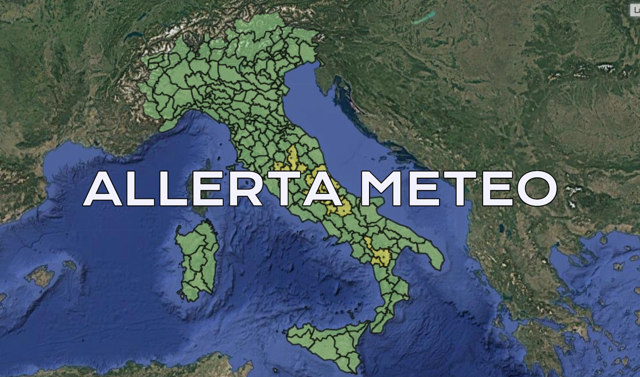
The Italian Civil Protection Department (Dipartimento della Protezione Civile) issued a yellow weather alert for tomorrow, Tuesday, August 4, 2026, warning of incoming thunderstorms and potential hydrogeological risks across multiple regions. Meteorologists tracking the severe weather system indicate that unstable atmospheric conditions are moving across the peninsula, prompting local authorities to urge caution as heavy downpours threaten urban drainage systems and regional roadways.
According to the official bulletin released by the Department, the yellow alert status—signifying ordinary criticizability—serves as an early warning for residents and municipal agencies in the designated zones. While a yellow alert is the lowest tier on Italy’s three-stage warning scale, it calls for active vigilance, particularly regarding localized flash flooding, intense electrical activity, and sudden gusts of wind capable of disrupting transport networks.
Regional emergency response teams have been placed on standby to monitor river levels and manage potential disruptions. Civil protection officials emphasize that local weather patterns can shift rapidly during August convective storms, turning localized rain events into swift hazards for motorists and outdoor workers alike.
Regions Affected by the August 4 Weather Alert
The forecasted weather instability impacts a varied swath of the Italian territory, though the specific administrative boundaries under the yellow designation depend on real-time updates from regional functional centers. Emergency coordinators are urging communities within the alert zones to review municipal safety protocols and stay informed through official channels as the storm front progresses.
Meteorological analysts note that summer thunderstorms frequently follow prolonged periods of high heat, creating a sharp contrast in air masses that triggers sudden, violent cloudbursts. These atmospheric dynamics make precise forecasting difficult beyond short-range windows, reinforcing the importance of the daily bulletins issued by national and regional civil protection authorities.
Safety Guidelines and Official Resources
For residents and travelers navigating the affected regions on Tuesday, authorities recommend avoiding low-lying areas, underpasses, and riverbanks during peak storm hours. Drivers should reduce speed, maintain safe stopping distances, and refrain from attempting to cross flooded roadways, where just a few inches of moving water can sweep away a vehicle.
Up-to-date bulletins, radar maps, and localized risk evaluations remain accessible directly through the Italian Civil Protection Department website and local municipal emergency portals. Officials encourage citizens to consult these verified platforms rather than unverified social media reports when making travel and safety decisions.
The next official update regarding the evolution of the weather system and potential modifications to the alert levels will be published by the Department of Civil Protection on its portal. Readers are invited to share their local observations or questions in the comments below as the situation develops.
Related reading