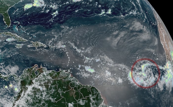
Meteorologists are closely monitoring a tropical disturbance in the eastern Atlantic Ocean that carries a 70 percent probability of developing into a tropical depression or a named storm late this week, according to CNN and the National Hurricane Center. The system, which could soon become the Atlantic season’s next tropical storm named Cristóbal, represents the first time this season that potential development is tracked far out in the main development region rather than near the United States coastline, according to CNN. While computer models show probabilities of formation over the open Atlantic, forecasters emphasize that persistent wind shear driven by El Niño will likely pose a severe challenge to the system’s longevity as it moves toward the Caribbean.
The Atlantic hurricane season has experienced an unusually quiet start, ranking as the least active beginning since 2009, according to CNN. Only two tropical storms, Arthur and Bertha, have formed so far, both hampered by strong wind shear near the Gulf coast, according to CNN. According to hurricane expert Phil Klotzbach of Colorado State University, record-high wind shear levels associated with El Niño have heavily suppressed activity across the basin, according to CNN. Despite these inhibiting conditions, CNN notes that a window of opportunity could open after Wednesday for the eastern Atlantic system to gather energy and organize as it tracks west-northwestward toward the Lesser Antilles, Puerto Rico, and the Virgin Islands.
Forecasting models currently display varying scenarios regarding the system’s future track and intensity. Conventional physics-based ensemble systems and machine learning models, such as those from Google DeepMind, project development odds ranging from 20 to 30 percent as the disturbance moves across the tropical Atlantic. Most computer guidance suggests the system will remain relatively weak, bringing localized heavy rainfall to parts of the eastern Caribbean over the weekend and early next week. A few outlier scenarios hint at a stronger system curving northward into the open central Atlantic, bypassing the islands entirely. Residents across the eastern Caribbean are advised to monitor local forecasts closely for updates.
Pacific Activity Near Hawaii
Meanwhile, in the central Pacific Ocean, a separate weather disturbance designated as Invest 93C is tracking toward the Hawaiian Islands. Located about 1,000 miles southeast of the state, the system is expected to strengthen into a named tropical storm over the coming days, with the first Pacific name on the forecast list being Lala. Major global forecast models suggest the system could approach the Big Island as a strong tropical storm or borderline hurricane late Saturday into Sunday local time.
Weather forecasters note that severe wind speeds are not required to generate significant impacts across island geography. Visitors and residents throughout Hawaii are encouraged to track official advisories as the system approaches during the weekend. The next official updates on both the Atlantic disturbance and Pacific system will be issued by the National Hurricane Center and local meteorological offices.
Worth a look