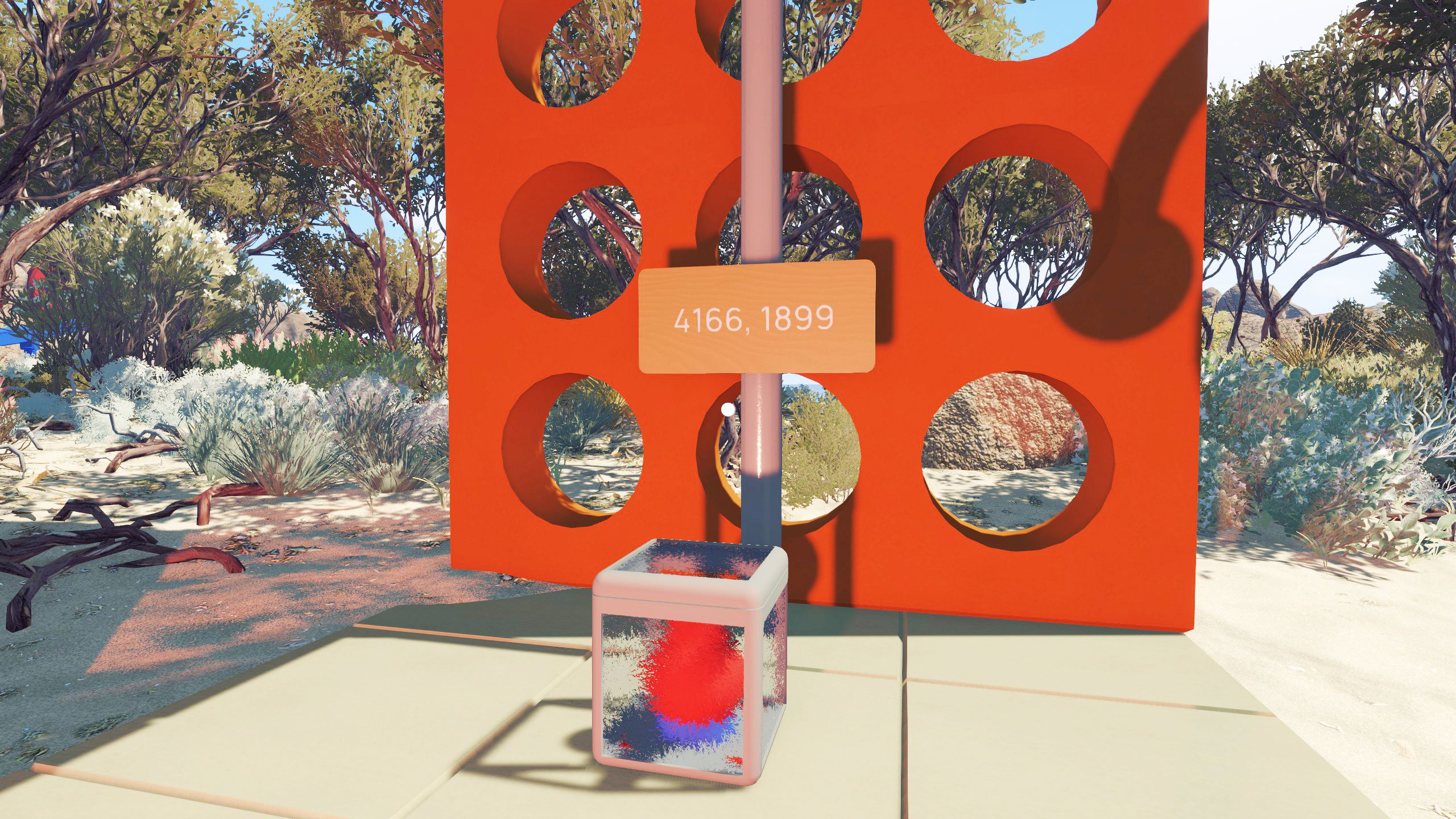
Navigating the cooperative world of the indie video game Big Walk often brings players to a puzzling architectural sight near the beach: a frosted glass container safeguarding an oblong prize, accompanied by a hanging sign marked with specific digits. This environmental riddle serves as one of the title’s early navigational hurdles, requiring friends to piece together map coordinates or put portable tracking tech to use in order to crack the code.
Cooperative puzzle games rely heavily on communication, and this island-based challenge is no exception. While early interactions with similar containers on the map typically require a nearby companion to hold down a pressure button, this particular beach structure presents a loftier geographic mystery. Players must decipher a pair of four-digit numbers to locate a hidden trigger mechanism scattered elsewhere across the terrain.
Understanding how the game’s navigation systems translate these cryptic numerals into physical locations transforms a frustrating roadblock into a rewarding team exercise.
Cracking the Island’s Coordinate System
When players first stumble upon the beach structure shortly after finishing the tutorial puzzles, the challenge remains completely out of reach. Progressing past this initial barrier requires leaving the area behind to explore the broader island, tackle five separate puzzles, and ultimately complete the red tower.
The numbers stamped on the sign—specifically 4166 and 1899—represent exact geographic coordinates corresponding to latitude and longitude across the island’s layout. Making sense of these figures demands either a dedicated map or a specialized tracking device found later in the campaign.
Acquiring the map requires players to place five oblong items on the roof of the red tower. Once completed, the map room opens adjacent to the starting hub, granting access to a floor map alongside a portable, foldable map and compass.
Using the Map and Compass to Locate the Hidden Button
With the portable map open, players can track longitude lines on the sides, marked at 41, and latitude lines along the top and bottom, marked at 18. The intersection of these lines points directly to the grid square sitting east and south of the starter hub.
The remaining digits provide granular precision beyond the basic grid lines. The “66” in the first coordinate string indicates a position roughly two-thirds of the way south from the top of the grid square, while “99” places the target as far east as possible right along the bounding gridline.
Scouting this exact sector reveals a small button carefully camouflaged behind a natural rock formation. Activating the glass container back at the beach requires one player to hold down this hidden switch while another waits by the prize structure, making reliable communication tools essential.
Tracking the Target with the GPS Device
An alternative method involves tracking down a portable GPS device located outside the green tower in the same region as the target button. Housed inside a red frame alongside its own numerical sign, this tracking unit can be held up to display current coordinates or attached directly to a companion’s backpack.
This hands-on approach lets one player roam the terrain while another monitors the screen readout. As the carrier moves across the island, the digital interface indicates whether they are drawing closer to or moving away from the hidden button’s exact coordinates.
Successfully synchronizing these actions allows teams to unlock the frosted glass container and retrieve the prize inside. Maintaining clear communication via walkie-talkies remains the key to mastering the cooperative mechanics embedded throughout the island’s landscape.
Keep reading
- Actor Responds to Controversy Over Footwear During Guruvayur Temple Visit
- Weekly Movie Releases in Leganés: PAW Patrol The Mighty Movie Now Showing
- Germany Mandates Electronic Withdrawal Button for Online Shops by 2026 (archyworldys.com)
- Smart Highway Tech to Solve Renewable Energy Traffic Boom (world-today-news.com)