BOULDER CREEK, Calif. – A moderate earthquake struck the Santa Cruz Mountains of Northern California early Thursday, jolting residents awake and prompting assessments for potential damage. The U.S. Geological Survey (USGS) initially reported the quake as a magnitude 4.9, but later downgraded it to a magnitude 4.6. The earthquake occurred at 1:41 a.m. Pacific Time and was centered near Boulder Creek, a community in Santa Cruz County, approximately 75 miles south of San Francisco.
The tremor was widely felt across the San Francisco Bay Area, with reports coming in from as far north as Richmond and as far south as Pacheco. Residents in Mountain View, Hayward, and Oakland also reported feeling the shaking. While initial reports suggest minimal structural damage, the quake served as a stark reminder of the region’s seismic activity. The USGS estimates the epicenter was located 1 kilometer (0.62 miles) east-southeast of Boulder Creek at a depth of 6.3 kilometers (3.9 miles). This relatively shallow depth contributed to the widespread feeling of the quake.
Earthquake Details and Initial Reports
According to the USGS, the earthquake struck at a latitude of 37.179° North and a longitude of 122.238° West. The event, identified as NC75337442, is being closely monitored by seismologists for potential aftershocks. Robert de Groot, a USGS seismologist, stated in an interview with ABC7 News that there is approximately a 40% chance of a magnitude 3.0 or larger aftershock within the next week. “There are on the order of 50 earthquakes a day in California,” de Groot explained. “These magnitude earthquakes don’t happen very frequently, but they happen frequently enough that there are these reminders that we do live in earthquake country.”
Early reports indicate some minor impacts in Boulder Creek. Items fell from shelves inside the Boulder Creek Drug Store, as captured in local news footage. However, no other stores in the immediate area reported similar incidents, and as of Thursday afternoon, there have been no widespread reports of significant damage or injuries. The Santa Cruz County Sheriff’s Office has not issued any emergency declarations and is currently conducting routine assessments.
Resident Reactions and Local Impact
Jenna Lupertino, owner of Jenna Sue’s Cafe in Boulder Creek, described being awakened by the earthquake. “It was super loud, I woke up, jumped out of bed, ran to my daughter’s room and then saw that she was fine and nothing really fell over in my house except for a mirror,” Lupertino told ABC7 News. Her experience reflects the varied impact of the quake, with some residents reporting significant shaking while others experienced only a mild tremor. The proximity of her home to the epicenter heightened the intensity of the shaking.
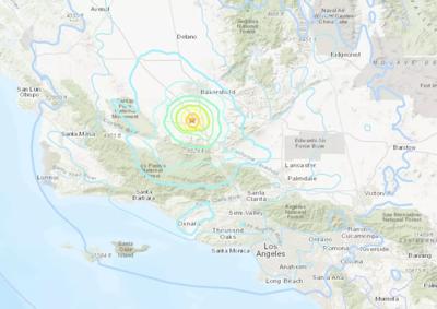
Social media platforms quickly filled with reports from residents across the Bay Area describing their experiences. Many reported being startled awake by the shaking, while others described items falling from shelves or rattling noises. The USGS’s “Did You Feel It?” map, a crowdsourced reporting tool, shows a concentrated area of strong shaking centered around Boulder Creek and extending throughout the Santa Cruz Mountains and into the broader Bay Area. The USGS event page provides detailed information about the earthquake, including seismic data and user reports.
Monitoring Water Levels and Potential Landslides
The earthquake also prompted monitoring of local water levels. The USGS monitoring location Boulder C at Boulder Creek, CA (USGS-11160070) is being closely watched for any changes that might indicate ground deformation or potential landslides. Data from this monitoring station provides real-time information on streamflow and water levels in the area. Santa Cruz County, where Boulder Creek is located, is particularly susceptible to landslides, especially during and after periods of heavy rainfall, and seismic activity can exacerbate this risk.
Aftershock Potential and Preparedness
Seismologists emphasize the importance of preparedness in earthquake-prone regions like California. While the initial 4.6 magnitude quake caused limited damage, the possibility of aftershocks remains. The USGS recommends that residents review earthquake safety procedures, including securing heavy objects, identifying safe spots in their homes, and assembling emergency kits. The California Earthquake Authority (www.earthquakeauthority.com) offers comprehensive resources on earthquake preparedness, including information on earthquake insurance and home retrofitting.
The recent earthquake also highlights the ongoing seismic activity in the region. California sits along the San Andreas Fault, a major tectonic boundary responsible for many of the state’s earthquakes. While predicting earthquakes remains a significant scientific challenge, ongoing monitoring and research efforts are crucial for understanding seismic hazards and mitigating their impact. The USGS continues to operate a network of seismographs throughout California to detect and analyze earthquakes, providing valuable data for hazard assessment and early warning systems.
Recent Seismic Activity in California
While this earthquake was felt widely, it is not an isolated event. According to the USGS, California experiences thousands of earthquakes each year, most of which are too small to be felt. In a separate, but related event reported by Reuters, a magnitude 5 earthquake struck Brookdale, California, also in the Santa Cruz Mountains, though this event appears to be a separate reporting of the same quake, with differing initial magnitude reports. The USGS is the primary source for accurate earthquake information, and its data is used by emergency responders and researchers to assess risks and develop mitigation strategies.
The earthquake serves as a timely reminder for residents of the Bay Area and throughout California to be prepared for seismic events. Reviewing emergency plans, securing homes, and staying informed about earthquake risks are essential steps for ensuring safety and resilience in this earthquake-prone region. The USGS provides up-to-date information on earthquake activity and preparedness resources on its website: www.usgs.gov.
Authorities will continue to monitor the situation for aftershocks and assess any potential damage. Residents are encouraged to report any damage to local authorities. The next update from the USGS is expected within the next 24 hours as they continue to analyze data from the event and monitor for aftershocks. We encourage readers to share their experiences and preparedness tips in the comments below.