
Severe thunderstorms swept through the Chicago metropolitan area Wednesday, bringing wind gusts reaching up to 70 mph that downed trees, damaged power lines, and prompted widespread emergency alerts. According to the National Weather Service (NWS) Chicago office, the volatile weather pattern triggered multiple severe thunderstorm warnings, with additional storm activity expected to persist into Thursday as the region remains under a continued weather watch.
The storms, which moved rapidly across Cook County and surrounding areas, caused significant localized damage. Utility providers reported thousands of power outages throughout the afternoon and evening as high-velocity winds snapped utility poles and cast debris onto roadways. The NWS confirmed that the peak wind speeds were recorded in several communities, causing structural damage to residential properties and disrupting transit systems during the evening commute. Residents are advised to monitor the latest NWS hazardous weather outlooks for real-time updates as the atmospheric instability moves east.
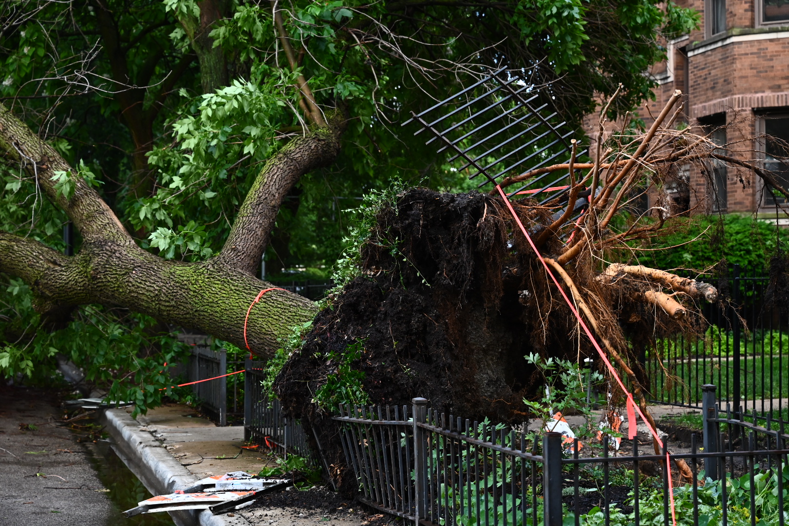
Assessing the Damage Across Chicagoland
The intensity of Wednesday’s weather event resulted in a chaotic scene across the region. Local law enforcement and municipal public works departments have been working to clear downed trees that blocked major thoroughfares and secondary streets. According to data provided by PowerOutage.us, which tracks grid stability, the surge in wind activity left tens of thousands of customers without electricity at the height of the storm. Crews were dispatched immediately to stabilize infrastructure, though the extent of the damage has required extended repair timelines for some neighborhoods.

The National Weather Service noted that the storms were characterized by “bow echoes,” a radar signature indicating the potential for damaging straight-line winds. While reports of tornadoes were monitored throughout the afternoon, the primary cause of destruction was attributed to these sustained, high-speed wind gusts rather than rotational activity. Officials emphasized that the danger remains present, even as the immediate intensity of the Wednesday system wanes.
What to Expect in the Coming Hours
Meteorologists at the National Oceanic and Atmospheric Administration (NOAA) have indicated that the weather pattern responsible for the Wednesday destruction is not yet fully exhausted. A secondary front is expected to move through the area on Thursday, potentially triggering further rounds of severe weather. The current forecast suggests that while the intensity may vary, the risk of localized flooding and additional wind-related damage remains a concern for local authorities.
Residents are encouraged to prepare for potential power interruptions by maintaining access to battery-powered chargers and emergency supplies. For those traveling, municipal agencies recommend checking local transit authority alerts, as overhead line damage can frequently lead to delays on commuter rail lines. The NWS continues to stress that severe weather can develop rapidly, and the most reliable way to receive life-safety information is through a NOAA Weather Radio or verified local emergency alert systems.
Safety Guidelines During Severe Wind Events
When wind gusts reach speeds capable of downing trees and power lines, the National Weather Service advises specific safety protocols to mitigate the risk of injury. Homeowners should secure loose outdoor furniture, trash receptacles, and other objects that can become projectiles during extreme gusts. If you encounter a downed power line, it should be treated as live and dangerous; maintain a significant distance and report the hazard to your utility provider immediately.
During a thunderstorm, the safest location is indoors in a sturdy building, away from windows and glass doors. If you are caught outdoors, avoid tall trees or metal structures that could attract lightning or collapse under wind pressure. For those in vehicles, high-profile trucks and vans are particularly susceptible to wind-induced rollovers; drivers should reduce speed and be prepared for sudden gusts that can push a vehicle out of its lane. Authorities will provide the next update on the storm’s trajectory and potential for severe weather on Thursday morning via official government communication channels.
As this situation remains fluid, we encourage readers to share their experiences in the comments section below and stay tuned to our live news feed for ongoing updates as they become available from local emergency management offices.