Canadian Wildfires Choke More Than a Dozen US States
More than 900 active wildfires are burning across Canada, driving thick plumes of smoke southward and triggering widespread air quality alerts for millions of residents.
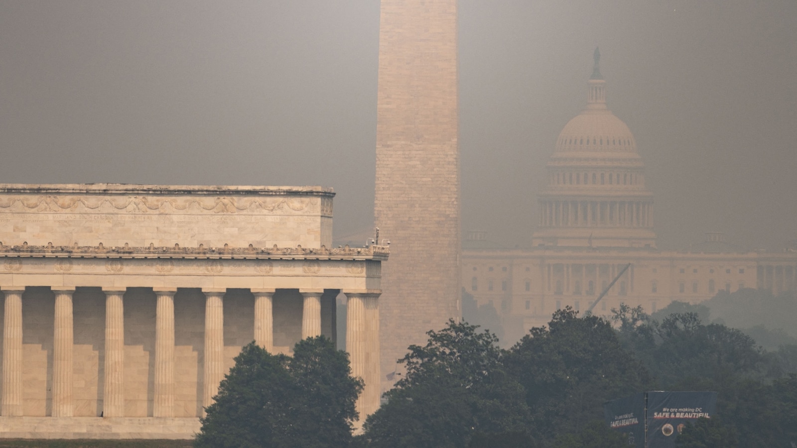
Dangerous wildfire smoke is impacting more than a dozen states as a heavy haze spans from the Upper Midwest and Great Lakes to New England, stretching south through the Northeast and Mid-Atlantic. The persistent drift of smoke has clouded skylines from Minnesota down to Maine, affecting major metropolitan centers including Chicago, Detroit, Washington, D.C., Philadelphia, New York City, and Boston. Environmental and weather authorities note that northwesterly winds continue to push the dense haze across the western Great Lakes and Upper Midwest, where poor air quality conditions are expected to linger through the weekend.
Ontario Mobilizes Emergency Teams and Aerial Fleet
In response to the escalating crisis, provincial officials have mobilized extensive resources. Ontario Premier Doug Ford traveled to Thunder Bay to review operational briefings and highlight ongoing emergency response efforts.
In a public statement shared on the social media platform X, Ford detailed the deployment of hundreds of firefighters, alongside specialized aircraft, helicopters, heavy equipment, and dedicated incident management teams to contain the blazes and protect nearby communities.
Weekend Weather Shift Promised Relief From Smoke
Relief from the thickest haze is on the horizon as meteorological conditions shift. A fast-moving weather system tracking across the Northeast is expected to sweep the wildfire smoke northward, clearing out much of the surface-level haze by Saturday evening. Forecasters anticipate a significant improvement in air quality across the region on Sunday, though lighter plumes of smoke may remain higher up in the atmosphere, creating slightly hazy skies in isolated areas.
Severe Storms and Flash Floods Threaten 100 Million Americans
Simultaneously, severe weather is threatening a massive swath of the country. Approximately 100 million Americans from Illinois to the East Coast are currently under alerts for severe thunderstorms and flash flooding.
The Storm Prediction Center has issued a Level 3 of 5 risk for severe storms spanning parts of the Ohio Valley, the Northeast, and the Mid-Atlantic, with major cities along the Interstate 95 corridor bracing for potential impacts. The incoming storm systems carry multiple hazards, including damaging winds, hail, isolated tornadoes, and intense downpours capable of producing flash floods. Flood watches remain active across parts of the Northeast, encompassing urban centers like New York City, Philadelphia, and Washington, D.C., as heavy rainfall rates challenge local drainage systems.
Monsoonal Moisture Fuels Western and Southern Systems
Farther south and west, monsoonal moisture is fueling separate rounds of thunderstorms. These storms bring heavy rainfall and flash flood risks extending from West Texas and New Mexico across central and northern Arizona into southern Utah.
Weather models indicate that the active weather pattern will shift toward parts of Virginia and the Carolinas on Sunday, where scattered storms could bring additional damaging winds and heavy rain to cities such as Charlotte, Raleigh, and Virginia Beach. Authorities advise residents living within active air quality alert zones and flood watch areas to monitor local forecasts closely, limit strenuous outdoor activities while smoke persists, and heed local emergency instructions as weather conditions evolve.