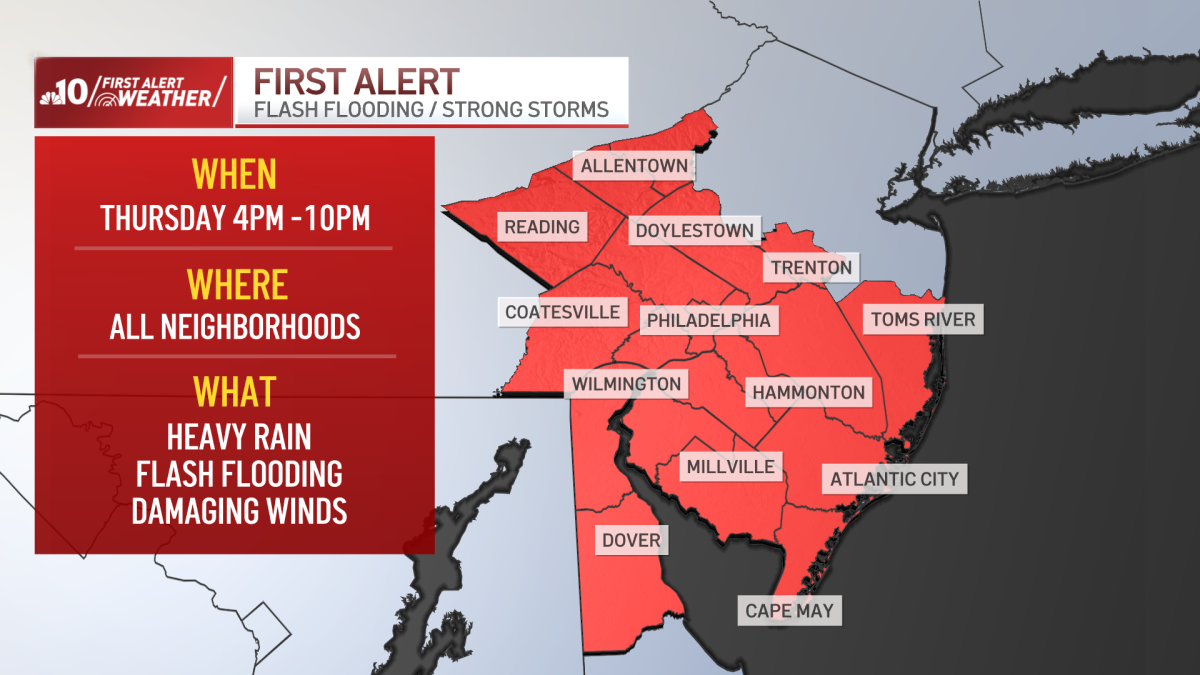
Forecasters have issued a First Alert for Thursday, warning that severe storms carrying the potential for damaging winds and flash flooding could impact the region. The alert follows recent heavy rainfall, which has left the ground saturated and unable to effectively absorb additional precipitation, increasing the risk of localized flooding in low-lying and poor-drainage areas.
Meteorological conditions are shifting as the week progresses. While Thursday is expected to begin with clear, sunny skies and temperatures climbing into the mid-to-upper 80s, atmospheric instability is forecast to develop by the afternoon. These conditions are expected to trigger strong storm cells, which may persist into the early evening. Residents are advised to monitor local National Weather Service updates for specific watches or warnings as the situation evolves.
Storm Progression and Weekend Outlook
The unsettled weather pattern is expected to continue through the end of the work week. Friday will begin with sunshine, but meteorologists anticipate that additional storms will develop later in the day. These systems have the potential to reach significant intensity, with afternoon highs projected to hover near 90 degrees.

The weekend forecast offers a mixed outlook as a cold front begins to move through the region. Saturday will remain partly to mostly cloudy, with the lingering risk of an isolated storm during the afternoon hours and temperatures in the mid-80s. By Sunday, conditions are expected to improve significantly. The arrival of the cold front will bring lower humidity levels and mostly sunny skies, providing what is currently viewed as the most favorable weather of the weekend, with highs once again reaching the mid-80s.
Mid-Week Outlook and Heat Trends
Following the weekend, the early part of next week is expected to remain largely stable. Monday, which coincides with the Home Run Derby, is currently forecast to be pleasant with mostly sunny skies and temperatures in the upper 80s. Similar conditions are expected for the All-Star Game, where dry, sunny weather will accompany highs ranging from the upper 80s to 90 degrees.
Long-range climate models suggest that the current period of relative stability may be short-lived. A new heatwave is currently being monitored for the middle of next week, which could bring sustained high temperatures to the region. As with all long-range outlooks, these projections remain subject to change as atmospheric data is updated by regional weather centers.
Safety and Preparedness
Given the specific threat of flash flooding, emergency management officials emphasize the importance of situational awareness. Because the ground is already saturated from previous rainfall, even moderate bursts of rain can lead to rapid accumulation on roadways and in urban settings. Motorists are reminded to avoid driving through flooded streets, as the depth of the water can be deceptive and the road surface underneath may be compromised.

The next official update regarding the severe weather threat for Thursday is expected to be released by local meteorological offices early Thursday morning. Residents are encouraged to check local news sources and official government weather portals for the most current information. We invite readers to share their local weather observations in the comments section below as the storms develop.