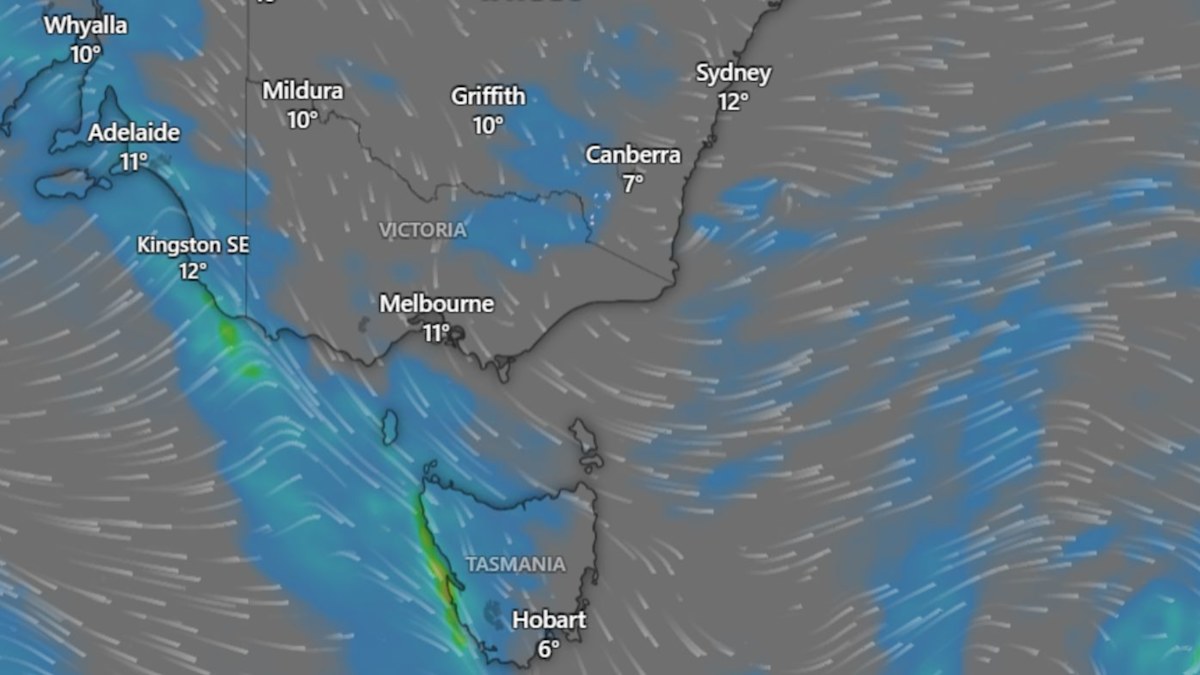
Severe weather sweeping across south-eastern Australia has triggered widespread flood alerts and gale warnings across Victoria, South Australia, southern New South Wales, and the Australian Capital Territory, according to the Bureau of Meteorology. The hazardous conditions follow a heavy soaking last weekend, delivering intense rainfall, record rainfalls for parts of Victoria, and winds that impacted regional ski resorts before a colder, drier air mass began moving across the region.
Meteorological data compiled by Weatherzone showed that rainfall totals exceeding 100 millimeters were recorded at no fewer than 13 distinct sites across Victoria during the 24-hour window leading up to 9 a.m. local time on Monday. Multiple locations across South Australia, New South Wales, and the ACT simultaneously crossed the 50-millimeter threshold as the cold front advanced, bringing cooler temperatures and winds to higher elevations.
The severe weather system also battered alpine zones over the weekend. Gusts reached up to 130 kilometers per hour at the Thredbo Top Station, while Mount Hotham recorded winds peaking at 120 kilometers per hour on Sunday.
Flood Warnings and River Basins Under Watch
According to the Bureau of Meteorology, active flood warnings remained in place on Tuesday across several south-eastern river basins. The majority of these alerts are concentrated in north-east and central Victoria, where rising water levels are being closely monitored along the Ovens, Goulburn, Yea, and King rivers.
While peak rainfall totals have largely subsided, lighter showers replace the heavier downpours observed over the weekend.
Across the border in New South Wales, a gale warning was issued for the Eden Coast alongside strong wind alerts covering the Macquarie, Hunter, Illawarra, and Bateman coasts.
Capital Cities Record Significant August Rainfall
Major urban centers in the south-east also registered notable rainfall figures, providing a substantial boost to their monthly precipitation tallies. In Melbourne, the weekend brought a 24-hour rainfall total of 24.4 millimeters—substantially lighter than the heavy deluges recorded in regional areas, but nonetheless marking the Victorian capital’s wettest single day of 2026 to date.
Adelaide experienced a comparable weather pattern. By 9 a.m. on Monday, South Australia’s capital had collected 26.4 millimeters of rain over the preceding 24 hours. This single weather event pushed Adelaide’s running August rainfall total to 52 millimeters, bringing the city within close range of its long-term monthly average of 61 millimeters.
Further east in New South Wales, the heaviest downpours concentrated east of the Dividing Range in the state’s southern districts. During the 24 hours leading up to Monday morning, Thredbo recorded 84 millimeters of precipitation, while the nearby Perisher Valley received 61 millimeters.
Alpine Snowfall and Mid-Week Forecast
Forecasters note that skiers and snowboarders visiting the alpine regions of New South Wales and Victoria can anticipate heavy snowfalls.
Looking ahead for the remainder of the week, dry and cool conditions are establishing dominance across south-eastern Australia. While showers will continue to drift across a broad area, precipitation amounts are expected to be lighter than Sunday’s totals.
Residents in affected zones are advised to monitor official updates from the Bureau of Meteorology for the latest flood watches and marine warnings as the weather system gradually clears the region.
Keep reading