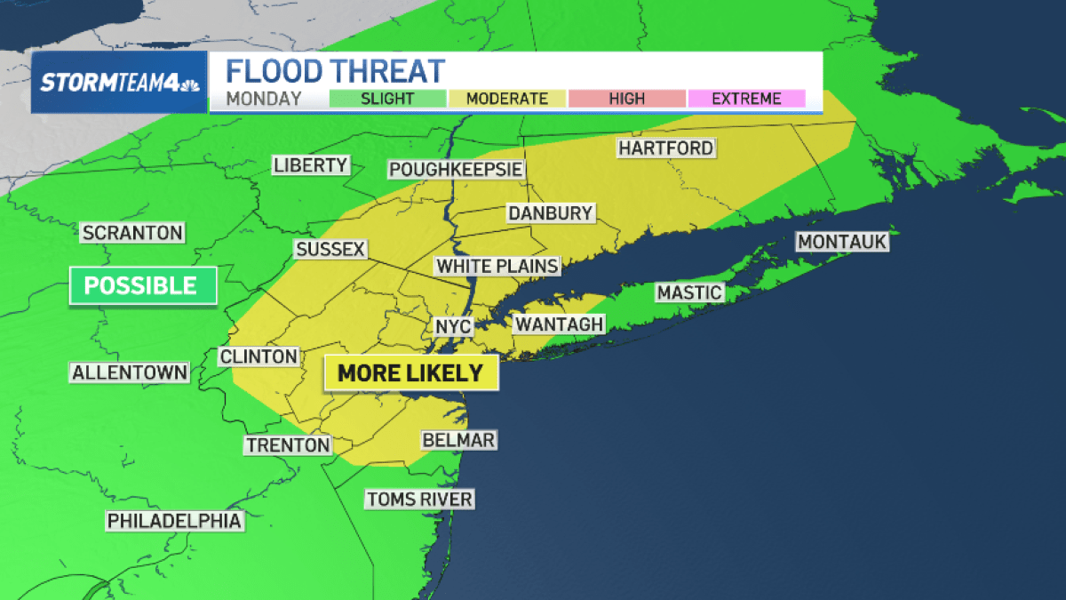
While Sunday starts off mostly cloudy and dry for most of the day, meteorological conditions are set to deteriorate rapidly after dinner, paving the way for rounds of severe thunderstorms extending through Monday afternoon.
The impending weather pattern brings distinct hazards to the tri-state area, most notably for the Monday morning commute. Forecasters warn that persistent storm cells could drop heavy precipitation in short windows, triggering localized flash flooding across low-lying urban areas and major thoroughfares. In addition to heavy downpours, the storms carry a risk of severe-level wind gusts exceeding 58 miles per hour, creating potential hazards for transit systems and outdoor infrastructure.
Residents hoping for immediate relief from the oppressive moisture will have to wait until midweek. Tuesday offers a brief respite with drier conditions expected across the five boroughs, but the reprieve will be short-lived. The regional pattern shifts toward increasingly hot and unsettled weather as the week progresses, keeping a daily chance of pop-up showers and isolated thunderstorms in the forecast.
Understanding the Threat: Timing and Commuter Impact
The transition from a dry Sunday afternoon to active severe weather begins late Sunday evening. According to regional meteorological tracking, storm systems moving in from the west will intensify overnight, directly impacting the Monday morning travel window.
Wind risks accompanying the frontal boundary add another layer of hazard. Sustained wind speeds and gusts reaching or exceeding 58 mph are capable of downing tree limbs and causing scattered power outages throughout the metropolitan area.
Midweek Drier Window Followed by Unsettled Heat
By Tuesday, high pressure builds temporarily over the region, clearing out the lingering humidity and providing a drier, more stable atmosphere.
Temperatures are projected to climb, returning muggy conditions and fueling daytime convective activity. While continuous washouts are not anticipated for the latter half of the week, the persistent humidity and daytime heating will generate scattered afternoon showers and occasional thunderstorms on a nearly daily basis.
We welcome your thoughts and local weather updates in the comments below. Share this report to keep your community informed as conditions develop this week.
Worth a look
- The New Internet Phenomenon Taking Over the Youth: Have You Heard of It?
- Independent Real Estate Advisor in Tegucigalpa, Honduras
- Surat Evacuates 4,000 Residents Amid Heavy Monsoon Rains and Flooding (archyworldys.com)
- Josh Kerr and Jake Wightman Face Australian Threat in Glasgow Mile Final (time.news)