
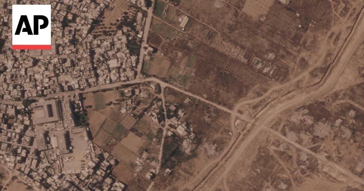
The Israeli military has constructed over 23 kilometers (14 miles) of earthen barriers inside the Gaza Strip, effectively deepening the division between territory it currently controls and the remainder of the enclave. The construction, confirmed by military officials this week, follows the boundaries of a temporary ceasefire line established in October 2025.
The Apnews first reported the development after analyzing satellite imagery provided by Planet Labs PBC. The images reveal that the barrier—a series of berms—stretches across more than half the length of the coastal territory. While the Israeli military maintains that the project is a necessary security measure, the scale of the earthworks has fueled concerns regarding the long-term status of the land.
Defining the ‘Yellow Line’ Security Zone
The physical barrier follows the route of the so-called “yellow line,” a boundary established under the October 2025 ceasefire agreement between Israel and Hamas. Originally envisioned as a temporary division of the territory, the line’s exact route was never precisely defined, leading to inconsistent marking on the ground.
In response to inquiries regarding the construction, the military confirmed it is developing a security zone
around the boundary. According to JNS, the project aims to integrate intelligence and technological infrastructure to protect Israeli troops and nearby civilian communities. The military stated that the fortification is intended to reduce friction and prevent harm to uninvolved individuals.
Satellite Evidence of Rapid Expansion
Satellite imagery illustrates the speed of the construction. Between July 1 and July 15, 2026, a specific section of the network in southern Gaza grew from 500 meters to 2.4 kilometers. This expansion effectively isolates the ruins of Rafah from the al-Mawasi camp area, which currently houses a significant portion of the displaced population.
The barrier is not a single, continuous wall but a network of segments. One major stretch runs nearly 17 kilometers from near Khan Younis to the outskirts of Gaza City. Smaller, unconnected berms have also been observed near the leveled town of Beit Lahia in the north. Military officials declined to provide a complete map of the route or specify how far the barriers might eventually extend.
Diplomatic and Military Stagnation
The expansion of the berms occurs against a backdrop of stalled negotiations. While the Board of Peace, led by U.S. President Donald Trump, is tasked with overseeing the ceasefire, the body has remained largely silent regarding the new construction. Neither the Board nor U.S. Central Command responded to requests for comment on the barrier’s impact on the ceasefire terms.
Tensions remain high regarding the future of the territory. According to reports, Israel has pushed Hamas back from the 47% line established in the 2025 deal toward a 30% line, citing the group’s failure to begin the disarmament process scheduled for early 2026. Hamas, conversely, has maintained that disarmament is contingent upon the partial rebuilding of Gaza—a condition that has not yet been met.
Impact on the Ground
For the population residing in Gaza, the barrier represents a concrete shift in the geography of the conflict. Much of the territory on the Israeli-controlled side of the line has been leveled, with buildings demolished by bulldozers and explosives to clear space for new road networks and military bases.
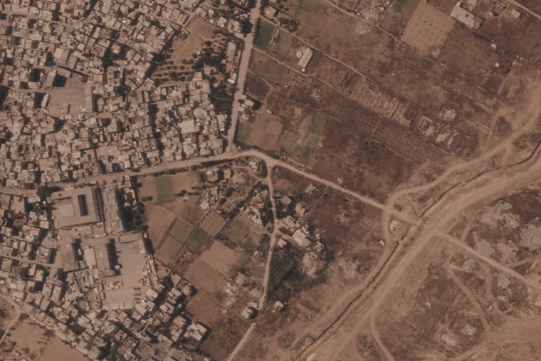
The military told AP it is working to clearly mark the route of the yellow line to “reduce friction and prevent harm to uninvolved individuals.”
Israeli Military, via Associated Press
Despite these stated intentions, the presence of the line has proven lethal for civilians. The military continues to authorize lethal force against individuals who approach or cross the boundary, classifying the area as a no-go point.
As the barrier becomes more permanent, the primary uncertainty remains whether these earthworks are a temporary tactical necessity or a precursor to a long-term territorial shift.