
Cold Front 45 and Polar Air Mass Bring Freezing Temperatures and Heavy Rain Across Mexico
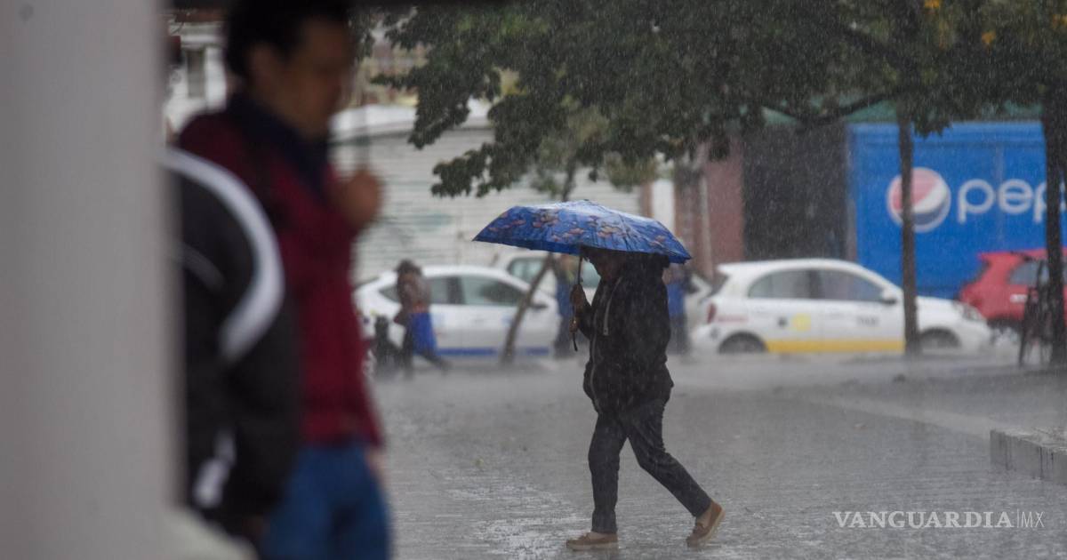
Mexico is experiencing a significant drop in temperatures and widespread heavy rainfall due to the arrival of Cold Front 45 and an associated polar air mass, according to the National Meteorological Service (SMN). The system, which began affecting northern and central regions on April 17, 2025, has triggered frost warnings, strong winds and the potential for hail in multiple states. Authorities have urged residents to take precautions against hypothermia, slippery roads, and possible flooding in low-lying areas.
The combination of the cold front and the polar air mass has led to temperatures dropping below freezing in elevated areas, particularly in the northern states of Chihuahua, Coahuila, Nuevo León, and Durango, where minimums have reached as low as -5°C (23°F). In central Mexico, including Mexico City and surrounding states like Estado de México, Puebla, and Tlaxcala, temperatures have fallen to between 0°C and 5°C (32°F to 41°F), with intermittent showers and overcast skies persisting through April 18.
According to the SMN’s latest update issued on April 18, 2025, the frontal system is expected to continue influencing weather patterns across the country for the next 24 to 48 hours, with the most intense impacts concentrated in the northeast, north, and central regions. The agency emphasized that the polar air mass accompanying the front is responsible for the sharp temperature drop, reinforcing winter-like conditions uncommon for mid-April in many parts of the country.
States Most Affected by Frost, Rain, and Potential Hail
The National Meteorological Service has identified eight states where the combination of cold temperatures, precipitation, and atmospheric instability increases the likelihood of hail formation: Chihuahua, Coahuila, Nuevo León, Tamaulipas, San Luis Potosí, Zacatecas, Aguascalientes, and Jalisco. In these areas, the collision of the cold front with warmer, moist air from the Gulf of Mexico has created conditions conducive to thunderstorms capable of producing ice pellets.
In Chihuahua, cities such as Ciudad Juárez and Chihuahua City have reported temperatures near -3°C (27°F) with light snow flurries observed in higher elevations. Meanwhile, in Nuevo León, the metropolitan area of Monterrey experienced rainfall accumulations of up to 20 mm in under six hours on April 17, prompting temporary road closures in low-lying zones due to water accumulation. Civil protection units in both states have been placed on alert to respond to weather-related incidents.
The SMN also warned of strong north winds, with gusts exceeding 60 km/h (37 mph) in coastal areas of Tamaulipas and Veracruz, increasing the risk of fallen trees, damaged structures, and hazardous driving conditions. These winds are a direct result of the pressure gradient created by the advancing cold front, which continues to push southward across the Gulf Coast region.
Understanding Cold Fronts and Polar Air Masses in Mexico’s Spring Climate
A cold front is the leading edge of a mass of cold air that replaces warmer air at the surface, often bringing abrupt changes in temperature, wind shifts, and precipitation. When such a system is reinforced by a polar air mass — a large body of exceptionally cold air originating from northern latitudes — the effects can be significantly amplified, even during transitional seasons like spring.
Although cold fronts are common in Mexico from October to May, the intensity of Front 45 is notable for its timing. According to historical data from the SMN, April typically sees a decline in the frequency and strength of such systems as the country transitions toward warmer weather. However, intermittent incursions of polar air, particularly during La Niña-influenced years, can still produce winter-like conditions well into mid-spring.
The current event underscores the variability of Mexico’s climate, where geographic diversity — ranging from tropical coasts to high-altitude plateaus — results in wide-ranging weather experiences even within the same national forecast. Meteorologists note that while the southern and southeastern regions remain relatively warm, the northern and central plateaus are especially susceptible to rapid cooling when polar air descends from the Rocky Mountains and moves south across the United States into northern Mexico.
Public Safety Recommendations and Official Monitoring
In response to the ongoing weather event, the National Coordination of Civil Protection (CNPC) has issued a series of public advisories urging residents in affected areas to dress in layers, avoid prolonged exposure to cold, and ensure heating sources are used safely to prevent carbon monoxide risks. The agency also recommended checking on elderly neighbors, children, and individuals with chronic health conditions who may be more vulnerable to temperature extremes.
For motorists, the CNPC and federal highway authorities have advised reducing speed, increasing following distance, and avoiding travel during periods of heavy rain or potential ice formation on bridges and overpasses. Real-time road condition updates are available through the Secretariat of Communications and Transportation (SCT) website, which provides live feeds from traffic cameras and incident reports across federal highways.
The SMN continues to monitor the system’s progression and updates its forecasts every six hours. As of the 15:00 Central Time update on April 18, the agency confirmed that Cold Front 45 was positioned over the eastern and southeastern parts of the country, with the polar air mass still entrenched over the northern plateau. No immediate changes to the forecast are expected before the system begins to weaken and dissipate by April 20.
Looking ahead, meteorologists indicate that a gradual warming trend is expected to return by mid-next week, particularly in central and western regions, as high-pressure systems begin to reestablish dominance. However, officials caution that additional frontal systems cannot be ruled out during the remainder of April, and the public should remain attentive to official updates.
Stay informed through verified sources such as the National Meteorological Service (SMN) and National Coordination of Civil Protection for the latest alerts, safety guidance, and regional forecasts. Share this information with others who may be affected, and consider posting your own observations or questions in the comments below to support foster community awareness.