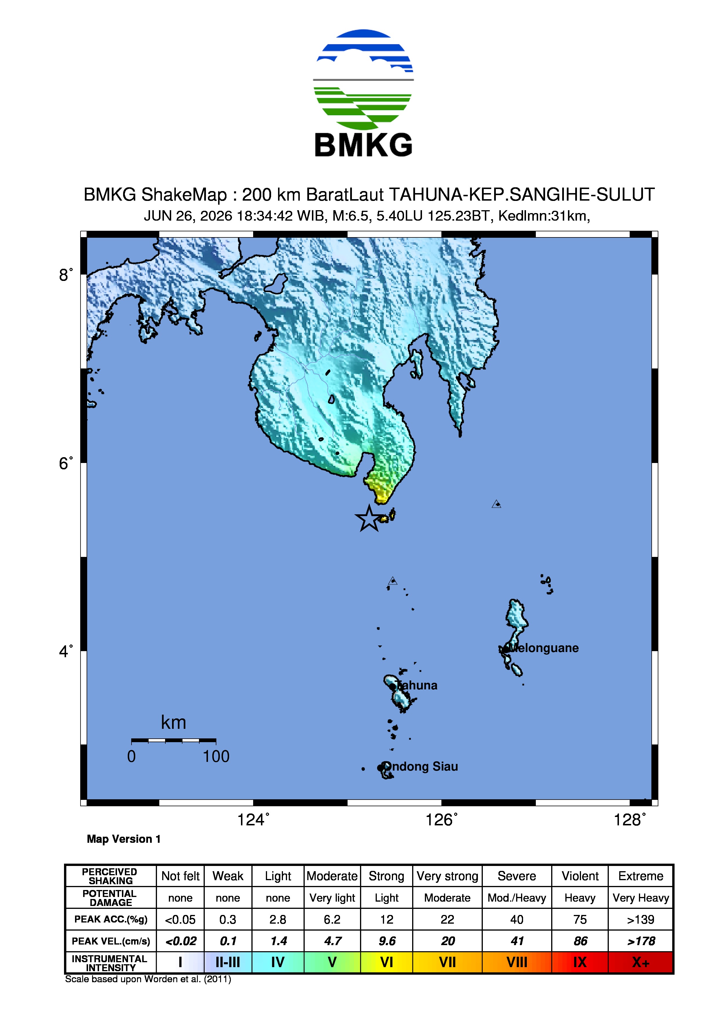
A significant seismic event measuring magnitude 6.8 struck the waters northwest of the Sangihe Islands in North Sulawesi, Indonesia, prompting monitoring agencies to track the potential impact across the region. According to the Indonesian Agency for Meteorology, Climatology, and Geophysics (BMKG), the earthquake originated approximately 195 kilometers northwest of the Kepulauan Sangihe region. While the epicenter was located at sea, the tremors were felt across various parts of North Sulawesi and beyond.
The tremor occurred in a geologically active zone. Data from the United States Geological Survey (USGS) often classifies such events in this specific maritime corridor as deep-focus or intermediate-depth earthquakes, which frequently results in the shaking being felt over a wide geographic area, including neighboring provinces and southern Mindanao in the Philippines. Authorities have emphasized that residents in coastal areas should remain vigilant, though official bulletins in the immediate aftermath did not trigger a widespread tsunami warning for the Indonesian coastline.
Regional Impact and Seismic Activity
The impact of the magnitude 6.8 event was not confined to the Sangihe Islands; residents as far away as Gorontalo reported feeling the ground sway. According to reports, the intensity of the shaking varied depending on soil composition and proximity to the epicenter, with higher-altitude areas and coastal plains experiencing different levels of perceived motion.

Subsequent seismic activity has been monitored closely. Following the primary event, smaller tremors, including a magnitude 4.1 earthquake, were recorded near Melonguane, the administrative center of the Talaud Islands. The BMKG maintains a continuous observation network to distinguish between mainshocks and potential aftershocks.
Understanding the Tectonic Context
The region between the Sangihe Islands and the southern Philippines is one of the tectonic junctions in Southeast Asia. Geologists note that the subduction of the oceanic crust beneath the archipelago is the primary driver of these events. Because the epicenter of this magnitude 6.8 quake was located in the sea, the depth of the rupture plays a critical role in the amount of energy reaching the surface.
For residents, the primary concern remains the risk of secondary hazards. While this specific event did not result in major structural failure reported by national news agencies, it serves as a reminder of the necessity for earthquake-resistant infrastructure. The Indonesian National Board for Disaster Management (BNPB) consistently advises that during such events, individuals should move to open spaces away from buildings and power lines, and monitor official channels for updates regarding structural integrity in their local areas.
Preparedness and Official Monitoring
Public safety remains the priority for regional authorities in North Sulawesi. The BMKG provides real-time updates via their mobile application and web portals, which serve as the definitive source for earthquake magnitude, depth, and tsunami potential. Residents are encouraged to rely exclusively on these official sources rather than unverified reports circulating on social media, which often mischaracterize the scale or nature of seismic events.

Moving forward, the focus for local government agencies is the assessment of any potential damage to remote coastal villages that might have experienced higher localized intensity. While the magnitude 6.8 event was significant, the lack of immediate reports regarding catastrophic damage suggests that the depth of the earthquake may have mitigated some of the surface-level destructive potential. Ongoing surveillance will continue, and the public is urged to maintain emergency kits and stay informed through the official BMKG information service. We will continue to monitor the situation for any further updates from the regional geological offices.
You can share your thoughts or local observations in the comments section below.
Related reading