
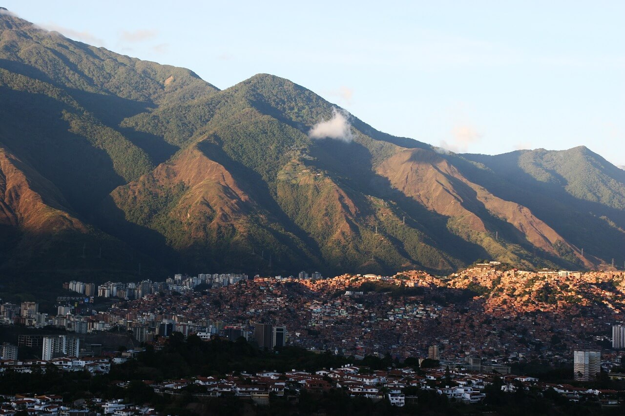
The Coastal Range of Venezuela, or Cordillera de la Costa, serves as a vital geological barrier spanning approximately 53,000 square kilometers, effectively shielding the nation’s northern valleys from the Caribbean Sea. This mountainous system, which stretches from the state of Yaracuy in the west to the Paria Peninsula in the east, acts as a climatic regulator and a repository of significant mineral resources, according to geographical data from the Venezuelan Ministry of Ecosocialism.
Geologically distinct from the Andes, the Coastal Range is divided into two primary chains: the Northern Range, which drops sharply into the Caribbean, and the Southern Range, which borders the interior valleys. The formation plays a critical role in the country’s hydrology, as its peaks capture moisture from the trade winds, feeding the river systems that provide water to the heavily populated central regions, including the Caracas valley. This topographical defense is not merely a physical wall but a complex ecosystem that has historically influenced the settlement patterns and agricultural viability of northern Venezuela.
Geological Significance and Mineral Wealth
Beyond its role as a geographic buffer, the Cordillera de la Costa is known for its complex lithology, which includes metamorphic rocks such as schists, gneisses, and marbles. Scientific assessments by the Instituto Geográfico de Venezuela Simón Bolívar indicate that these formations contain varied mineral deposits, including industrial minerals like limestone, clay, and gypsum, which are essential for the construction and manufacturing sectors. While the region is not the primary site for the country’s massive gold or iron ore extraction—which are concentrated in the Guiana Shield—the Coastal Range possesses localized mineral wealth that has been subject to various levels of state-managed exploration and regulation over the decades.
The extraction of these resources is governed by national mining laws, which mandate environmental impact assessments for any industrial activity in these sensitive mountainous zones. The Venezuelan government maintains oversight of these areas, balancing the need for raw materials with the necessity of protecting the watersheds that supply water to millions of residents in the capital and surrounding urban centers.
Climate Regulation and Environmental Protection
The mountain range functions as an orographic barrier, forcing the moist air coming from the Caribbean to rise, cool, and condense, resulting in higher precipitation levels on the northern slopes compared to the southern interior valleys. This phenomenon is fundamental to the regional microclimates that sustain the diverse flora and fauna of the Henri Pittier National Park, the oldest national park in Venezuela, established in 1937 under the name Rancho Grande, according to UNESCO World Heritage documentation.

Environmental experts point out that the stability of these slopes is essential for mitigating the risk of landslides, which have historically affected the urban infrastructure of the coastal states. The protection of the mountain’s forest cover is a stated priority for national environmental authorities, as deforestation in these areas directly correlates with increased sedimentation in water reservoirs and a heightened risk of flooding in the lower valleys during the rainy season.
Challenges and Future Oversight
The management of the 53,000-square-kilometer range faces ongoing challenges, ranging from urban encroachment in the Caracas valley to the need for sustainable land-use policies. As population centers expand, the pressure on the foothills of the Coastal Range increases, requiring strict enforcement of protected area boundaries. The National Institute of Parks (INPARQUES) remains the primary body responsible for the management and surveillance of the numerous national parks situated within this mountain system.

Future development and conservation efforts in the region are expected to be guided by the National Plan for Territorial Ordering, which aims to reconcile industrial mineral extraction with the preservation of essential ecosystem services. Readers interested in monitoring official updates regarding land use or environmental status in these regions can consult the annual reports published by the Ministry of Ecosocialism. Stakeholders, including local municipal governments and environmental advocacy groups, continue to participate in public forums regarding the sustainable management of these critical highland territories.
This report provides an overview of the geographical and economic role of the Cordillera de la Costa. For further information on official environmental policies, please visit the Ministry of Ecosocialism portal. We welcome your thoughts on this analysis in the comments section below.