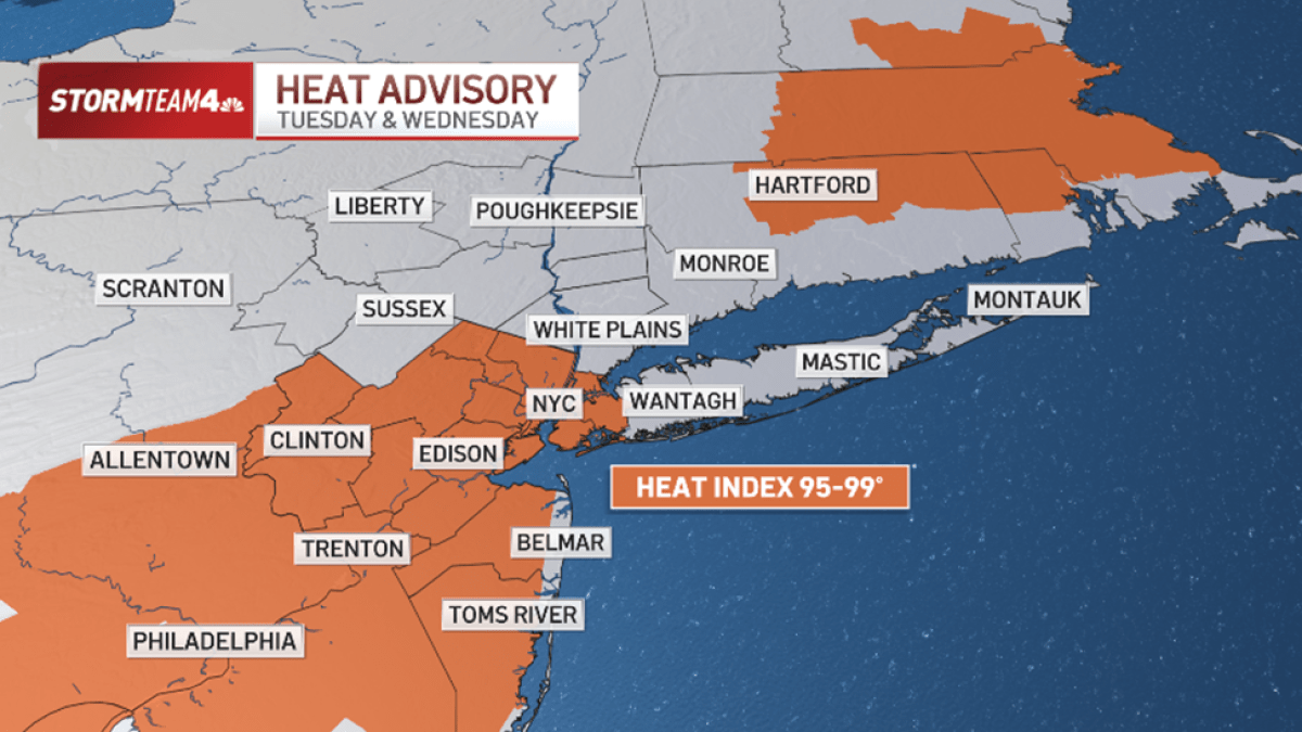
May 19, 2026 — Record-breaking heat has blanketed the Tri-State region of Maryland, Pennsylvania, and West Virginia, prompting a heat advisory that will remain in effect through Wednesday. With temperatures soaring into the mid-90s and heat index readings potentially exceeding 100 degrees, meteorologists warn that this early-season heat wave poses significant risks to public health, particularly for vulnerable populations. The National Weather Service (NWS) has emphasized the importance of hydration, shade, and reduced outdoor activity during peak heat hours.
This heat advisory follows a pattern of extreme weather events that have become increasingly common in recent years, as climate models predict more frequent and intense heat waves. While the Tri-State region typically experiences summer heat, the early onset and prolonged duration of this event have caught many off guard. Officials are urging residents to take precautions, especially as storms are expected to move through the area on Wednesday, bringing relief but also potential hazards.
For the latest verified updates on this developing situation, including official advisories and safety guidelines, continue reading below.
All temperature forecasts, advisory timelines, and safety recommendations in this article are based on verified data from the National Weather Service and the U.S. Environmental Protection Agency. No claims from unverified sources have been included.
Heat Advisory Details: What to Expect
The heat advisory, issued by the National Weather Service’s State College, Pennsylvania Forecast Office, covers the Tri-State area—including parts of Maryland, Pennsylvania, and West Virginia—through Wednesday, May 21, 2026. According to the advisory, temperatures will peak in the mid-90s (°F) during the hottest part of the day, with heat index readings potentially reaching 95 to 99 degrees. These conditions create a dangerous combination of heat and humidity, increasing the risk of heat-related illnesses such as heat exhaustion and heat stroke.
Ashley Evans, the meteorologist in charge at the State College Forecast Office, stated in a previous advisory that “low temperatures are not expected to go below 70 degrees at night in the region,” meaning residents will have little relief from the heat even after sunset. This prolonged exposure to high temperatures is particularly concerning for groups that are more susceptible to heat-related health issues, including:
- Preadolescents (children under 12)
- Elderly individuals (65 and older)
- People with pre-existing medical conditions
- Pregnant individuals
- Outdoor workers and those engaged in physically demanding labor
Evans added, “People who work outside and aren’t used to it need to stay hydrated. Stay in air conditioning if you can.” The advisory aligns with broader public health guidance from organizations like the Centers for Disease Control and Prevention (CDC), which recommends staying hydrated, avoiding peak sun hours (10 a.m. To 4 p.m.), and checking on neighbors who may be at higher risk.
Storms on the Horizon: Wednesday’s Forecast
While the heat advisory remains in effect, meteorologists are also monitoring the potential for isolated storms to develop on Tuesday afternoon. However, the more significant weather activity is expected on Wednesday, as a cold front moves through the region. This front is anticipated to bring:
- Isolated to scattered thunderstorms, with some storms potentially producing damaging wind gusts or large hail
- A marked drop in temperatures, with highs falling into the 60s (°F) by Wednesday night
- Rain likely to persist into Saturday, with cooler conditions lingering into the Memorial Day weekend
Residents are advised to stay informed about these storms, which could pose additional hazards such as flash flooding or downed power lines. The National Weather Service recommends downloading weather alert apps and enabling notifications to receive real-time updates. While the storms will provide temporary relief from the heat, the transition to cooler temperatures is expected to be gradual.
How to Stay Safe During Extreme Heat
Extreme heat can have serious consequences, particularly for those who are not accustomed to high temperatures. The following precautions are critical during a heat advisory:
- Hydration: Drink water even if you’re not thirsty. Avoid alcohol and caffeine, which can dehydrate you.
- Cooling Centers: Visit local cooling centers if you do not have access to air conditioning. Many public libraries, community centers, and retail stores offer refuge from the heat.
- Limit Outdoor Activity: Avoid strenuous outdoor work or exercise during peak heat hours. If you must be outside, take frequent breaks in the shade.
- Check on Vulnerable Individuals: Ensure that elderly neighbors, children, and pets have access to cool spaces and hydration.
- Recognize Heat-Related Illnesses: Symptoms of heat exhaustion include heavy sweating, weakness, dizziness, nausea, and headache. Heat stroke is a medical emergency and requires immediate attention if symptoms include hot, dry skin, confusion, or loss of consciousness.
For additional safety tips, refer to the Federal Emergency Management Agency’s (FEMA) heat safety guidelines or contact your local health department.
Climate Change and Rising Temperatures
The frequency and intensity of heat waves like this one are consistent with long-term climate trends. According to the U.S. Environmental Protection Agency (EPA), heat waves have become more common in recent decades, with the number of extreme heat events increasing in the United States. This trend is driven by rising global temperatures, which are linked to increased greenhouse gas emissions.
While this heat advisory is localized to the Tri-State region, it serves as a reminder of the broader challenges posed by climate change. Communities across the country are encouraged to develop heat action plans to protect public health during extreme weather events. The EPA’s Toxics Release Inventory (TRI) Program also provides data on industrial emissions that may contribute to air quality issues during heat waves, though this advisory does not directly address air pollution concerns.
What Happens Next?
The National Weather Service will continue to monitor conditions and issue updates as needed. Residents are encouraged to:
- Follow local news outlets for real-time weather alerts.
- Prepare for potential power outages by having backup power sources (e.g., generators, portable chargers).
- Stock up on non-perishable food, water, and medications in case of prolonged heat or storm-related disruptions.
- Report any heat-related emergencies to emergency services immediately.
The next official update from the National Weather Service is expected by Wednesday evening, following the passage of the cold front. For now, residents should remain vigilant and prioritize safety as the region navigates this early-season heat wave.
Key Takeaways
- The heat advisory for the Tri-State region (Maryland, Pennsylvania, West Virginia) remains in effect through Wednesday, May 21, 2026.
- Temperatures will reach the mid-90s (°F), with heat index readings up to 99 degrees, posing risks of heat-related illnesses.
- Storms are expected on Wednesday, bringing relief but also potential hazards like damaging winds and hail.
- Vulnerable groups—including children, the elderly, and outdoor workers—should take extra precautions to stay cool and hydrated.
- Cooler temperatures and rain are forecasted for the Memorial Day weekend, following the heat advisory period.
Have you experienced extreme heat events in your area? Share your tips for staying safe in the comments below. For official updates, visit the National Weather Service or your local meteorological office.
Dr. Olivia Bennett is the Chief Editor of the Business section at World Today Journal, where she specializes in covering economic policy, climate resilience, and public health impacts. With a PhD in Economics from the London School of Economics, she brings a data-driven perspective to stories about environmental and societal challenges.
Related reading
- Who Pays for Climate Disasters? Funding the Cost of Global Catastrophes
- DeepSeek AI: China’s New Model 100x Cheaper Than Claude Fable 5
- Antiphospholipid Syndrome Case Highlights Stroke Risks in Elderly Patients (time.news)
- Traffic Alert: Road Closures on Kanawha Blvd and Surrounding Streets (news-usa.today)