Temperatures across the United Kingdom are forecast to climb above 30C this week as a plume of warm air moves across the country, according to the Met Office. Meteorologists anticipate a shift in atmospheric conditions that will bring significantly warmer weather, marking a potential return to heatwave thresholds for several regions.
The upcoming period of elevated temperatures is expected to last longer than previous short-lived warm spells observed this summer. While the UK often experiences brief spikes in heat, current atmospheric modeling suggests a more sustained period of high pressure. This shift is consistent with broader climate trends that have seen more frequent and intense heat events across Western Europe, as noted in recent World Meteorological Organization reports regarding global temperature anomalies.
Drivers of the Upcoming Heatwave
The primary driver of the rising mercury is a high-pressure system currently building over the continent. This system acts as a “heat dome,” trapping warm air and preventing the typical Atlantic weather fronts—which usually bring cooler, wetter conditions—from reaching the British Isles. According to the European Centre for Medium-Range Weather Forecasts, the movement of this air mass from the south is a well-documented phenomenon that frequently triggers significant temperature increases in the UK during the late summer months.

Unlike transient heat spikes, which may last 24 to 48 hours, this pattern is projected to maintain its influence for several days. The duration of the heat is a critical factor for public health officials, as prolonged exposure to temperatures above 30C increases the risks associated with heat exhaustion and dehydration, particularly among vulnerable populations such as the elderly and those with pre-existing cardiovascular conditions.
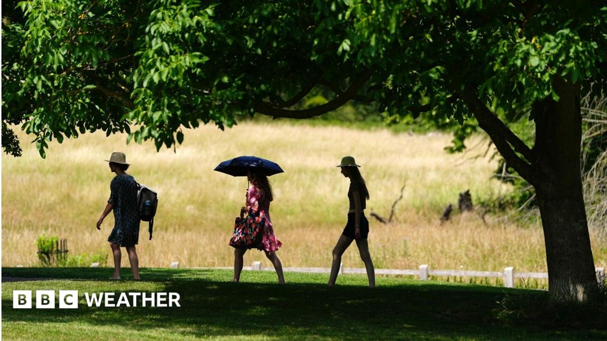
Public Health and Safety Guidance
The UK Health Security Agency (UKHSA) regularly issues guidance during periods of extreme heat to help the public mitigate health risks. Their standard advice emphasizes the importance of staying hydrated, keeping living spaces cool by closing curtains during the day, and avoiding strenuous outdoor activity during the peak hours of 11:00 AM to 3:00 PM.
For those residing in urban environments, the “urban heat island” effect remains a significant consideration. Concrete and asphalt structures absorb heat during the day and release it slowly at night, preventing temperatures from falling to comfortable levels for sleeping. Residents are advised to monitor local Met Office weather warnings, which are updated in real-time to reflect the severity and geographic scope of the heat.
Comparing Recent Weather Trends
When comparing this forecast to historical data, the frequency of 30C-plus days has shown an upward trajectory over the last decade. Data from the UK Climate Projections indicates that the UK is experiencing hotter, drier summers on average. While a single heatwave cannot be attributed solely to climate change, the intensity and duration of these events are consistent with projections regarding the warming of the North Atlantic and the shifting of the jet stream.
The following table outlines the key differences between a standard summer day and a heatwave event as defined by UK meteorological standards:
| Factor | Standard Summer Day | Heatwave Threshold |
|---|---|---|
| Temperature Range | 18C – 24C | 28C – 32C+ |
| Duration | Single day | 3+ consecutive days |
| Health Impact | Low | Moderate to High |
What Happens Next
The duration of this heatwave remains subject to change as the high-pressure system evolves. The Met Office is scheduled to release updated long-range forecasts throughout the week, which will provide further clarity on whether the warm air will persist into the following weekend or be displaced by cooler, low-pressure systems moving in from the Atlantic. Residents are encouraged to check official government portals for the latest information on local weather alerts and to share this guidance with neighbors who may be at higher risk.
