
Residents across South Australia, Victoria, and New South Wales are facing a period of intense atmospheric instability as a significant weather system moves across the region. The Bureau of Meteorology has issued urgent warnings regarding damaging wind gusts and hazardous coastal conditions, marking a period of volatility that has disrupted travel and prompted local authorities to call for heightened public vigilance.
This fierce storm hitting South Australia and neighboring states is part of a broader, unseasonal weather pattern that has brought heavy rainfall and severe thunderstorms to the east coast. For many, the conditions serve as a stark reminder of the unpredictable nature of regional climate systems, with meteorologists noting that the humidity and storm intensity are more characteristic of peak summer months than the transition into winter.
Understanding the Atmospheric Drivers
The current weather event is being driven by a complex interaction of meteorological factors. According to the Australian Bureau of Meteorology, a broad low-pressure trough has funneled significant tropical moisture into the region. As this trough interacts with developing low-pressure systems, it has created ideal conditions for widespread flash flooding and destructive wind events.
Meteorologists have highlighted that while storm activity is common in Australia, the timing of this particular system is notable. The late-autumn arrival of such high-energy weather patterns—complete with intense lightning activity and saturation-level rainfall—has tested infrastructure in both urban and rural settings. The combination of saturated soil and high-velocity winds has led to numerous reports of road closures and travel disruptions throughout the affected zones.
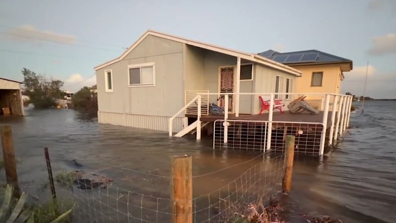
Impact on Coastal Communities
One of the primary concerns for emergency services is the risk posed by dangerous high tides. Coastal communities are currently under advisory as the combination of storm surges and high astronomical tides threatens to breach low-lying areas. The Bureau of Meteorology continues to update its official severe weather warnings, urging residents to monitor local conditions closely and adhere to instructions from emergency personnel.
The impact extends beyond the immediate threat of flooding. Strong winds have the potential to bring down power lines and cause structural damage to property. Utility providers are on standby, though they have cautioned that repairs may be delayed until weather conditions improve sufficiently to ensure the safety of field crews.
Safety and Preparedness
In light of the ongoing threats, emergency management agencies are emphasizing the importance of individual preparedness. For those in high-risk flood zones, the standard guidance remains to avoid unnecessary travel, particularly through flooded roadways. As the saying goes, “if it’s flooded, forget it,” a mantra that remains critical during these periods of rapid water accumulation.
For international observers and residents alike, staying informed through verified government channels is the most effective way to navigate the situation. The Bureau of Meteorology provides real-time updates via their website and official social media channels, which serve as the primary source for accurate, localized information during severe weather events.
Looking Ahead
As the low-pressure system is expected to move offshore, meteorologists are closely monitoring the trajectory and potential for lingering instability. While the most intense phase of the storm is expected to pass, the residual effects—including swollen waterways and weakened infrastructure—will likely persist for several days. Residents are encouraged to check for ongoing flood warnings and to remain alert for updates from local municipal councils.
We will continue to track the development of this weather system as it moves toward the Tasman Sea. For those affected by the storm, please ensure you have access to emergency contact lists and stay tuned to local radio or official government alerts for the latest developments. We invite our readers to share their experiences or questions in the comments section below, and we encourage you to share this report to help keep your local community informed.