
Google Maps displays speed limit information in many regions, but the feature is not universally available and may be absent due to regional data limitations, local regulatory constraints, or variations in how individual devices process map updates. While the application is designed to provide real-time guidance, the presence of a speed limit icon depends on the availability of reliable data for specific road segments as maintained by local transport authorities and geographic information systems.
Drivers frequently encounter missing speed limit data because Google Maps relies on a combination of third-party data, official government reporting, and imagery analysis to populate its speed limit database. According to the official Google Maps Help portal, speed limit information is only available in certain locations and is intended for informational purposes rather than as a definitive source for traffic law compliance. When the app cannot verify the legal speed limit for a specific stretch of road, the icon will simply remain hidden from the navigation interface.
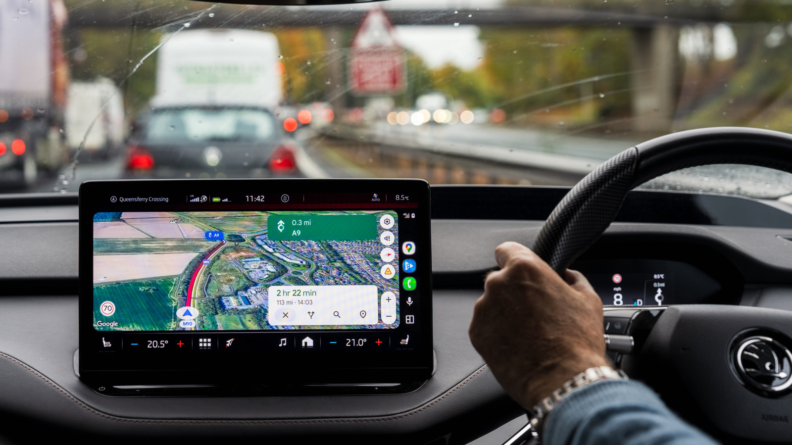
Why Speed Limit Data Disappears During Navigation
The primary reason for the absence of speed limit indicators is the lack of standardized, digitized data for specific geographic areas. Mapping services require high-quality, up-to-date inputs from local municipalities to accurately display road rules. In many regions, local governments do not provide open-access digital databases for speed limit signage, forcing companies to rely on slower, manual verification methods, such as Street View imagery or community-reported updates.

Furthermore, technical settings can influence the display of these features. Users must ensure their application is updated to the latest version, as legacy software may fail to render newer interface elements or display data correctly. According to the Google Maps Platform technical documentation, real-time layers require a stable data connection to sync with the server; a weak or intermittent cellular signal can cause the app to omit non-essential UI elements, like speed limits, to prioritize basic turn-by-turn navigation data.
Regulatory and Regional Variations
The availability of speed limit data is often tied to the legal and administrative environment of a specific country. In some jurisdictions, road authorities maintain strict control over how mapping data is utilized, and privacy or safety regulations may restrict the real-time broadcast of speed-related information. Consequently, a user may see speed limits in one country or state but find the feature missing after crossing a border where local data sharing agreements differ.

Additionally, the accuracy of the speed limit icon can be impacted by temporary changes to road conditions. Construction zones, seasonal speed limit adjustments, and emergency traffic management orders are not always reflected instantly in global mapping databases. Because Google Maps relies on a delayed update cycle for these segments, the app may intentionally withhold speed limit information if it determines that the stored data is outdated or potentially unreliable, thereby preventing the display of inaccurate guidance that could lead to traffic violations.
How Users Can Improve Data Accuracy
Users who notice missing or incorrect speed limit information can contribute to the improvement of the platform through the built-in reporting tools. By selecting the “Report a problem” option within the Google Maps interface, drivers can flag missing signage or incorrect limits for specific road segments. Once submitted, this data is reviewed by the company’s moderation teams or processed via automated systems to verify the change against current imagery and official records.
It is important to remember that, regardless of what is displayed on a screen, the physical signage posted by local law enforcement and transport departments remains the sole legal authority for speed limits. Drivers are encouraged to prioritize road signage over digital interfaces, as mapping software acts as a secondary aid rather than a replacement for visual observation of traffic laws.
Next Steps for Platform Updates
Google has not announced a specific date for the global expansion of speed limit data, as the feature continues to be rolled out on a region-by-region basis as data quality permits. Users should monitor the official Google Keyword blog for announcements regarding new feature deployments in their specific area. As mapping technology advances, the integration of AI-driven image recognition is expected to speed up the verification of roadside signs, potentially reducing the frequency of missing data in the future.
If you have experienced issues with missing speed limit data, feel free to share your observations in the comments below. Staying informed about your local navigation updates ensures a safer driving experience for everyone.