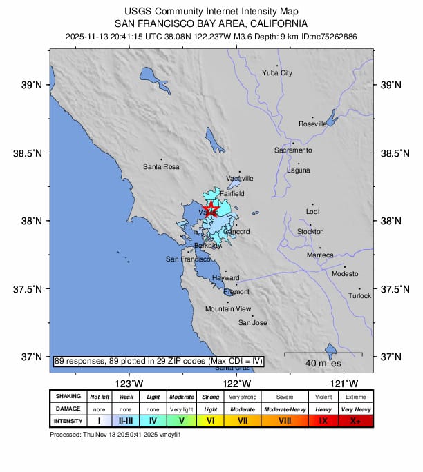
Residents in the San Francisco Bay Area were rattled early Sunday morning, June 7, 2026, when a magnitude 3.6 earthquake struck the East Bay region. According to data from the United States Geological Survey (USGS), the tremor occurred in the vicinity of Alamo, California, and was felt across various parts of the East Bay. The seismic activity serves as a reminder of the region’s ongoing geological volatility.
The primary event, recorded at a magnitude of 3.6, was followed by at least one smaller temblor in the same area. While such earthquakes are relatively common in the seismically active San Francisco Bay Area, the early morning timing meant the shaking was widely noticed by local residents. The USGS provides real-time monitoring and reporting for these events, allowing the public to track seismic activity as it happens.
Understanding the Seismic Activity Near Alamo
The earthquake’s epicenter was situated near Alamo, a community nestled in the East Bay, an area frequently monitored by geologists for movement along regional fault lines. Because the magnitude was 3.6, the shaking was generally light, though it was sufficient to wake some residents and trigger reports of movement across the surrounding counties. Earthquake magnitude, as measured by the USGS, is a logarithmic scale, meaning each whole number increase represents a ten-fold increase in measured amplitude.
Following the initial 3.6-magnitude quake, officials noted a secondary, smaller tremor. Seismologists often classify such events as aftershocks if they occur within the same general rupture zone shortly after a larger, primary earthquake. For those living in California, the state’s Office of Emergency Services encourages residents to maintain emergency preparedness kits and stay informed through official channels like the USGS “Did You Feel It?” reporting system.
Preparedness in the San Francisco Bay Area
The San Francisco Bay Area sits atop a complex network of faults, including the Hayward and Calaveras faults, which run through the East Bay. Sunday’s event highlights the necessity of remaining earthquake-ready in a region defined by its tectonic environment. Experts emphasize that while smaller earthquakes like the one recorded on June 7 do not necessarily indicate an imminent larger disaster, they are a functional part of the region’s geological life cycle.
For residents, the most effective way to stay informed is to check the USGS interactive earthquake map, which provides the most accurate and up-to-date coordinates, depths, and magnitudes for all seismic events in the United States. Following these alerts helps the public distinguish between minor, routine tectonic shifts and events that might require additional caution or structural checks.
What Happens Next
There are no scheduled public hearings or official government briefings regarding this specific seismic event, as it falls within the range of standard activity for the region. However, the USGS continues to monitor the area for any further seismic signatures. Residents are encouraged to report their experiences through the USGS Did You Feel It? website, as these crowd-sourced reports assist scientists in mapping the intensity and impact of earthquakes in real time.
If you felt the shaking this morning, you can share your observations on the USGS portal to help improve local seismic data collection. Stay tuned to our reporting as we continue to monitor updates from geological authorities regarding regional seismic trends.