First Snowfall on the Horizon: What to Expect This Week
The first significant snowfall of the season is approaching, and you’ll want to be prepared. I’ve been tracking this system closely,and here’s a breakdown of what you can expect across the New York metropolitan area.
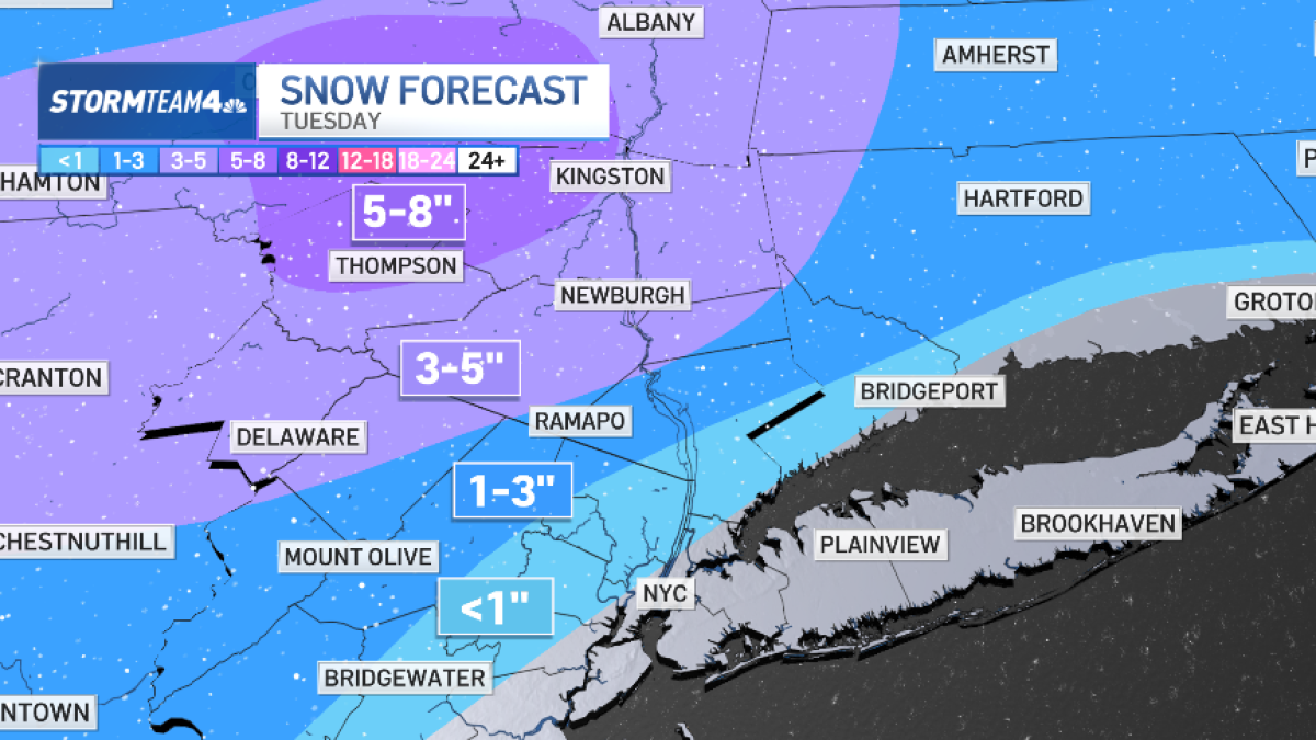
Snowfall Predictions: A Regional Outlook
Conditions will vary significantly depending on your location. here’s a look at the forecast:
* Mid-Hudson Valley & Northwest New Jersey: Expect the heaviest snowfall, with accumulations of five to eight inches possible.
* North of New york City: A substantial dusting is likely, possibly reaching half a foot in some areas.
* New York City & Southern Communities: Rain is the more probable outcome, though a few snowflakes aren’t entirely out of the question.
Timing: When Will the Snow Arrive?
The snow is anticipated to begin moving in during Tuesday morning, potentially impacting your commute. It’s an excellent idea to allow extra travel time and check road conditions before heading out.
Fortunately, the system is expected to clear out by Wednesday. This means conditions should be dry in time for a major event.
Rockefeller center Christmas Tree Lighting: A Chilly Festivity
The iconic Rockefeller Center Christmas tree lighting is scheduled for Wednesday, and while the weather will be clear, it will be cold. Temperatures are currently projected to be in the mid-30s.
I always recommend dressing warmly in layers for outdoor events like this. A hat, gloves, and a warm coat are essential!
Looking Ahead: A Glimpse at the Temperature Trend
Here’s a quick look at the projected low temperatures over the next few days.(See image for a visual representation).
[Image of 10-Day Low Temperature Bar Graph]
this early-season snowfall is a reminder that winter is officially here. stay safe, stay warm, and enjoy the beauty of the season!