
Residents across multiple Colombian cities were alerted on Wednesday, April 29, 2026, as a moderate earthquake struck the region, sending tremors through urban centers and coastal provinces. The seismic event, which occurred during the afternoon and evening hours, was felt most acutely in the capital city of Bogotá and the city of Villavicencio, prompting a surge of reports from concerned citizens and local authorities.
The earthquake, which has been described as a moderate seismic event, originated in the North Pacific Ocean. While the tremor caused widespread alarm, there have been no immediate reports of major structural failures or significant casualties. The event underscores the ongoing seismic vulnerability of the region, which is situated along some of the world’s most active tectonic boundaries.
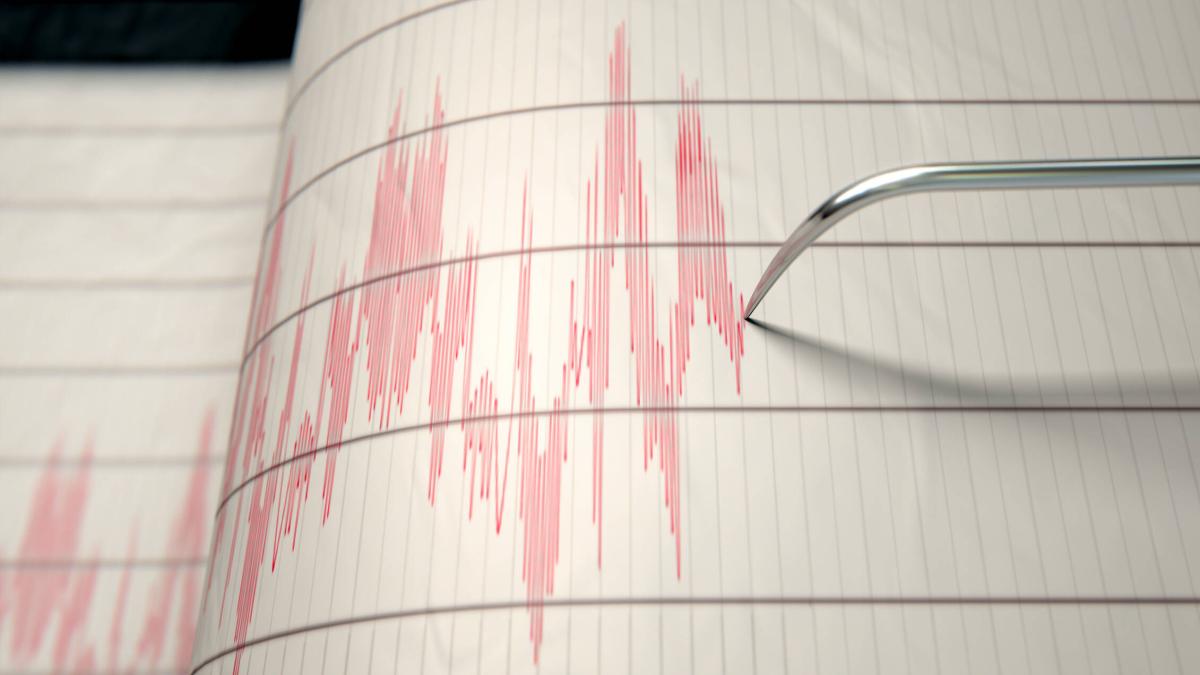
According to seismic monitoring data, the earthquake registered a magnitude of 4.4 and was located approximately 210 kilometers southwest of Quibdó, in the department of Chocó Volcano Discovery. The tremor was recorded at 15:08 (GMT -5) on Wednesday, April 29, 2026, with the epicenter situated well offshore in the North Pacific.
Epicenter and Technical Specifications of the April 29 Sismo
The technical profile of the earthquake indicates a moderate release of energy, typical of the subduction processes occurring off the western coast of South America. The epicenter’s location—210 km southwest of Quibdó—placed the origin of the quake in the Pacific Ocean, meaning the seismic waves had to travel through the Andean cordilleras to reach the interior of the country.

In the city of Villavicencio, the tremor was reported as a magnitude 4.0 event La FM. The variance in reported magnitudes between the epicenter and specific cities is common in seismology, as different stations measure different types of waves (P-waves and S-waves) and local soil conditions can amplify or dampen the perceived intensity of the shaking.
The depth of the earthquake played a critical role in how the tremor was perceived. Shallow earthquakes typically cause more intense shaking at the surface near the epicenter, while deeper events can be felt over a much wider geographic area but with less localized intensity. This particular event was felt as far inland as Bogotá, indicating that the seismic energy propagated efficiently across the Colombian territory.
Regional Impact: From Bogotá to Villavicencio
In Bogotá, the capital, the earthquake was felt by a significant number of residents, particularly those in high-rise buildings where the swaying motion of the structure often amplifies the sensation of a tremor. Social media and local news outlets reported a wave of apprehension as people stepped outside to assess their surroundings RCN Radio.
Villavicencio also experienced notable shaking, with local reports confirming that the magnitude 4.0 tremor was clearly perceptible to the population La FM. For residents of the Meta department, such events serve as a stark reminder of the region’s geological instability.
The department of Chocó, specifically around Quibdó, is geographically closest to the epicenter. But, because the quake originated 210 kilometers offshore, the immediate coastal impact was mitigated. The Pacific coast of Colombia is a high-risk zone for seismic activity due to the continuous interaction between the Nazca Plate and the South American Plate.
Understanding Colombia’s Seismic Risk
Colombia is one of the most seismically active countries in South America. What we have is primarily due to its location at the convergence of several tectonic plates. The most significant interaction occurs where the Nazca Plate subducts beneath the South American Plate, a process that creates the Andes Mountains and generates frequent earthquakes along the western coast and the Pacific basin.

Seismologists categorize these events based on the Richter scale or the Moment Magnitude Scale (Mw). A magnitude 4.4 event is classified as “light” to “moderate.” While such quakes are rarely catastrophic, they can cause minor damage to older or poorly constructed buildings and often trigger anxiety in densely populated urban areas.
The frequency of these tremors is a result of the “Pacific Ring of Fire,” a string of volcanoes and seismic sites encircling the Pacific Ocean. Colombia’s position makes it susceptible to both interplate earthquakes (occurring at the boundary of plates) and intraplate earthquakes (occurring within a single plate), the latter of which can sometimes be felt more strongly in the interior of the country, including Bogotá.
Key Takeaways from the April 29 Event
- Date and Time: Wednesday, April 29, 2026, at 15:08 (GMT -5).
- Magnitude: Registered at 4.4 at the epicenter Volcano Discovery and 4.0 in Villavicencio La FM.
- Epicenter: North Pacific Ocean, approximately 210 km southwest of Quibdó, Chocó.
- Areas Affected: Felt prominently in Bogotá, Villavicencio, and the Chocó region.
- Casualties: No major injuries or fatalities reported.
Safety Protocols and Official Guidance
In the wake of the tremor, Colombian emergency management agencies emphasize the importance of following established safety protocols. The Servicio Geológico Colombiano (SGC) is the primary authority for monitoring seismic activity and providing official data on magnitudes and epicenters.
During a seismic event, experts recommend the “Drop, Cover, and Hold On” maneuver. Residents in urban areas are advised to stay away from glass windows, heavy furniture, and external walls. In high-rise buildings, it is critical to avoid using elevators during and immediately after the shaking stops, as power failures or structural shifts can lead to entrapment.
For those living in coastal regions like Chocó, the primary concern during a large offshore earthquake is the potential for a tsunami. While a magnitude 4.4 quake is generally too small to trigger a significant tsunami, the SGC and the Dirección General Marítima (DIMAR) monitor sea levels constantly to issue warnings if necessary.
What to Do During an Earthquake in Colombia
- Stay Calm: Avoid panic to prevent stampedes or accidental injuries.
- Seek Cover: Get under a sturdy table or desk to protect yourself from falling debris.
- Evacuate Safely: Once the shaking stops, use stairs—not elevators—to move to a designated safe zone.
- Stay Informed: Follow official channels such as the SGC for verified information rather than relying on unconfirmed social media reports.
Looking Ahead: Monitoring and Preparedness
The earthquake on April 29 is part of a continuous pattern of seismic release in the region. Geologists note that moderate quakes can sometimes be precursors to larger events, or they can be the primary release of accumulated stress along a fault line. Continuous monitoring by the SGC is essential for mapping risk zones and improving building codes in cities like Bogotá and Villavicencio.

Public preparedness remains the most effective tool in reducing the impact of future sismos. Regular earthquake drills in schools and workplaces, combined with the reinforcement of older infrastructure, are critical components of Colombia’s national disaster risk reduction strategy.
The next official update regarding regional seismic activity is expected as the SGC continues to analyze the data from the April 29 event to determine if any aftershocks are likely in the Chocó region. Residents are encouraged to remain vigilant and keep emergency kits prepared.
World Today Journal encourages readers to share their experiences of the tremor in the comments below and to share this article with friends and family in Colombia to spread awareness of safety protocols.