As the Pearl River Delta region enters a period of intense atmospheric instability, meteorologists are closely monitoring a series of severe weather systems impacting southern China. Authorities across the Guangdong province, including the Zhongshan Meteorological Observatory, have issued high-level emergency warnings as a combination of torrential rain, gale-force winds, and thunderstorms sweeps across major urban centers, including Guangzhou, and Shenzhen.
For residents and travelers in the region, the issuance of a red alert for rainstorms—the highest level in China’s four-tier color-coded weather warning system—signals an immediate need for caution. These developments highlight the volatile nature of the summer monsoon season in South China, where rapid shifts from extreme heat to violent convective weather can pose significant risks to urban infrastructure and public safety, according to data provided by the National Meteorological Center of China.
Understanding the Severity of Guangdong’s Weather Alerts
The current weather pattern is characterized by localized but extreme convective activity. When a red rainstorm alert is triggered, it indicates that precipitation has reached or is expected to reach extreme levels—typically exceeding 100 millimeters within three hours—posing a severe threat of urban waterlogging, flash flooding, and geological hazards. In cities like Zhongshan, local emergency management bureaus have activated response protocols to mitigate the impact of this heavy rainfall on low-lying areas and transit networks.
Simultaneously, neighboring regions are grappling with strong convective weather. In Guangzhou, specifically within the Nansha District, authorities have deployed yellow alerts for thunderstorms and gales. These systems are frequently accompanied by short-duration, high-intensity wind gusts, sometimes reaching force 6 to 8 on the Beaufort scale, which can down trees and disrupt power lines. The Guangdong Meteorological Service continues to provide real-time updates as these storm cells move across the Pearl River Delta, emphasizing that the danger lies in the unpredictability of these “pop-up” storms.
Impact on Daily Life and Urban Infrastructure
The transition from the intense “steaming” heat common to Guangdong in the summer to these sudden, violent thunderstorms represents a challenging shift for residents. In Shenzhen, the weekend forecast suggests a significant departure from the recent high-temperature “baking” mode, as incoming rain and wind gusts are expected to bring a temporary reprieve in temperatures but a sharp increase in travel hazards. The combination of strong lightning and sudden wind shear requires heightened vigilance for those navigating the city’s dense transport corridors.

Public safety officials are advising citizens to take the following precautions during these active weather periods:
- Monitor Official Channels: Stay tuned to the latest bulletins from the local meteorological bureaus via official mobile apps or verified social media accounts.
- Avoid Low-Lying Areas: Exercise extreme caution when driving or walking in areas prone to urban flooding.
- Secure Outdoor Items: Given the forecasted 8-grade wind gusts, residents should ensure that balcony items, plants, and temporary structures are secured to prevent them from becoming projectiles.
- Limit Outdoor Exposure: During the peak of thunderstorm activity, remain indoors and away from large metal structures or tall, isolated trees to avoid lightning strikes.
The Science of Convective Weather in the Pearl River Delta
The Pearl River Delta’s unique geography, situated between the South China Sea and the mountainous interior, creates a perfect environment for rapid convective development. When warm, moist air from the sea meets the intense heat of the urban heat island effect, it triggers rapid cloud formation. According to the World Meteorological Organization, these localized storms are becoming more frequent as global climate patterns shift, necessitating more sophisticated early-warning systems and robust urban planning.
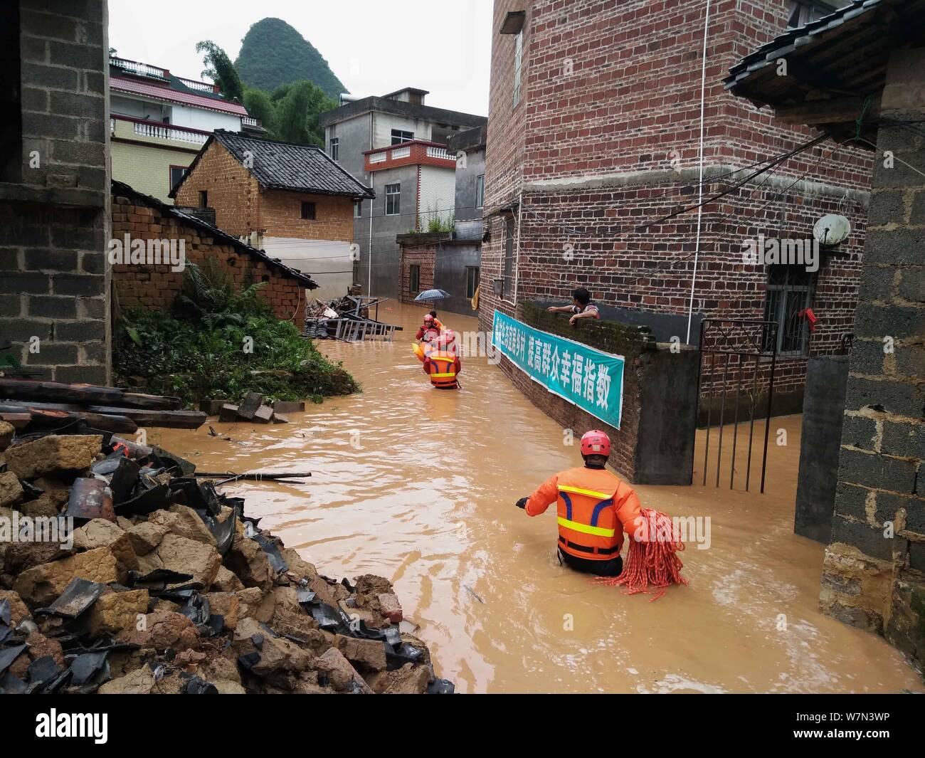
In practice, this means that even when the broader regional forecast appears benign, specific districts like Yuexiu or Tianhe in Guangzhou may face intense, localized deluges. The authorities utilize a sophisticated network of Doppler radar and ground-based sensors to track these cells, allowing for the issuance of “nowcasting” alerts that provide residents with a window of just a few hours to prepare for severe impacts.
What Happens Next: Preparedness and Response
As the weekend progresses, the focus remains on the movement of the cold front pushing into the region. Meteorological experts indicate that while the intensity of the rain is expected to fluctuate, the risk of secondary disasters—such as landslides in mountainous outskirts or sudden street flooding—remains elevated until the atmospheric pressure stabilizes. The China Meteorological Administration has urged all local departments to maintain high levels of readiness, ensuring that emergency pumps and drainage systems are fully operational.
For those living in or visiting Guangdong, the best defense is preparedness. Keep your mobile devices charged and ensure you have access to emergency alerts. As I have observed throughout my years covering international affairs and environmental developments, the resilience of these mega-cities often depends on the speed and clarity of communication between the state and the individual citizen.
We will continue to monitor the situation as official reports are updated. If you are in the affected areas, please share your experiences or local observations in the comments section below, and ensure you remain connected to local emergency services for the most current safety instructions.
Related reading