
Cold Front Sweeps Across Brazil, Triggering Rain and Temperature Drops in South-Central Regions
A significant meteorological shift is currently unfolding across Brazil as a powerful cold front advances through the country, bringing a period of intense weather instability. The arrival of this system is expected to bring widespread rainfall and a notable decrease in temperatures, particularly affecting the South-Central regions. As the air mass moves, it is fundamentally altering the recent weather patterns, signaling a transition toward much cooler and more volatile conditions.
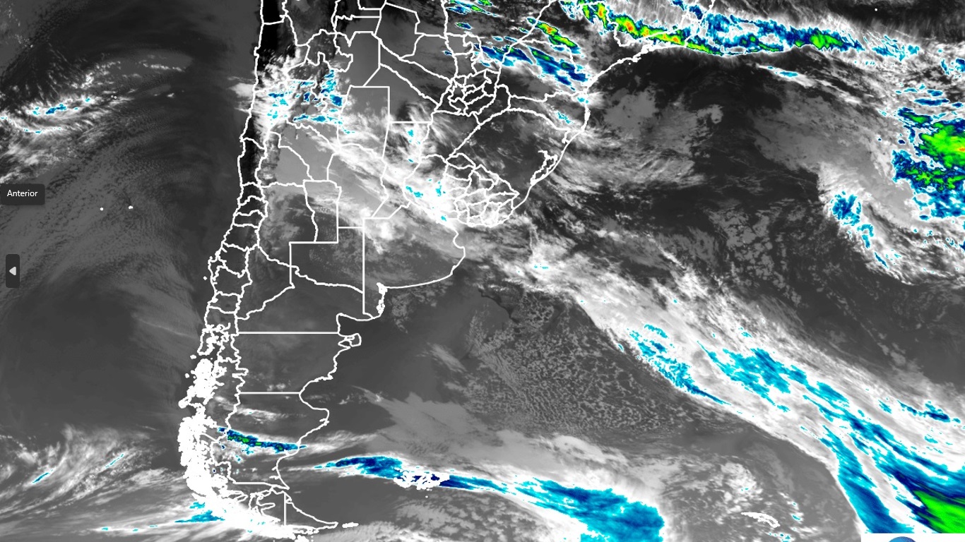
Meteorological observers are closely monitoring the progression of these storms, which are moving across the national territory. Of particular concern to weather services is the potential formation of a cyclone, a development that could intensify storm activity and prolong periods of instability. With heavy rain predicted for major urban centers, including São Paulo, the system poses a significant impact on regional weather patterns through the upcoming weekend.
Meteorological Shift in South-Central Brazil
The current weather event is driven by the movement of a cold front, a boundary separating a mass of cooler air from a warmer one. As this boundary advances, it forces the warmer, more moist air upward, a process that frequently results in the development of cumulonimbus clouds and significant precipitation. This transition is expected to be most pronounced in the South and Central-South regions, where the temperature drop will be most tangible.
The influx of cooler air is not merely a temporary dip in temperature but represents a broader shift in the atmospheric dynamics of the region. This movement of air masses is a characteristic feature of seasonal transitions, yet the intensity of the current front suggests a more aggressive arrival than typical patterns. Residents in the affected areas are advised to prepare for a marked departure from the recent warmth, as the cold air mass settles into the lower latitudes.
Precipitation and Temperature Declines
As the cold front establishes itself, the primary impacts will be twofold: a substantial increase in rainfall and a sharp decline in ambient temperatures. In the South-Central regions, the convergence of air masses is expected to trigger consistent precipitation. This rainfall is not expected to be light; rather, meteorological reports indicate the potential for heavy downpours that could lead to localized flooding and reduced visibility in transit corridors.

Accompanying the rain is a significant drop in temperatures. The thermal shift is expected to be felt most acutely during the overnight and early morning hours, as the cooler air settles into valleys and low-lying areas. This sudden cooling may catch many off guard, particularly in regions that have recently experienced warmer-than-average conditions. The combination of moisture and falling temperatures often increases the sensation of damp cold, which can impact public health and energy consumption levels.
Weather Instability and Cyclone Alerts
One of the most critical aspects of the current weather system is the alert regarding potential cyclone formation. As the cold front interacts with existing atmospheric instabilities, there is a risk of cyclogenesis—the process of a cyclone forming. If a cyclone develops, the resulting pressure gradients could significantly escalate the wind speeds and the intensity of the storms currently moving through the country.
The progression of these storms is being tracked with high priority, as the formation of a cyclone would introduce more complex and unpredictable weather patterns. Such a development typically brings sustained winds and more organized storm cells, which can increase the risk of structural damage and disruption to essential services. Meteorologists are emphasizing the need for continued vigilance as the atmospheric conditions evolve over the next several days.
Regional Forecast and Weekend Outlook
The outlook for the weekend remains characterized by instability. In major metropolitan areas, such as São Paulo, forecasts indicate a period of heavy rainfall. This instability is expected to persist, making Sunday a particularly challenging day for outdoor activities and travel. The combination of rain and cooler temperatures is expected to define the weekend experience for much of the South-Central population.

While the most intense activity is centered on the South and South-Central regions, the reach of the instability may extend to neighboring states. The movement of the front suggests that while some areas may experience brief periods of clearing, the underlying pattern of instability will remain a dominant feature of the regional weather through the end of the week. Authorities and weather services are continuing to update their models to provide more precise timing for these shifts.
Key Takeaways
- Primary Impact: Widespread rain and a significant drop in temperatures across South-Central Brazil.
- Critical Alert: Potential formation of a cyclone, which could intensify storm activity and wind speeds.
- Urban Risk: Heavy rainfall is specifically anticipated in São Paulo and surrounding regions.
- Weekend Outlook: Continued instability, rain, and cooler conditions are expected to persist through Sunday.
As the situation develops, meteorological agencies will continue to issue updates regarding storm intensity and temperature fluctuations. Residents are encouraged to monitor official weather advisories and prepare for potential disruptions to daily routines caused by heavy rain and sudden temperature changes.
The next scheduled meteorological update is expected as the system moves further into the South-Central interior. Please share this report with those in affected regions and leave your comments below regarding the weather conditions in your area.