
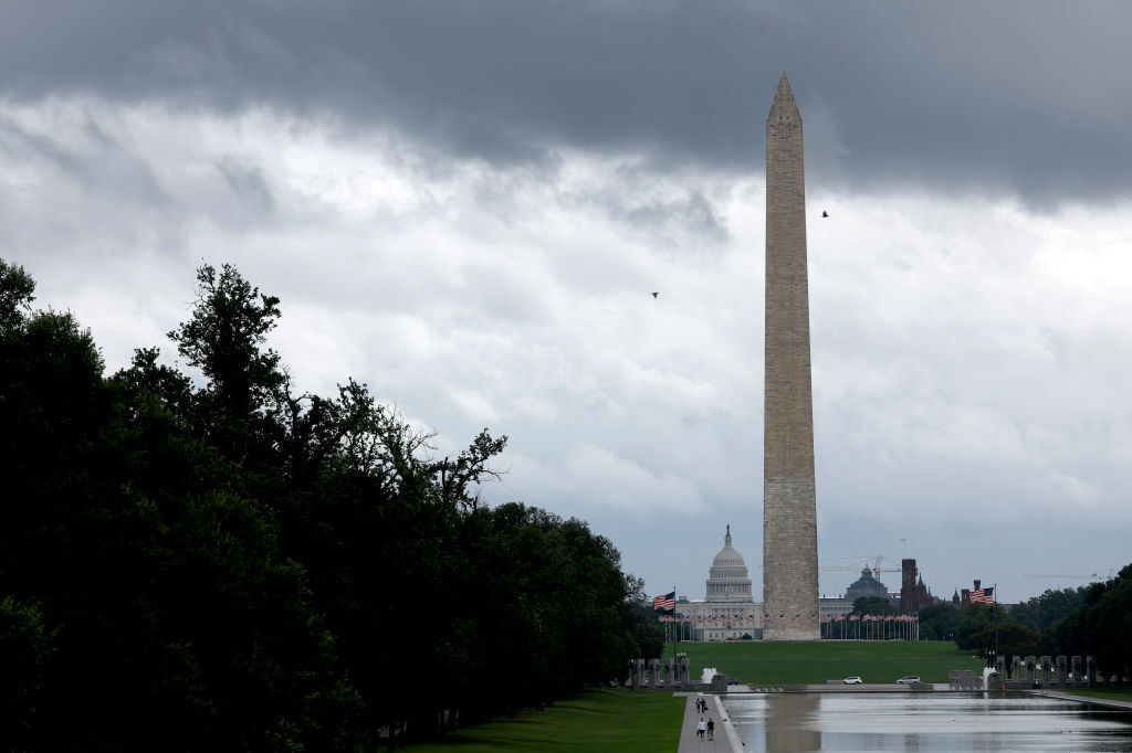
A significant weather transition is currently underway for the Mid-Atlantic, as a cold front approaches the DC region, bringing a mixture of thunderstorm threats, travel disruptions and a dramatic shift in temperature. Residents and travelers in the Washington metropolitan area should prepare for a volatile evening characterized by gusty winds and heavy downpours, followed by a period of unseasonably cool air before a rapid surge into summer-like heat.
The immediate impact of the approaching system has already disrupted regional travel. A ground stop was issued for both Reagan National Airport and Dulles International Airport due to thunderstorm activity, with restrictions expected to remain in place until approximately 8:30 p.m. This interruption comes as a breezy and cloudy afternoon transitioned into a stormy period during the peak afternoon commute, complicating transit for thousands of residents across the beltway.
Meteorologist Steve Rudin noted that while the system is moving through, there is a significant opportunity for much-needed precipitation. “But a better chance for widespread meaningful rainfall along with some gustier winds and rumbles of thunder this evening,” Rudin said, adding that the region “needs every drop we can get.”
Evening Storm Threats and Airport Disruptions
As the evening progresses, the primary concern for the Washington DC weather forecast involves the arrival of a main line of rain. This system is expected to bring the potential for heavier downpours and thunder, accompanied by gusty winds reaching between 20 and 30 mph. While meteorologists indicate that severe weather is not a widespread threat, the localized intensity of these storms could lead to brief but heavy rainfall.
The storm activity is expected to move eastward throughout the night. As these cells progress, they are projected to weaken, with the majority of showers reaching the I-95 corridor by mid-to-late evening. Current estimates suggest that rain totals for most areas will remain relatively modest, generally staying under half an inch. However, the combination of moisture and wind will remain the primary concern for commuters and outdoor activities through the overnight hours.
Following the main line of storms, the region may experience patchy fog in areas where skies briefly clear before the wind shifts. Overnight, temperatures are expected to settle into the 50s, providing a sharp contrast to the mid-70s seen earlier in the day.
The Cold Front Transition and Thursday’s Cool Down
The arrival of the cold front will bring more than just rain; it will fundamentally alter the regional air mass. Behind the front, winds are expected to shift from a southerly direction to the northwest. This shift will usher in a noticeably different atmospheric feel, marking a significant weather transition for the area.
Thursday is forecasted to be a damp and significantly cooler day. High temperatures are expected to reach only the lower 60s, a figure that sits nearly 15 degrees below the seasonal normal for mid-May. Under partly to mostly cloudy skies, the northwest breeze will persist, with wind gusts potentially reaching up to 25 mph. While most neighborhoods surrounding the beltway should remain dry, some scattered showers may continue to linger across the mountain regions.
This period of cooler, less humid air will provide a brief reprieve before the next major shift in the pattern. By Friday, high pressure is expected to build back into the area, leading to a “solid rebound” in weather conditions. Friday will likely be mostly sunny and breezy, with temperatures climbing into the mid-70s and humidity remaining low, offering a comfortable conclusion to the workweek.
A Rapid Weekend Warmup and Summer Heat Preview
Following the brief cool period, the region will experience a rapid temperature warmup heading into the weekend. A southwest flow will push temperatures upward, bringing a much warmer, early-summer feel to the suburbs and the metro area.
On Saturday, sunshine is expected to dominate the region, with highs climbing into the lower and middle 80s. While humidity will begin to inch upward, conditions are expected to remain relatively manageable for mid-May. Forecasters note that while the warmth will be felt, local temperature records do not appear to be in immediate jeopardy; for instance, the record high at Reagan National (DCA) of 93 degrees is expected to remain out of reach. However, the record at Dulles (90 degrees) may see temperatures move closer to the mark.
The warming trend intensifies on Sunday, with highs climbing into the middle and upper 80s, and some locations potentially reaching the 90-degree threshold. While the day should remain mostly sunny, a stray late-day shower or thunderstorm cannot be entirely ruled out. This Sunday warmth serves as a precursor to even more intense conditions expected early next week.
Long-Term Outlook: Increasing Humidity and Heat
The transition from the current cold front to the weekend heat is only the beginning of a building pattern. As we move into Monday and Tuesday, the regional weather pattern is expected to stabilize into a much hotter and more humid setup.

By the start of next week, humidity is forecasted to build significantly. High temperatures could reach the low to mid-90s, marking a return to high-summer conditions. Residents are advised to prepare for this humidity increase and the accompanying heat by ensuring air conditioning systems are functional and staying hydrated during the peak afternoon hours.
Quick Forecast Summary
| Period | Expected Conditions | High/Low Temp | Wind/Alerts |
|---|---|---|---|
| Wednesday Night | Lingering Showers | 48°F – 55°F | South to NW winds |
| Thursday | Partly Cloudy/Cool | 60°F – 65°F | NW winds, 25 mph gusts |
| Friday | Mostly Sunny/Breezy | ~75°F | NW winds 10-20 mph |
| Saturday | Mostly Sunny/Warm | 83°F – 88°F | SW winds 5-10 mph |
| Sunday | Mostly Sunny/Hot | 85°F – 90°F | SW winds 5-10 mph |
As the weather pattern continues to evolve, official updates from local meteorological offices and airport authorities should be monitored for any changes to travel advisories or severe weather warnings. We will continue to track these developments as they unfold.
What are the weather conditions like in your part of the DC metro area today? Share your observations in the comments below and share this update with anyone traveling this weekend.