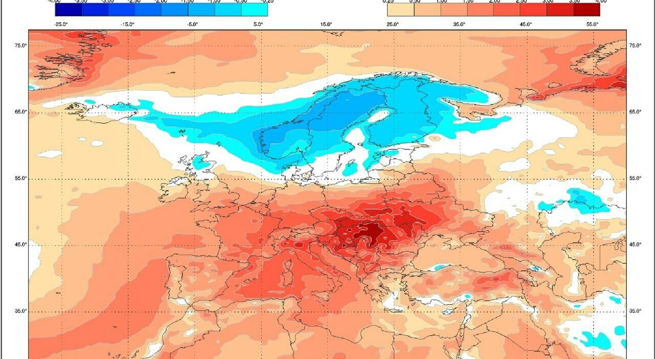
An oppressive subtropical heatwave gripping Italy shows little sign of immediate relief, with meteorological data indicating that temperatures and humidity levels will remain exceptionally high through the mid-August holiday before a potential shift arrives around August 17, according to cross-referenced analyses from major mathematical models like GFS and ECMWF.
The current weather pattern marks the fourth subtropical heatwave of the season, a prolonged period of stifling conditions that began during the final week of July. Unlike typical summer weather cycles, this stretch has lacked any substantial southward influx of cooler oceanic air to break the sustained heat, leaving large parts of the country exposed to prolonged high temperatures and exceptionally heavy humidity.
According to meteorological observations, the critical peak of this heatwave is projected to last through the national holiday, with maximum temperatures climbing toward 42°C across southern regions and the major islands of Sicily and Sardegna. Northern areas face similar daytime highs approaching 40°C before more pronounced atmospheric shifts begin to develop.
The Forecast Breakdown: Mid-August Peaks and Rising Humidity
Day-to-day comfort levels depend heavily on dew point measurements rather than standard thermometer readings alone. Meteorologists note that dew points exceeding 25°C severely inhibit the human body’s ability to cool itself through perspiration, significantly elevating the risk of heat-related illnesses. The Mediterranean Sea, maintaining unusually warm surface temperatures, continues to function as an immense reservoir of atmospheric moisture.
Before any significant weather disruption occurs, brief convective storms are expected to develop primarily over higher terrain and mountain ranges, driven by the intense thermal energy accumulated near the ground. While daytime conditions remain hot and stable across most regions, nighttime storms pose risks of sudden hail and strong wind gusts, particularly across northern lowland areas like the Po Valley.
The European Model Outlook for August 17 and Beyond
Looking ahead to the middle of the month, forecasting models diverge on how the weather pattern will evolve. The European Centre for Medium-Range Weather Forecasts (ECMWF) projects an organized push of unstable North Atlantic air arriving around Monday, August 17. This upper-level trough is expected to sweep across northern regions before tracking southeastward over the central Mediterranean.
Under this scenario, a sharp drop in temperatures is anticipated starting August 18, accompanied by widespread rainfall, potential downpours, and localized severe weather events. Forecasters warn that the combination of lingering tropical heat near the surface and incoming cooler, dynamic air masses could trigger violent storms, torrential precipitation, and large hail.
Conversely, the United States Global Forecast System (GFS) presents a different trajectory. While the American model acknowledges an increase in atmospheric instability around August 17, it does not depict a clean, sweeping cold front crossing the peninsula. Instead, GFS outputs favor isolated but intense thunderstorms embedded within a persistent dome of hot air that may continue to influence weather patterns across southern Europe through the final week of August.
What Lies Ahead for the Remainder of August
Weather analysts emphasize that a temporary drop in temperature driven primarily by cloud cover and rainfall does not automatically equate to a definitive end to the summer season. True relief requires a sustained influx of cooler continental or oceanic air capable of eroding the entrenched tropical air masses.
As meteorological centers continue to process daily model runs, residents and travelers are advised to monitor official civil protection advisories and local forecasts for updates on incoming storm risks and temperature fluctuations.
Keep reading