
The global climate is currently witnessing a significant transition as the cooling influence of La Niña fades, making way for the emergence of a robust El Niño. This shift in the El Niño-Southern Oscillation (ENSO) cycle is more than just a meteorological curiosity; it represents a fundamental change in ocean-atmosphere interactions that can alter weather patterns across the globe, including the European continent and the Italian peninsula.
For those tracking the transition from La Niña to El Niño, the current atmospheric data suggests a pivot toward the warmer phase of the cycle. While La Niña is characterized by cooler-than-average sea surface temperatures in the central and eastern tropical Pacific, El Niño brings the opposite: a warming of these waters. This shift triggers a domino effect in the atmosphere, influencing the jet stream and the movement of moisture and heat across the planet.
Understanding what this means for Italy and Europe requires a appear at how these tropical anomalies translate into regional weather. While the influence of ENSO on European weather is often more indirect than its impact on the Americas, the transition to a “robust” El Niño can influence seasonal temperature trends and precipitation levels, potentially shifting the balance between wet and dry periods across the Mediterranean.
Understanding the ENSO Cycle: From La Niña to El Niño
The El Niño-Southern Oscillation, or ENSO, is a recurring climate pattern involving changes in the temperature of the Pacific Ocean and the atmosphere above it. It consists of two opposing phases—El Niño and La Niña—separated by a neutral phase. When La Niña fades, it typically signals that the atmospheric pressure and trade winds are shifting, allowing warmer water to migrate toward the eastern Pacific.
According to reports from South Carolina Public Radio, La Niña is currently fading as a robust El Niño comes into sight. This transition is critical because the “robust” nature of the incoming El Niño suggests a stronger-than-average warming event, which can amplify the resulting weather anomalies worldwide.
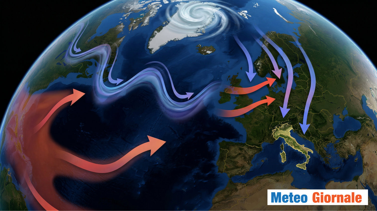
The mechanisms behind these changes are complex. El Niño typically involves a weakening of the trade winds, which allows warm water to pool near the coast of South America. This redistribution of heat alters the position of the jet stream, the high-altitude “river of air” that steers storm systems across the Northern Hemisphere. For Europe, this can mean a shift in how Atlantic depressions are routed toward the continent.
Impacts on European and Italian Weather Patterns
The influence of La Niña and El Niño on European weather is often described as indirect. Unlike the dramatic impacts seen in the Pacific Rim, the effects in Italy and the broader European region are filtered through other atmospheric drivers, such as the North Atlantic Oscillation (NAO). However, the shift to El Niño still carries significant implications for the Mediterranean climate.
Historically, the transition to El Niño can correlate with changes in winter precipitation and temperature. While La Niña is often associated with a “cold phase” of ENSO, the arrival of El Niño may alter the frequency of high-pressure systems over Central Europe. For Italy, this can manifest as changes in the stability of the atmosphere, potentially affecting the amount of rainfall the peninsula receives during the winter and spring months.
The BBC notes that these phenomena change the weather by shifting moisture and heat, which in turn affects where storms develop and where dry spells persist. In the context of Italy, a strong El Niño can influence whether the region experiences a milder, wetter winter or a more volatile period of temperature swings.
What Changes When El Niño Arrives?
- Temperature Shifts: The transition may lead to variations in average seasonal temperatures, potentially altering the duration of winter frosts in Southern Europe.
- Precipitation Levels: Changes in the jet stream can shift the path of moisture-bearing storms, which may either increase or decrease rainfall in the Mediterranean basin depending on the strength of the event.
- Agricultural Impact: Because Italian agriculture is highly dependent on predictable rainfall patterns, the shift from a La Niña influence to an El Niño influence is closely monitored by farmers and water management authorities.
- Atmospheric Stability: A robust El Niño can contribute to a more dynamic atmosphere, potentially increasing the likelihood of extreme weather events, such as intense bursts of rain or unexpected heatwaves.
Analyzing the “Robust” Nature of the Current Shift
The term “robust” is used by meteorologists to describe an El Niño event that is expected to have a significant impact on global temperatures. When an El Niño is strong, the warming of the Pacific is more pronounced, which generally increases the global average surface temperature. This overarching warming trend can exacerbate existing climate trends in Europe, such as the increasing frequency of summer droughts and winter flooding.
Industry analysts, including those at Stonex, monitor these shifts not only for weather forecasting but for the economic implications. The transition from La Niña to El Niño can impact global commodity markets, as weather anomalies in the Pacific affect crop yields in Asia and the Americas, which in turn influences global food prices and trade dynamics that eventually reach European markets.
For the resident of Italy, the primary concern is the “indirect” influence. While the Pacific is thousands of miles away, the interconnectedness of the global atmosphere means that a robust El Niño can nudge the European weather machine toward specific patterns. For instance, it may influence the strength of the polar vortex or the positioning of the Azores High, both of which are critical in determining whether Italy has a rainy spring or a dry one.
Key Takeaways: The Transition at a Glance
| Feature | La Niña (Fading) | El Niño (Emerging) |
|---|---|---|
| Pacific Ocean Temp | Cooler than average | Warmer than average |
| Global Temp Trend | Slight cooling effect | General warming effect |
| European Influence | Indirect / Cold phase | Indirect / Warm phase |
| Atmospheric Driver | Stronger trade winds | Weaker trade winds |
As the meteorological community continues to track the fading of La Niña, the focus now shifts to the intensity of the developing El Niño. The “robust” nature of this event suggests that the atmospheric response could be more pronounced than in previous neutral-to-warm transitions.
Meteorologists and climate agencies will continue to provide updates as the sea surface temperature anomalies in the Pacific become more established. The next critical checkpoint will be the official seasonal outlooks from global climate monitoring centers, which will provide more precise predictions on how this specific El Niño event will manifest in European precipitation and temperature charts.
Do you reckon the shift in global weather patterns is becoming more unpredictable? Share your thoughts in the comments below and share this article with your network to stay informed on the changing climate.