
The U.S. National Oceanic and Atmospheric Administration (NOAA) has officially confirmed that El Niño conditions are present in the Pacific Ocean, with the climate pattern expected to strengthen through the autumn and potentially reach significant intensity by the end of the year. This shift in sea surface temperatures, which influences global weather, has prompted meteorologists to monitor for potential shifts in precipitation and temperature patterns that could alleviate drought conditions in specific regions.
According to the NOAA Climate Prediction Center, the transition from La Niña to El Niño was officially declared in June 2023, marking the end of a rare “triple-dip” La Niña that persisted for three consecutive years. While the term “Super El Niño” is often used in media to describe events where sea surface temperatures in the equatorial Pacific rise more than 2.0 degrees Celsius above average, official agencies prioritize the term “strong” or “very strong” to describe the intensity of the event based on the Oceanic Niño Index (ONI).
Understanding the El Niño Climate Pattern
El Niño is a natural climate phenomenon characterized by the warming of surface waters in the central and eastern Pacific Ocean. This warming alters the position of the jet stream, which acts as a guide for storm tracks across the globe. As the jet stream shifts, it often directs moisture toward areas that are typically dry, while potentially causing drier conditions in regions that usually receive heavy rainfall.
The World Meteorological Organization (WMO) notes that El Niño events occur on an irregular cycle, typically every two to seven years. The current event follows a period of cooling, and its arrival is expected to have far-reaching implications for global agriculture, energy demand, and disaster management. Because the phenomenon changes the distribution of heat in the atmosphere, it frequently leads to a temporary increase in global average temperatures.
Potential Benefits and Regional Impacts
While El Niño is frequently associated with extreme weather, the shift can provide relief to regions suffering from prolonged aridity. In parts of the southwestern United States and South America, the increased storm activity often associated with El Niño can replenish reservoirs and improve soil moisture levels that were depleted during the previous La Niña phase, according to reports from the United States Department of Agriculture (USDA).
However, the impact is not uniform. The Food and Agriculture Organization of the United Nations (FAO) has cautioned that while some areas may benefit from increased rain, others—such as parts of Australia, Southeast Asia, and Southern Africa—may face heightened risks of drought and heatwaves. These variations require local governments to adjust water management strategies and agricultural planning well in advance of the peak impact months.
Monitoring the Intensity of the Current Event
Meteorologists track the intensity of El Niño by measuring sea surface temperature anomalies in the Niño 3.4 region of the Pacific. When these temperatures remain elevated for several consecutive months, the event is classified as “strong.” The NOAA National Centers for Environmental Information provides ongoing updates on these metrics, allowing researchers to compare current data against historical benchmarks like the 1997-1998 or 2015-2016 events, which were among the strongest on record.
The current forecast suggests the peak will occur between late autumn and early winter. Because El Niño changes the wind shear patterns in the Atlantic, it often suppresses hurricane formation in that basin while potentially increasing the number of tropical cyclones in the Pacific. Authorities in coastal regions are encouraged to consult local meteorological services for hyper-local impact assessments as the event matures.
Next Steps for Public Preparedness
The next official update regarding the status and projected strength of the El Niño event is scheduled for release by the NOAA Climate Prediction Center in their monthly ENSO Diagnostic Discussion. Residents in affected regions are advised to monitor these official channels for guidance on seasonal outlooks and potential weather hazards.
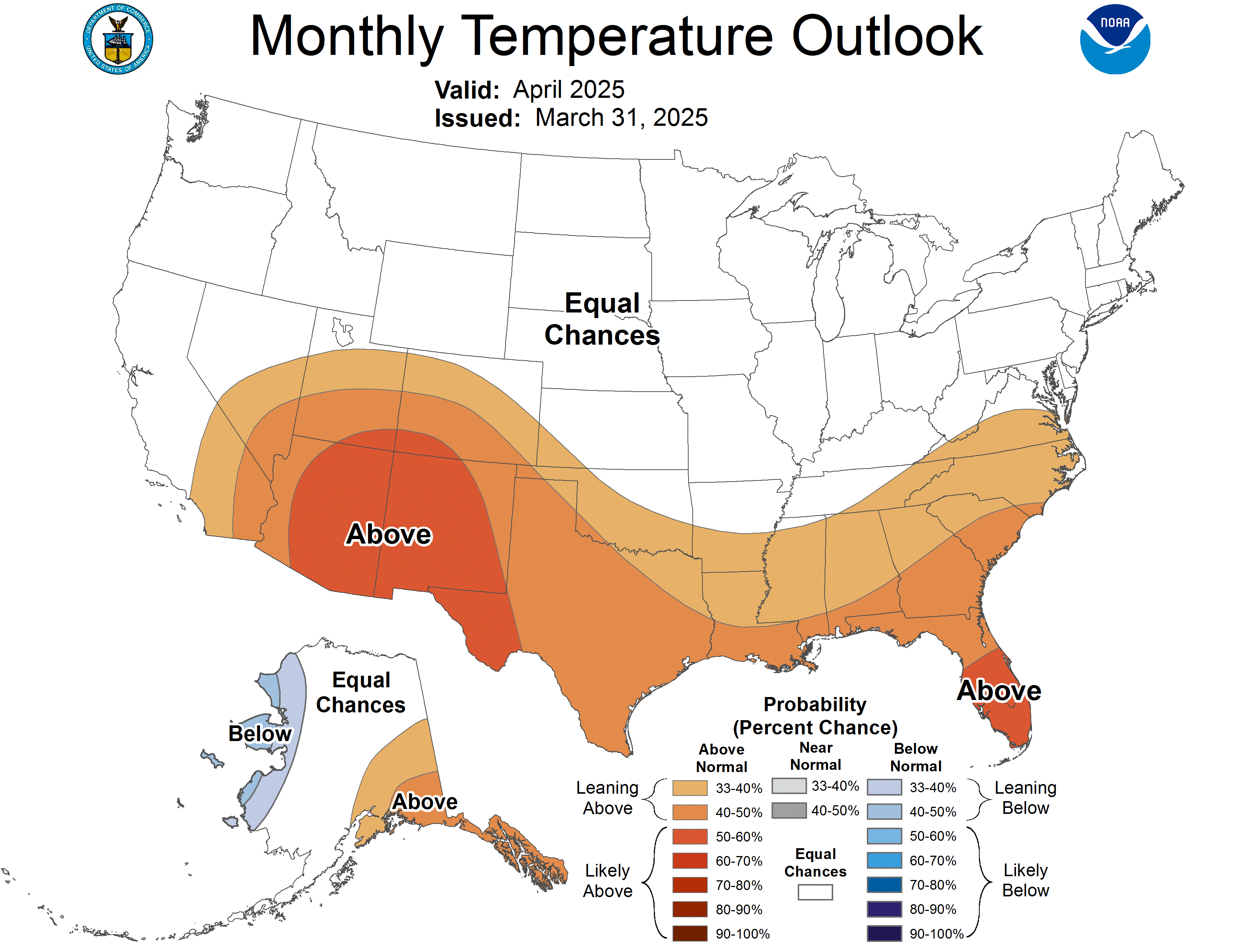
As the global community prepares for the peak of this cycle, transparency in data sharing remains essential for managing climate risks. For those interested in following the data, the NOAA Climate.gov portal offers interactive tools and historical data sets that explain the progression of current climate anomalies. Please feel free to share your thoughts or local observations in the comments section below.
Related reading