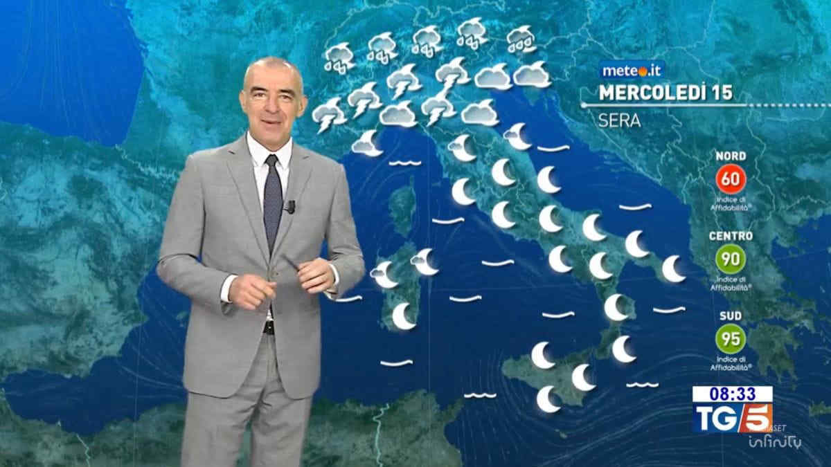
Italy is currently gripped by an intense heatwave driven by an anticyclone of African origin, with temperatures soaring well above seasonal averages across much of the peninsula. According to the Italian Air Force Meteorological Service, this period of extreme heat is expected to persist through the weekend, though a significant atmospheric shift is forecast to arrive by Monday, July 17, bringing a marked drop in temperatures and widespread instability.
While the center and south of the country remain under the influence of stable, high-pressure conditions, the northern regions are bracing for a transition. Meteorologists have issued warnings regarding the development of severe thunderstorms, particularly during the afternoon and evening hours of July 15 and 16. These weather events are expected to be characterized by intense lightning, the risk of localized hailstorms, and sudden, powerful wind gusts, as noted in recent bulletins from the Department of Civil Protection.
Atmospheric Instability and Severe Weather Risks in Northern Italy
The primary concern for residents and travelers in northern Italy—specifically across the Alpine and Pre-Alpine zones, as well as the Po Valley—is the rapid formation of convective cells. As the intense heat from the ground meets cooler, unstable air currents arriving from the Atlantic, the resulting thermal contrast is expected to trigger violent storm activity. These storms can develop with little warning, moving from the mountainous areas toward the plains during the late afternoon.
According to data from the Regional Agency for Environmental Protection (ARPA), the combination of high humidity and heat accumulation creates the perfect conditions for “supercell” phenomena. These localized events are capable of producing large-diameter hail and damaging wind gusts. Local authorities have advised citizens to secure outdoor furniture, avoid parking under trees, and remain indoors during peak storm activity. The intensity of these events is a direct consequence of the persistent heat, which has acted as a fuel source for atmospheric instability throughout the week.
The Shift in Temperature Trends and the Outlook for Next Week
The current heatwave, which has pushed thermometers into the high 30s (Celsius) in many inland areas, is slated to break as a new synoptic configuration takes hold. By Monday, July 17, a trough of low pressure is expected to displace the African anticyclone, allowing cooler air to flow across the Mediterranean. This shift marks the end of the current, prolonged period of extreme thermal stress for the Italian population.
The European Centre for Medium-Range Weather Forecasts indicates that this cooling trend will be most pronounced in the north and the central regions, where temperatures are expected to return to more typical seasonal averages. While the heat will dissipate, the transition phase itself remains the period of highest risk for severe weather. Coastal areas of the Adriatic, which have been shielded from the worst of the storm activity, may also experience a shift in wind patterns and a slight reduction in humidity as the new air mass arrives.
Practical Guidance for Monitoring Weather Developments
For those planning outdoor activities or travel during the weekend, monitoring official channels is essential. The Italian Air Force Meteorological Service provides hourly updates and radar imagery that can help track the progression of storm cells in real-time. Additionally, regional Civil Protection alerts provide specific information on flood risks and hydrogeological instability that may arise from sudden, heavy rainfall in sensitive areas.
The next major update regarding the stabilization of the weather pattern will be issued by national meteorological authorities on Monday morning, July 17. Residents are encouraged to follow local municipal directives regarding public safety and to check for any specific weather warnings relevant to their province. Stay informed through official weather portals and share this information with those who may be traveling in high-risk areas.
Worth a look