Major Winter Storm to Bring Heavy Snow and Treacherous Conditions to the Northeast
A powerful and fast-moving winter storm is poised to deliver meaningful snowfall and hazardous travel conditions across the Northeast, beginning Friday evening. The National Weather Service has issued a Winter Storm Warning for the entire region, urging residents to prepare for ample disruptions.
This isn’t a typical snowfall event. The storm is characterized by intense snowfall rates, possibly exceeding 2 inches per hour at its peak. Such heavy accumulation will overwhelm snow removal efforts, making roadways extremely risky.
Here’s what you need to know:
* Timing: The worst of the storm will unfold between 7 p.m. Friday and 1 a.m. Saturday, though moderate snow will continue into Saturday morning.
* Intensity: Expect snowfall rates of 1 to 2.5 inches per hour during the peak, significantly impacting visibility.
* Location: central Park could experience 2 inches of snow per hour by 10 p.m., with similar rates across the wider area.
Accumulation Forecast:
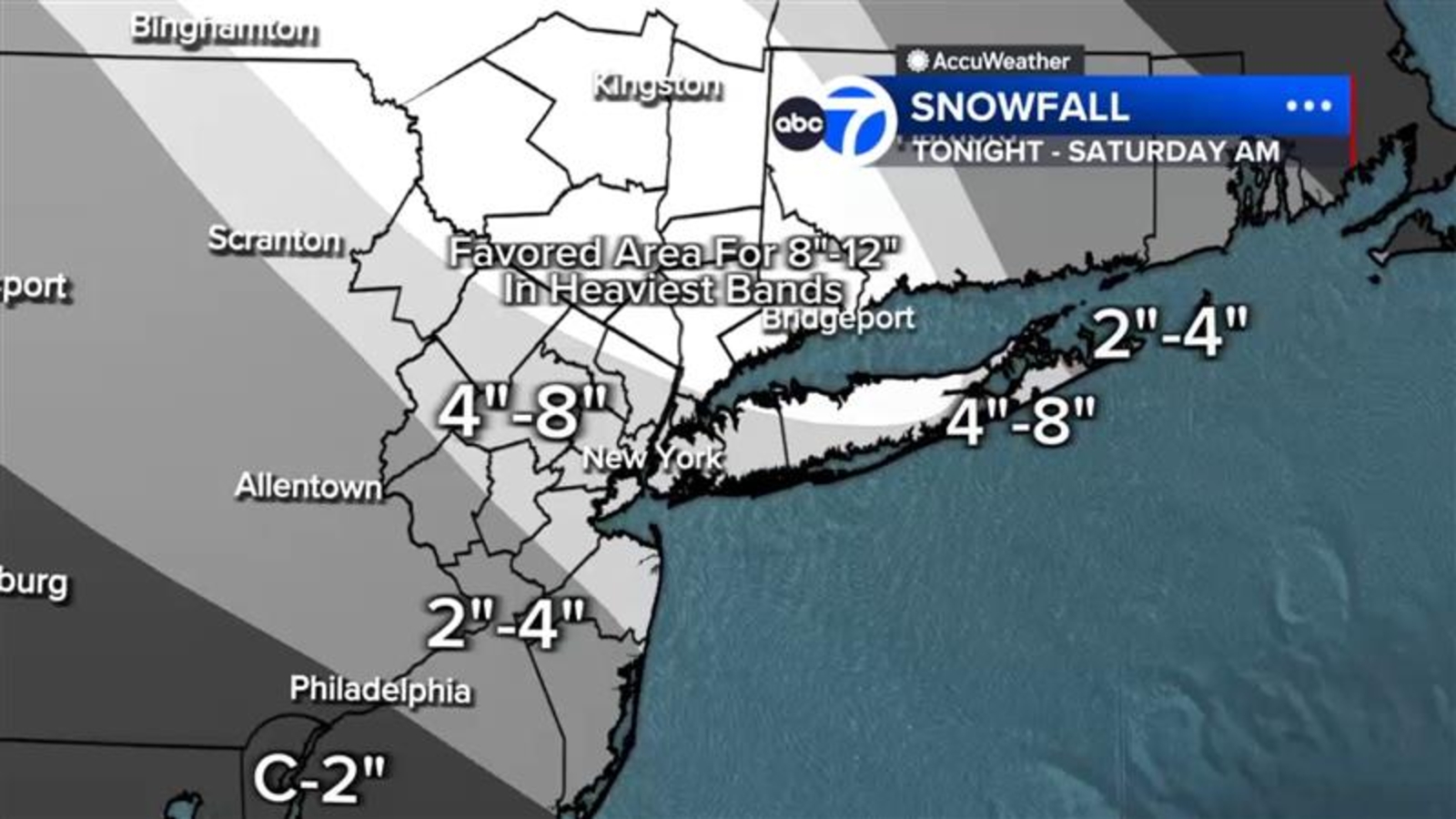
* New York City & Much of the Area: Widespread accumulations of 4 to 8 inches are expected.
* Heaviest Bands (North & East of NYC): 8 to 12 inches of snow are possible in localized areas.
* Hudson Valley, Northern NJ, Long Island, Northern Bronx: These areas are likely to be impacted by the heaviest snowfall bands.
* Southern New Jersey: A mix of sleet will limit accumulations to 2 to 4 inches.
The exact location of the heaviest snowfall bands remains uncertain, meaning significant variations in accumulation are possible within short distances. You should be prepared for potentially substantial differences in snowfall amounts even within your own community.
Temperatures will remain cold throughout the event, ensuring the precipitation falls as snow for most of the region. while winds aren’t expected to be a major factor, they will increase as the storm progresses.
Understanding the Storm’s Origins
This storm is an ”Alberta Clipper” – a fast-moving low-pressure system originating in Canada. However, this clipper has been significantly amplified by energy from Pacific storms currently delivering atmospheric river rainfall to the West Coast.This infusion of moisture is creating a particularly potent system,described by meteorologists as an ”Alberta Clipper on steroids.”
What You Should Do Now:
* Limit Travel: Avoid unnecessary travel during the peak of the storm.
* Prepare for Power Outages: Have a plan in place for potential power outages, including a supply of flashlights, batteries, and non-perishable food.
* Stay Informed: Monitor the latest forecasts and advisories from the National Weather Service.
* Clear Pathways: If you must venture out, be prepared for slippery conditions and reduced visibility.
This storm represents a serious threat to travel and daily life. Taking proactive steps now will help you and your family stay safe during this winter weather event.