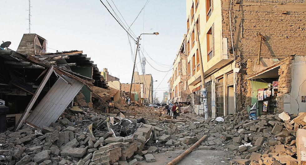
Following a significant earthquake in Colombia, Peruvian geophysical authorities have reiterated warnings regarding a major impending seismic event along the Pacific Rim, focusing attention on 14 regions across Peru classified as facing very high seismic risk. According to the Geophysical Institute of Peru (IGP), seismic activity across the Pacific Ring of Fire remains continuous, leaving countries along the tectonic boundary vulnerable to large-scale tremors.
The recent geological activity has heightened public safety discussions throughout western South America, where massive tectonic plate interactions constantly threaten nations including Peru and Colombia. While scientists emphasize that individual earthquakes cannot be precisely timed or predicted, institutional monitoring indicates that regions built on vulnerable soil compositions or near active fault lines must maintain rigorous disaster preparedness.
Understanding the Seismic Threat Along the Pacific Ring of Fire
The tectonic framework driving these warnings involves the subduction of the Nazca Plate beneath the South American Plate, a colossal geological process that releases immense amounts of energy. This subduction zone is responsible for triggering some of history’s most powerful recorded earthquakes. According to statements from Hernando Tavera reported by El Comercio, scientists cannot predict the exact day or week a major earthquake will strike, but geological pressures mean a high-magnitude event is inevitable over time.
Recent seismic events in Colombia and several other nations situated within the Pacific Ring of Fire during 2026 have underscored this ongoing vulnerability. Geoscientists explain that energy accumulation along plate boundaries is a continuous process. When friction between grinding tectonic plates finally overcomes the resistance of the Earth’s crust, sudden slips occur, generating seismic waves that radiate across densely populated urban centers and rural communities alike.
Identifying the 14 Regions Facing Very High Risk in Peru
Peruvian civil defense and geophysical agencies utilize historical data, soil mechanics, and fault mapping to categorize territorial vulnerability. The 14 regions identified as facing a very high seismic risk encompass extensive coastal and highland sectors where population density is high and infrastructure varies significantly in age and building code compliance.
Urban planning experts emphasize that the danger stems not only from the magnitude of a potential underground rupture but also from local soil amplification. Coastal zones featuring soft sedimentary layers often experience stronger ground shaking and liquefaction during major tremors compared to areas resting on solid rock formations. Municipal authorities across these high-risk departments are continually urged to update evacuation plans, reinforce critical public buildings, and conduct routine community drills.
Preparedness and Institutional Response
National emergency management systems in Peru regularly advise residents to secure heavy furniture, prepare emergency supply kits, and identify safe zones within homes and workplaces. While geological monitoring provides advance technical data to researchers, public awareness remains the primary defense against structural collapse and injury during sudden natural disasters.
Authorities continue to monitor tectonic activity around the clock using advanced seismic networks deployed across the country. Residents seeking official safety guidelines and updates on regional seismic monitoring can consult the official portals provided by the Geophysical Institute of Peru for verified scientific reports and hazard assessments.
Keep reading