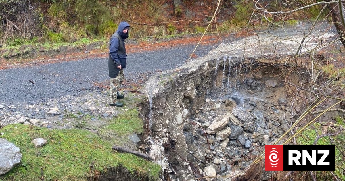
Residents in the Kaikōura region of New Zealand’s South Island are navigating the complex aftermath of significant geological instability, as authorities urge continued vigilance regarding ongoing land movement. Following recent weather events and seismic activity, local landscapes have been reshaped, with reports of new watercourses emerging in areas that were previously stable. The primary challenge for the community remains the identification of ground hazards that threaten infrastructure and residential safety.
According to the Earthquake Commission (EQC), which manages natural disaster insurance for residential property in New Zealand, land damage can often be hidden beneath the surface. Officials have advised homeowners to monitor their properties for signs of shifting ground, such as cracks in foundations, tilting fences, or changes in drainage patterns that indicate subterranean soil movement. These assessments are critical for the long-term stabilization of the region following the severe seismic history of the Kaikōura district, most notably the 7.8 magnitude earthquake that struck in November 2016, which significantly altered the local topography.
Geological Shifts and Infrastructure Challenges
The emergence of new creeks and surface water flows is a common, if disruptive, byproduct of significant land displacement. When seismic or heavy rainfall events alter the water table or fracture bedrock, surface water often seeks new paths of least resistance. This phenomenon can lead to unexpected erosion and the saturation of land that was previously considered load-bearing. The Environment Canterbury Regional Council has emphasized that land movement after such events is not always immediate; it can be a slow, progressive process as the landscape settles into a new equilibrium.

For landowners, the primary concern is the potential for landslips and bank erosion. Local authorities suggest that residents document any changes to their property—such as the sudden appearance of water or new fissures—and report these to the relevant district council. Maintaining clear communication with insurance providers is also essential, as the New Zealand government’s recovery guidelines mandate that property owners take reasonable steps to prevent further damage while awaiting geotechnical assessments.
Safety Protocols for Property Owners
The unpredictability of the terrain requires a methodical approach to property maintenance and safety. Experts from GNS Science, which monitors geological hazards across New Zealand, note that land movement can be triggered by subsequent rainfall, even weeks or months after the initial seismic or weather event. Residents are encouraged to observe the following safety indicators:
- Structural Integrity: Monitor doors and windows for jamming, which can indicate that a building’s frame is being twisted by ground movement.
- Drainage Anomalies: Be alert to water pooling in areas where it previously did not, or the appearance of springs and creeks in previously dry paddocks.
- Vegetation Signs: Watch for leaning trees or posts, which are often the first visible signs of soil creep or slope instability.
- Fissures: Immediately mark and report any ground cracks that appear to widen or deepen over time.
The Path Toward Regional Stabilization
Recovery in Kaikōura involves a combination of central government oversight and local community resilience. The Kaikōura District Council continues to manage the repair of rural roads and essential infrastructure, which are frequently the first assets impacted by shifting earth. Because the region sits atop a complex network of active fault lines, the standard for rebuilding requires rigorous geotechnical investigation to ensure that new structures are not placed in high-risk zones.
The process of “clean-up” is therefore more than just debris removal; it is an ongoing observation phase. As the land continues to shift, the data gathered by residents—by reporting new creeks or land movement—serves as vital input for regional hazard mapping. This collaborative effort between citizens and geological authorities is designed to mitigate future risk and ensure that the recovery process is grounded in the current reality of the landscape.
The next official update regarding regional hazard assessments and recovery assistance programs will be provided through the Kaikōura District Council’s public notices. Residents are encouraged to visit the official council website for the latest geotechnical advisories and to share their experiences with local recovery coordinators to help build a comprehensive understanding of the changing terrain. We invite readers to share their own experiences or questions regarding property safety in the comments section below.