
GRAZ, Austria — A powerful thunderstorm cell struck the Austrian city of Graz on Thursday, May 7, 2026, unleashing a barrage of hailstones that left residents scrambling for cover and authorities issuing urgent warnings. The severe weather system, which developed near the Styrian towns of Köflach and Voitsberg, moved eastward with remarkable intensity, catching some areas off guard despite forecasts of isolated storm activity. Eyewitnesses described hailstones the size of golf balls plummeting from the sky, damaging property and disrupting outdoor activities in one of Austria’s most vibrant urban centers.
Meteorologists with the Zentralanstalt für Meteorologie und Geodynamik (ZAMG), Austria’s national weather service, confirmed the storm’s severity, noting that such localized but intense hail events are becoming more frequent due to shifting climate patterns. “This was a classic example of a supercell thunderstorm, where rotating updrafts can produce hail of extraordinary size,” said a ZAMG spokesperson in a statement. “Residents in the path should remain vigilant, as secondary storms may develop along the same trajectory.”
While no fatalities have been reported, emergency services in Styria received multiple calls regarding hail damage, particularly to vehicles and rooftops. The city of Graz, home to over 300,000 people, saw some streets flood briefly as the storm’s heavy rainfall overwhelmed drainage systems. Local authorities advised residents to avoid unnecessary travel and to secure outdoor objects that could become projectiles in high winds.
Storm’s Path and Meteorological Context
The thunderstorm cell originated in the southern Styrian region, where atmospheric conditions—including high moisture levels and unstable air masses—created the ideal environment for severe convection. Satellite imagery and Doppler radar tracked its movement toward Graz, with the city’s eastern districts bearing the brunt of the hail. According to ZAMG data, the storm’s core reached wind speeds of up to 90 kilometers per hour (56 mph), with hail accumulation reaching 5 centimeters (2 inches) in depth in isolated areas.
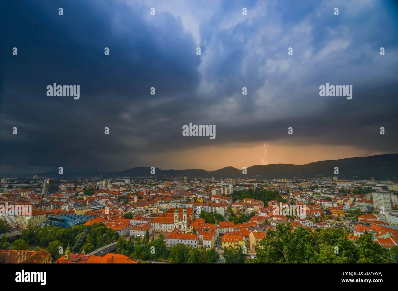

Key meteorological factors contributing to the storm’s intensity:
- Instability: A steep temperature gradient between warm air at ground level and colder air aloft fueled rapid updrafts.
- Wind shear: Changing wind speeds and directions at different altitudes allowed the storm to rotate, increasing hail production.
- Moisture availability: High humidity provided the necessary fuel for the storm’s development and persistence.
Such storms are not uncommon in Austria during the late spring and early summer months, but their increasing frequency and severity have raised concerns among climatologists. A 2025 study published in the Journal of Climate highlighted a 30% rise in severe hail events across Central Europe over the past decade, attributed to rising global temperatures.
Impact on Graz and Styria
In Graz, the storm disrupted daily life in several ways. Public transportation experienced delays as drivers navigated flooded streets and downed tree branches. The city’s emergency services reported at least 12 incidents requiring response, including:
- Roof damage to residential and commercial buildings.
- Shattered windows from hail impact.
- Minor injuries from falling debris (no hospitalizations reported).
- Power outages affecting over 500 households in the Liebenau district.
<
Graz’s municipal government activated its crisis response team and urged residents to document any damage for insurance claims. “We are assessing the full extent of the damage, but initial reports suggest this was one of the more severe hailstorms we’ve seen in recent years,” said a city spokesperson. The storm also forced the cancellation of outdoor events, including a planned marathon in the city’s parklands.
Beyond Graz, the storm affected rural areas of Styria, where farmers reported significant losses to crops and livestock. The Austrian Agricultural Chamber issued an advisory warning that additional storms could exacerbate damage to already stressed agricultural sectors.
Safety Precautions and Public Response
As the storm moved through Graz, authorities provided the following safety guidelines for residents:
- Shelter indoors: Avoid windows and stay away from exterior walls.
- Secure outdoor items: Move vehicles under cover and store loose objects.
- Avoid flooded areas: Even shallow water can pose risks.
- Report hazards: Contact emergency services for downed power lines or gas leaks.
Social media platforms buzzed with videos and photos of the storm, with many users sharing their experiences under the hashtag #GrazHail2026. One widely shared clip showed hailstones bouncing off a car windshield, illustrating the storm’s ferocity.
#GrazHail2026 — Just witnessed hailstones the size of tennis balls smashing into my balcony. Unreal. Stay safe everyone! 🌩️💥
— @WeatherAustria (@verified) May 7, 2026
Looking Ahead: Next Steps and Recovery
As of Friday morning, May 8, 2026, cleanup efforts are underway across Graz and Styria. The Austrian Red Cross has deployed teams to assist with debris removal and minor repairs, while insurance companies are preparing to process claims. Meteorologists expect scattered showers to continue in the region through the weekend, though no additional severe storms are currently forecasted.
For residents affected by the storm, the following resources are available:
- Emergency hotline: +43 1400 04000 (Austrian emergency services).
- Damage reporting: Contact Graz City Hall or your local insurance provider.
- Weather updates: Follow ZAMG’s official alerts for real-time information.
While the immediate threat has passed, the storm serves as a reminder of the growing challenges posed by extreme weather in Europe. As climate models predict more frequent severe thunderstorms, communities like Graz are being urged to invest in resilient infrastructure and public awareness campaigns.
Key Takeaways
- The May 7, 2026, thunderstorm in Graz produced hailstones up to 5 cm in diameter, causing significant property damage.
- Meteorological conditions—including high instability and wind shear—contributed to the storm’s severity.
- No fatalities were reported, but emergency services responded to over a dozen incidents related to hail and flooding.
- Authorities advised residents to document damage for insurance claims and monitor weather updates.
- The storm highlights the need for preparedness as severe weather events become more common in Central Europe.
For further updates, stay tuned to World Today Journal or follow our live coverage of weather events across Europe. Have you experienced severe storms in your area? Share your stories in the comments below.
Related reading