
Romania is currently bracing for a period of significant atmospheric instability, as the National Meteorological Administration has issued a series of weather warnings across multiple regions. A “Yellow Code” alert—a designation used to signal potentially dangerous weather conditions that require public vigilance—is currently in effect, bringing the threat of torrential rainfall, violent storms, and hail to several counties.
As of Sunday, May 10, 2026, meteorologists are tracking a volatile weather system moving across the country, particularly impacting the western, central, and northern territories. The warnings highlight a high probability of electrical discharges and sudden wind intensifications, with some gusts expected to reach speeds of 55 km/h, posing risks to outdoor activities and unsecured structures.
The current meteorological situation is characterized by heavy precipitation and localized flooding risks. Residents in the affected areas are being urged to monitor official updates closely, as the rapid nature of these storms can lead to immediate changes in road safety and visibility. The focus of the current warnings centers heavily on the counties of Cluj, Alba, and Sibiu, though the instability extends further into the Oltenia region and other northern districts.
For those traveling or residing in these zones, the combination of hail and torrential downpours can create hazardous driving conditions. The National Meteorological Administration’s alerts are designed to provide early warning to local authorities and the general public to mitigate the impact of these sudden atmospheric shifts.
Understanding the Romania Weather Alert Yellow Code
In the Romanian meteorological warning system, a “Yellow Code” (Cod Galben) serves as a critical communication tool for the public. While it does not indicate an immediate catastrophe on the scale of an Orange or Red alert, it signifies that the weather is “potentially dangerous.” So that while the events are not uncommon for the season, their intensity in specific local areas can cause disruption or minor damage.
The current alert is driven by atmospheric instability, a state where the air is unstable and prone to creating vertical clouds (cumulonimbus), which are the primary drivers of thunderstorms, hail, and heavy rain. When this instability is paired with moisture-rich air masses, the result is often the “torrential downpours” currently being forecasted for the central and western regions of the country.
This specific weather pattern is particularly disruptive because of its localized nature. A “Yellow Code” often means that while one town may experience a severe hailstorm with 55 km/h winds, a neighboring village might see only light rain. This volatility makes real-time monitoring essential for safety.
High-Risk Zones and Expected Impacts
The most acute warnings have been issued for the counties of National Meteorological Administration (ANM) monitored zones, specifically targeting Cluj, Alba, and Sibiu. In these areas, the risk of torrential rainfall is highest, which can lead to rapid water accumulation in urban drainage systems and the potential for flash flooding in low-lying rural areas.
Beyond the central hub, the alerts extend to the following regions:
- Oltenia: This region has been under a yellow alert specifically for storms and strong winds, with effects noted from early Friday morning through the weekend.
- Western and Northern Romania: Broad alerts for atmospheric instability, focusing on the risk of hail and electrical discharges.
- Sibiu County: Specifically noted for short-duration, high-intensity torrential rain alerts.
The wind gusts, peaking at approximately 55 km/h, are sufficient to cause damage to temporary structures, blow over garden furniture, and potentially bring down weakened tree branches. When combined with hail, these winds can significantly impact agricultural crops, which are particularly vulnerable during the month of May.
Safety Guidance and Practical Precautions
Given the nature of “Yellow Code” storms, the National Meteorological Administration recommends several immediate precautions to ensure public safety. The primary goal during these events is to avoid exposure to lightning and to secure property against wind damage.
For Residents: It is advised to secure any loose outdoor items, such as trampolines, umbrellas, or patio furniture, that could be caught by 55 km/h gusts. Ensuring that gutters and drains are clear of debris can also help prevent localized flooding around residential foundations during torrential rains.
For Drivers: Visibility can drop to near zero during a torrential downpour or hailstorm. Drivers are encouraged to reduce speed, increase following distances, and, if visibility becomes too poor, pull over in a safe area away from trees or power lines until the cell passes. Hydroplaning is a significant risk on the highways connecting Cluj, Alba, and Sibiu during these peak instability windows.
General Safety: During electrical discharges (lightning), it is critical to stay indoors. Avoid using wired electronic devices and stay away from tall structures or isolated trees, which act as natural lightning rods.
What This Means for Regional Infrastructure
The recurrence of these atmospheric disturbances in May often puts a strain on regional infrastructure. In cities like Cluj-Napoca and Sibiu, heavy rainfall can lead to “urban flooding,” where the volume of water exceeds the capacity of the sewage system. This often results in temporary road closures and traffic congestion, which can complicate emergency response times.
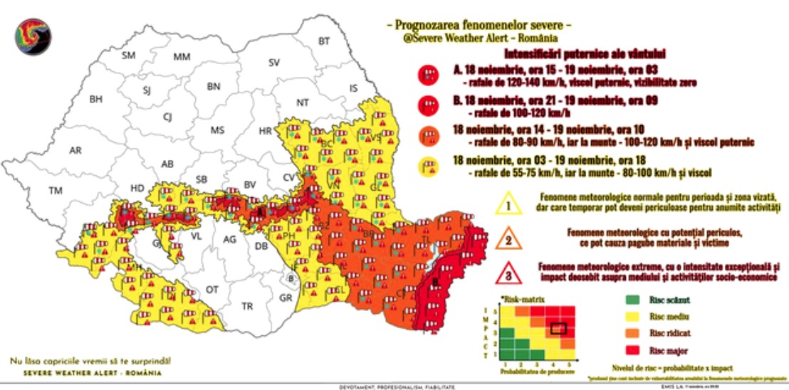
the threat of hail is a major concern for the agricultural sector in the Alba and Sibiu regions. May is a critical growth period for many crops, and a sudden hailstorm can lead to significant yield losses. Local farmers are typically advised to monitor the ANM alerts to deploy protective netting or other mitigation measures where possible.
From a broader perspective, these weather patterns are indicative of the seasonal transition in Eastern Europe, where clashing air masses—cold air from the north and warmer, moist air from the south—create the perfect conditions for the severe thunderstorms currently affecting Romania.
Key Takeaways for the Current Alert
- Alert Level: Yellow Code (Potentially Dangerous).
- Primary Threats: Torrential rain, hail, and wind gusts up to 55 km/h.
- Most Affected Areas: Cluj, Alba, Sibiu, and Oltenia.
- Key Authority: National Meteorological Administration (ANM).
- Primary Risk: Localized flooding, agricultural damage, and hazardous driving conditions.
The current weather warnings remain active, and the situation is being monitored in real-time. The next confirmed checkpoint for weather updates will be the daily forecast release from the National Meteorological Administration, which will determine if the Yellow Code is extended, upgraded, or lifted for the affected counties.
We encourage our readers to stay safe and share this information with anyone currently traveling through central or western Romania. Please leave your comments below or share this report to help others stay informed.
Worth a look