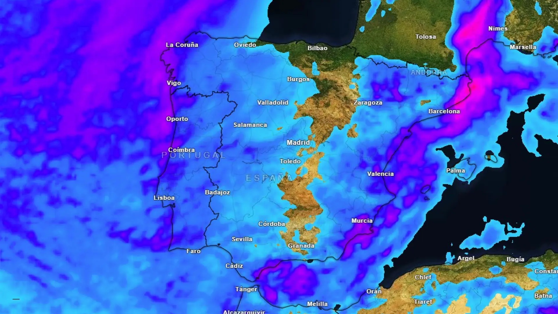
Approaching Storm Emilia: A Detailed Forecast for the Iberian Peninsula
A significant weather system, Storm emilia, is poised to bring widespread rainfall and impactful conditions to much of the Iberian Peninsula. Understanding the specifics of this forecast is crucial for you to prepare and stay safe. Here’s a complete breakdown of what you can expect in the coming days.
Current Situation & Key Areas of Concern
Currently, a frontal system is interacting with Storm Emilia, intensifying precipitation across several regions. The most significant impacts are anticipated in the Levante and southeastern Iberian Peninsula,particularly during the morning hours. Specifically, Castellón is bracing for substantial rainfall.
* Expect accumulations of 80-100 liters per square meter within a 12-hour period in Castellón.
* Alborán (western part) and Catalonia will also experience heavy rainfall.
Regional Breakdown: What to Expect Where You Are
Let’s dive into a region-by-region forecast, so you can understand how this storm will affect your area.
* Northeast Peninsula: Rainfall will become more persistent throughout the afternoon, though generally less intense then earlier in the day.
* Galicia & Asturias: Localized, strong showers are likely late in the day, particularly in western Asturias and northern Galicia.
* Mediterranean Coast: Be prepared for thunderstorms, potentially including hail, along the mediterranean coastline. The possibility of mangas marinas (sea sleeves – localized, intense downpours over the sea) also exists.
* Southeast & Levante: This region will see the heaviest rainfall during the first half of the day, with substantial accumulations.
* High Ebro & Eastern Cantabria: You can expect mostly cloudy or covered skies, but precipitation is less probable in these areas.
* Canary Islands (Easternmost) & Southern Mountainous Regions: Intervals of cloudiness are expected, but widespread rainfall is less likely.
Snow Levels & Visibility
For those in mountainous regions, the snow line will be relatively high.
* Snow is expected to fall between 1,400 and 1,600 meters in the northern mountains.
* Morning fog is possible in inland areas of the northern half of the peninsula and in mountainous regions of the south, potentially reducing visibility.
Temperature Trends: A mixed Bag
Temperature changes will vary considerably depending on your location.
* Cooling Trend: Expect temperatures to drop in the Pyrenees, Alborán, and most of the western Iberian Peninsula.
* Warming Trend: Temperatures will rise in the Canary Islands, the Ebro Valley, and along the eastern coast.
* Minimum Temperatures: Overnight lows will increase in the northern peninsula and the Canary Islands, but will decrease elsewhere. Some areas, like Zamora and Palencia, could see temperatures as low as 1°C (34°F).
* Frost Potential: Weak frosts are possible in the Pyrenees, and isolated frosts may occur in other northern and southeastern mountains.
Wind Conditions: Prepare for Gusts
Wind will be a significant factor,particularly in certain areas.
* Península & balearic Islands: Expect winds from the east and south, with moderate intervals along the coast and in inland areas of the northern third. strong, potentially vrey strong, gusts are possible at higher elevations.
* Galicia: Intervals of strong winds are anticipated along the Galician coastline.
* Canary Islands: moderate north winds are expected.
Staying Informed & Safe
This is a dynamic weather situation, and conditions can change rapidly. It’s vital to stay informed and take necessary precautions.
* Monitor Updates: Regularly check for the latest forecasts from meteorological sources.
* Secure Property: If you live in an area prone to flooding or strong winds,take steps to secure your property.
* Travel Safely: Be cautious when traveling,especially in
Related reading