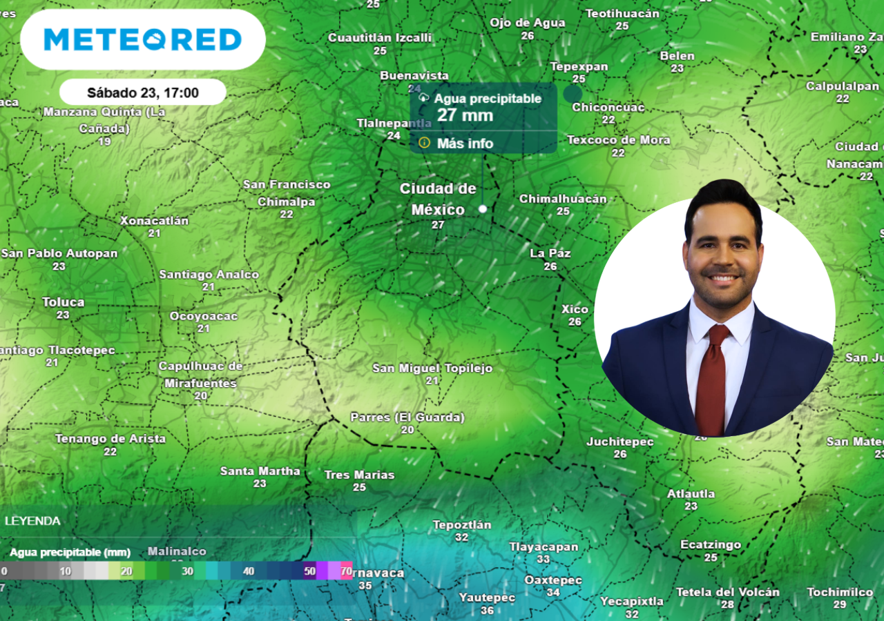
Mexico City is bracing for its wettest day of the week as meteorologists warn of extreme rainfall totals exceeding 60 millimeters in just a few hours. The capital’s weather systems are under the influence of a persistent low-pressure zone, fueled by a surge of moisture from the Gulf of Mexico and Pacific Ocean, creating conditions ripe for severe thunderstorms. While the city has experienced scattered showers in recent days, officials and residents alike are preparing for what could be the most intense downpour since early May, with potential flash flooding and localized disruptions.
This weather pattern aligns with broader trends observed across central Mexico, where atmospheric instability has triggered repeated storm systems. The National Meteorological Service (Servicio Meteorológico Nacional, or SMN) has issued advisories urging residents to stay vigilant, particularly in low-lying areas prone to flooding. Authorities are monitoring river levels and drainage systems, which have already shown signs of strain under recent rainfall. For now, the focus remains on the immediate 24-hour window, though forecasts suggest that the broader region could see continued storm activity through the remainder of the week.
What makes this storm system particularly notable is its intensity and rapid development. Unlike gradual, widespread rain, these storms are characterized by short bursts of heavy precipitation—often accompanied by lightning, strong winds, and even hail in some areas. Such conditions can lead to sudden flooding, road closures, and power outages, disrupting daily life for millions. The SMN has classified this as a “strong” weather event, using the term in its meteorological sense to describe both the physical force of the rainfall and its potential impact on infrastructure and safety.
Why Is Mexico City Seeing Such Heavy Rainfall?
Mexico City’s geography and climate make it particularly vulnerable to extreme rainfall events. Nestled in a high-altitude basin surrounded by mountains, the city’s drainage system was not originally designed to handle the volume of water produced by modern urbanization and climate change. When moisture-laden air from the Gulf of Mexico and Pacific collides with cooler air over central Mexico, it creates the perfect conditions for thunderstorms to rapidly intensify.
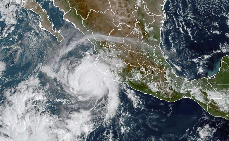
According to climate scientists, such events are becoming more frequent in the region due to rising global temperatures. Warmer air holds more moisture, leading to heavier downpours when storms finally break. The SMN has noted an increase in “extreme precipitation events” in recent years, with 2025 already seeing multiple instances of rainfall exceeding 50 millimeters in a single day across the capital. While this week’s storm is not yet classified as a tropical system, its behavior mirrors that of past severe weather patterns linked to broader climatic shifts.
For residents, the term “strong” takes on a dual meaning. Meteorologically, it refers to the storm’s power—its ability to dump large amounts of rain in a short period. Socially, it underscores the resilience required to navigate the challenges that follow: flooded streets, delayed public transport, and the need for community coordination to assist those most affected. Authorities have emphasized preparedness, urging citizens to avoid unnecessary travel, secure loose outdoor items, and have emergency kits ready.
How Is the City Responding?
The Mexico City government has activated its emergency response protocols in anticipation of the storm. Municipal teams are deploying additional personnel to monitor critical infrastructure, including the city’s complex network of tunnels and drainage channels. The Metropolitan Water System (Sistema de Aguas de la Ciudad de México) has also increased its capacity to manage overflow, though officials acknowledge that even well-maintained systems can be overwhelmed during such events.
Public safety campaigns are underway, with alerts disseminated through official channels, including the city’s emergency management platform (SEDENA) and social media. Residents are advised to follow updates from the SMN and local civil protection agencies, which provide real-time guidance on evacuation routes and safe zones. Schools and some businesses have adjusted schedules to accommodate the weather, though most remain open with enhanced safety measures.
One area of particular concern is the city’s historic center, where narrow streets and centuries-old drainage systems can quickly become inundated. In past events, such as the 2023 storms that dumped over 70 millimeters in a single day, parts of the Zócalo and surrounding areas required temporary closures. While this week’s forecast does not yet match that level of severity, officials are taking no chances.
What to Expect in the Coming Hours
Based on current models, the heaviest rainfall is expected between late afternoon and evening, with the potential for localized flooding in vulnerable neighborhoods. The SMN has issued a yellow alert (preventive) for the capital, indicating a high likelihood of significant impacts. Here’s what residents can anticipate:
- Flash Flooding: Low-lying areas, including parts of Iztapalapa and Tláhuac, may experience rapid water accumulation. Drivers are advised to avoid flooded roads and seek higher ground if possible.
- Transport Disruptions: The Metrobús and Metro systems may operate on modified schedules, with some stations temporarily closed. The city’s main airport, Benito Juárez International, has not yet announced delays, but passengers are encouraged to monitor updates.
- Power Outages: While rare, strong winds accompanying the storms could lead to localized blackouts. CFE (Comisión Federal de Electricidad) has pre-positioned crews to respond swiftly.
- Safety Precautions: Authorities recommend avoiding outdoor activities during the peak storm hours, securing property, and checking on vulnerable neighbors, particularly the elderly and those with mobility challenges.
For those planning to travel, the city’s traffic management agency (SEMOVI) has advised using alternative routes and allowing extra time for commutes. Ride-sharing services like Uber and Didi have also issued warnings about potential delays, urging users to stay informed.
Looking Ahead: Will the Storms Continue?
While today’s storm is the most immediate concern, meteorologists indicate that the broader weather pattern—characterized by high humidity and unstable air masses—will persist through the remainder of the week. This means additional rounds of thunderstorms are likely, though their intensity may vary. The SMN’s seven-day outlook suggests that while today’s event is the most severe, scattered showers could continue into the weekend, particularly in the western and southern regions of the city.

Residents are encouraged to stay updated through official sources, including the SMN’s website and its social media accounts (@conagua_clima). The city’s civil protection agency (Protección Civil CDMX) will provide further guidance as the situation evolves, including any evacuation orders or road closures.
Key Takeaways
- The capital is experiencing its wettest day of the week, with potential rainfall totals exceeding 60 millimeters in isolated areas.
- Storms are fueled by moisture from the Gulf of Mexico and Pacific, creating conditions for heavy, localized downpours.
- Flash flooding, transport disruptions, and power outages are possible risks, particularly in low-lying neighborhoods.
- Authorities urge residents to monitor official alerts and take precautions, including avoiding flooded roads and securing property.
- Additional storms are expected through the week, though today’s event is the most intense.
As Mexico City navigates this weather event, the term “strong” serves as a reminder of both the natural forces at play and the resilience of the communities affected. While the immediate focus is on safety and preparedness, the longer-term conversation about climate adaptation continues to gain urgency. For now, residents are advised to stay informed, stay safe, and support one another in the face of nature’s challenges.
For real-time updates, follow the Servicio Meteorológico Nacional and Protección Civil CDMX. Share this article to help others stay informed, and leave your thoughts or experiences in the comments below.
Worth a look