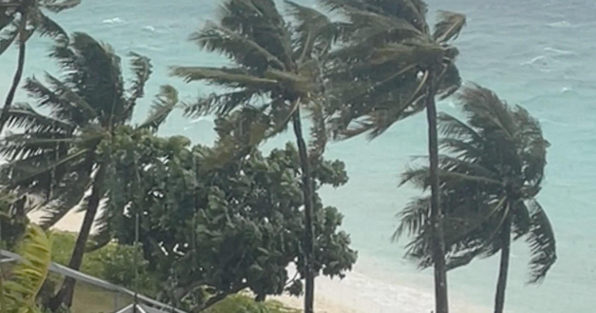
The Western Pacific is currently facing a meteorological crisis as Super Typhoon Sinlaku, the strongest tropical cyclone on Earth in 2026, barrels toward U.S. Territories in the Mariana Islands. The system, which rapidly intensified to Category 5 status over the weekend, is currently posing a severe threat to the U.S. Northern Mariana Islands and Guam, bringing the prospect of catastrophic wind damage, life-threatening storm surges, and historic rainfall.
As of Monday morning, the center of the Category 5 storm was located approximately 190 miles east of Guam, moving in a northwest direction according to Weather.com. The storm’s trajectory suggests it will curl toward the north-northwest, placing the islands of Saipan and Tinian directly in the path of its most destructive quadrant. Local authorities and the National Weather Service have issued urgent warnings, as the region prepares for a strike that could mirror some of the worst natural disasters in the archipelago’s recent history.
The scale of Sinlaku’s power is immense. After originating as a cluster of thunderstorms over the seas of Micronesia, it evolved into a tropical storm and then a typhoon between Friday and Saturday as reported by The Guardian. By Sunday, the system’s sustained winds had reached 150 mph, and meteorologists forecast that the storm could strengthen further, potentially reaching wind speeds of 165 mph as it moves through the islands per MetDesk analysis.
The Forecast: Saipan and Tinian in the Crosshairs
While Guam is currently experiencing the outer bands of the storm, the forecast indicates that Saipan and Tinian are expected to bear the brunt of the most severe conditions. The storm is projected to track close to, or directly over, these islands on Tuesday, maintaining either Category 4 or 5 intensity via Weather.com. This puts the islands at risk of “devastating winds” and extreme coastal inundation.
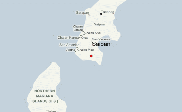
The National Weather Service has warned that Saipan and Tinian could see a storm surge of at least 5 to 8 feet above normally dry ground in areas of onshore winds according to official forecasts. Coupled with this surge is the threat of extreme precipitation, with rainfall totals estimated between 15 and 25 inches, a volume that is likely to trigger widespread and life-threatening flash flooding per Weather.com.
For the residents of Rota Island, while the impact may be slightly less severe than on Saipan, the danger remains significant. Forecasts for Rota include damaging winds, a storm surge of 3 to 5 feet in onshore flow areas, and at least 10 inches of flooding rainfall according to the National Weather Service.
Guam on Alert: Tropical Storm Warnings and Military Impact
Guam, the most populous island and the westernmost U.S. Territory in the region, is currently under tropical storm warnings. This includes critical infrastructure and military installations, specifically Andersen Air Base as noted by Weather.com. Tropical-storm-force winds and rain bands are already lashing the island, creating hazardous conditions for residents and personnel.
While a slight northward shift in the storm’s track makes a direct hit on Guam unlikely, the island is not out of danger. The National Weather Service in Guam has highlighted the risk of hazardous seas and storm surges arriving before the center of the storm passes. Rainfall totals across the Mariana Islands are expected to exceed 300mm between Monday and Thursday according to The Guardian. This volume of water is expected to lead to mudslides, wind damage, and severe flash flooding across the territory.
The potential for structural damage and widespread power outages is high. Meteorologists from AccuWeather have warned that the storm will bring destructive winds and coastal inundation to both Guam and the Northern Mariana Islands from Monday night into Thursday local time per AccuWeather.
Historical Context and Climatic Significance
The arrival of Super Typhoon Sinlaku is not merely a localized weather event but a significant climatic marker. It is currently identified as the strongest storm in the world so far in 2026 via AccuWeather. For the people of Saipan and Tinian, the storm evokes memories of Category 5 Super Typhoon Yutu, which struck in late October 2018 according to Weather.com. Sinlaku is forecast to be the strongest typhoon to strike so close to these islands since that 2018 event.
Beyond the immediate destruction, climatologists are watching Sinlaku as part of a larger pattern. It is the second of “twin” Pacific tropical cyclones that may signal an acceleration in the formation of El Niño as reported by Weather.com. El Niño events typically involve the warming of surface waters in the eastern Pacific Ocean, which can disrupt global weather patterns, affecting everything from rainfall in Southeast Asia to winter temperatures in North America.
Key Weather Metrics for Super Typhoon Sinlaku
| Location | Wind Speed Forecast | Expected Rainfall | Storm Surge Forecast |
|---|---|---|---|
| Saipan &. Tinian | Category 4 or 5 Intensity | 15 to 25 inches | 5 to 8 feet |
| Rota Island | Damaging Winds | At least 10 inches | 3 to 5 feet |
| Guam | Tropical Storm Force | Part of 300mm+ regional total | Hazardous seas/surges |
| Peak Intensity | Up to 165 mph | N/A | N/A |
What Residents and Travelers Need to Know
For those currently in the Mariana Islands or planning travel to the region, the priority is immediate safety and adherence to official government directives. Typhoon warnings are currently in effect for Saipan, Tinian, and Rota, meaning typhoon conditions—defined as winds of at least 75 mph—are expected by Tuesday per Weather.com.
The combination of extreme wind and torrential rain creates a multifaceted danger. High winds can cause structural failure and turn debris into projectiles, while the forecast rainfall of up to 25 inches can lead to rapid-onset flash flooding, which often traps residents in low-lying areas. The storm surge represents a significant threat to coastal communities, as seawater is pushed inland, flooding homes and destroying coastal infrastructure.
Residents are encouraged to monitor the National Weather Service in Guam for real-time updates on the storm’s track and intensity. Given the potential for power outages and communication failures, having a battery-powered radio and an emergency kit with several days of water and non-perishable food is critical.
The impact on regional logistics is likewise expected to be severe. With Andersen Air Base under tropical storm warnings, military and commercial flight operations in the Western Pacific may be disrupted as the storm passes through the region between Monday night and Thursday via AccuWeather.
The next critical checkpoint for the region will be Tuesday, as the storm is forecast to make its closest approach to Saipan and Tinian. Updates on whether the storm maintains its Category 5 status or fluctuates in intensity will be vital for emergency management teams on the ground.
World Today Journal will continue to monitor the trajectory of Super Typhoon Sinlaku. We encourage readers to share this report to aid spread awareness of the unfolding crisis in the Western Pacific and to depart their thoughts or questions in the comments section below.
Keep reading