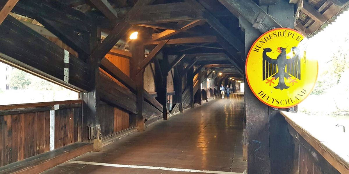
When engineering realities collide with geopolitical boundaries, sometimes even a bridge requires a bit of shifting. Recent adjustments to the international boundary between Switzerland and Germany have altered jurisdiction on a local crossing, illustrating how modern infrastructure projects require precise legal alignment between neighboring European states.
According to reports from Swiss publication 24 Heures, the modifications to the Swiss-German border on the structure in question highlight the meticulous legal agreements necessary to manage shared waterways and transit routes. Rather than a major territorial dispute, the adjustments stem from practical maintenance and structural redevelopments that necessitated a redraw of official cartography along the frontier.
The shifting of borders in this region underscores the complex nature of European border governance, where Schengen zone agreements allow for fluid movement while formal cadastral boundaries remain strictly defined. Local authorities from both nations coordinated the adjustments to ensure that policing, maintenance responsibilities, and emergency responses align correctly with the physical layout of the bridge.
Legal and Engineering Realities Behind the Boundary Shift
Infrastructure updates often trigger administrative reviews of adjacent property lines and international limits. When bridges spanning international rivers undergo significant renovation or reconstruction, engineers and surveyors must reconcile blueprint realities with historic treaties. In this specific case, the physical reconfiguration of the bridge deck and approach spans meant that previous boundary markers no longer aligned with the center of the thoroughfare or the thawline of the river below.
According to the Federal Department of Foreign Affairs (FDFA), adjustments of this scale require formal bilateral negotiations and ratification processes between Bern and Berlin. Such revisions are handled through established joint commissions tasked with maintaining the exact demarcation of the border, ensuring that municipal and national jurisdictions remain unambiguous for civil administration, taxation, and law enforcement.
While travelers crossing the bridge may notice little difference in their daily commute—largely due to the absence of systematic border controls under the Schengen Agreement—the legal implications for local municipalities are substantial. Police forces, municipal waste management, and road maintenance crews rely on precise demarcation to execute their daily duties without jurisdictional conflicts.
Impact on Local Communities and Cross-Border Transit
Border regions in central Europe depend heavily on seamless cross-border cooperation. Thousands of workers, students, and tourists traverse Swiss-German crossings daily, making administrative clarity essential for regional economic stability. Municipal leaders on both sides of the frontier worked closely with national mapping agencies to minimize disruptions during the surveying process.
According to the Swiss Federal Office of Topography (swisstopo), official national maps and digital geographic information systems are updated promptly following such bilateral agreements to reflect the new coordinates accurately. This ensures that emergency dispatchers can pinpoint incidents instantly, regardless of whether an emergency occurs a few centimeters to the Swiss or German side of the newly aligned demarcation line.
The adjustment serves as a modern example of peaceful, cooperative border management between neighboring states. By prioritizing practical administration over rigid territorial friction, Switzerland and Germany continue to streamline shared infrastructure maintenance along one of Europe’s most integrated frontiers.
Next Steps and Official Documentation
The updated boundary alignment is now fully integrated into the official cartographic records of both nations. Further updates regarding joint infrastructure maintenance projects along the Swiss-German border will be published through official channels managed by the respective federal departments of transport and foreign affairs. Stakeholders and local residents seeking detailed maps or specific legal documentation can consult the official portals of swisstopo or the German Federal Agency for Cartography and Geodesy.
We invite our readers to share their thoughts on this development in the comments below or share this report to join the global conversation on international affairs.