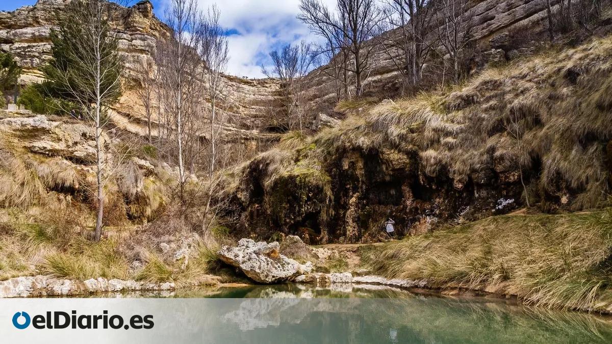
Anento, a small village in the province of Zaragoza, Spain, has garnered attention for a natural landscape feature often referred to as “the mountain that cries.” This phenomenon, characterized by moisture-rich rock formations and surrounding vegetation, is central to a popular circular hiking trail that attracts visitors interested in the region’s unique geological and botanical characteristics. According to local tourism data provided by the Government of Aragon, the area is recognized for its well-preserved medieval architecture and its integration into the surrounding natural environment, which includes the Aguallueve spring.
The Aguallueve Natural Phenomenon
The core of the local attraction is the Aguallueve, a spring that creates a constant, dripping effect along a limestone wall. This natural water flow, which gives the mountain its “crying” appearance, is the result of groundwater filtering through the porous rock and emerging on the surface. The Anento municipal authorities note that the constant moisture supports a dense ecosystem of mosses, ferns, and other hydrophilous plants, which thrive in the microclimate created by the spring. This site is a primary stop on the circular route that traverses the valley, offering visitors a direct view of the geological process.
Navigating the Circular Trail
The hiking route in Anento is designed as a circular path, allowing visitors to start and finish their walk within the village limits. The trail is generally considered accessible for those with moderate physical fitness, though the Rutas por Aragón platform identifies specific segments that require caution due to uneven terrain and potential slipperiness near the water source. The path provides a comprehensive view of the valley, moving from the historic center of the village—which has been designated one of the “Most Beautiful Villages in Spain”—toward the natural formations.
The route length is approximately 6 to 8 kilometers depending on the chosen deviations, and it is marked for hikers who wish to explore the surrounding landscape at their own pace. Safety signage is maintained by local entities to guide hikers through the forested sections and along the cliff sides. Visitors are encouraged to check local weather forecasts before departure, as heavy rainfall can impact trail conditions and water flow intensity at the spring.
Conservation and Regional Impact
The preservation of the Anento environment is managed under provincial guidelines that prioritize the protection of the Aguallueve spring and the surrounding forest. As noted by the Diputación Provincial de Zaragoza, the integration of sustainable tourism in rural areas is a key policy objective to ensure that natural sites remain undisturbed by high visitor traffic. Educational markers are placed along the path to inform hikers about the limestone erosion processes and the specific flora found in the valley.
For those planning a visit, the village provides information through its official visitor center. The site serves as a checkpoint for regional tourism initiatives that link historical heritage with environmental education. Visitors interested in the latest trail conditions or seasonal access restrictions should consult the official village portal for updates before their arrival. Participation in local conservation efforts and adherence to marked trails remain the primary requirements for maintaining the integrity of this unique ecosystem.
Keep reading