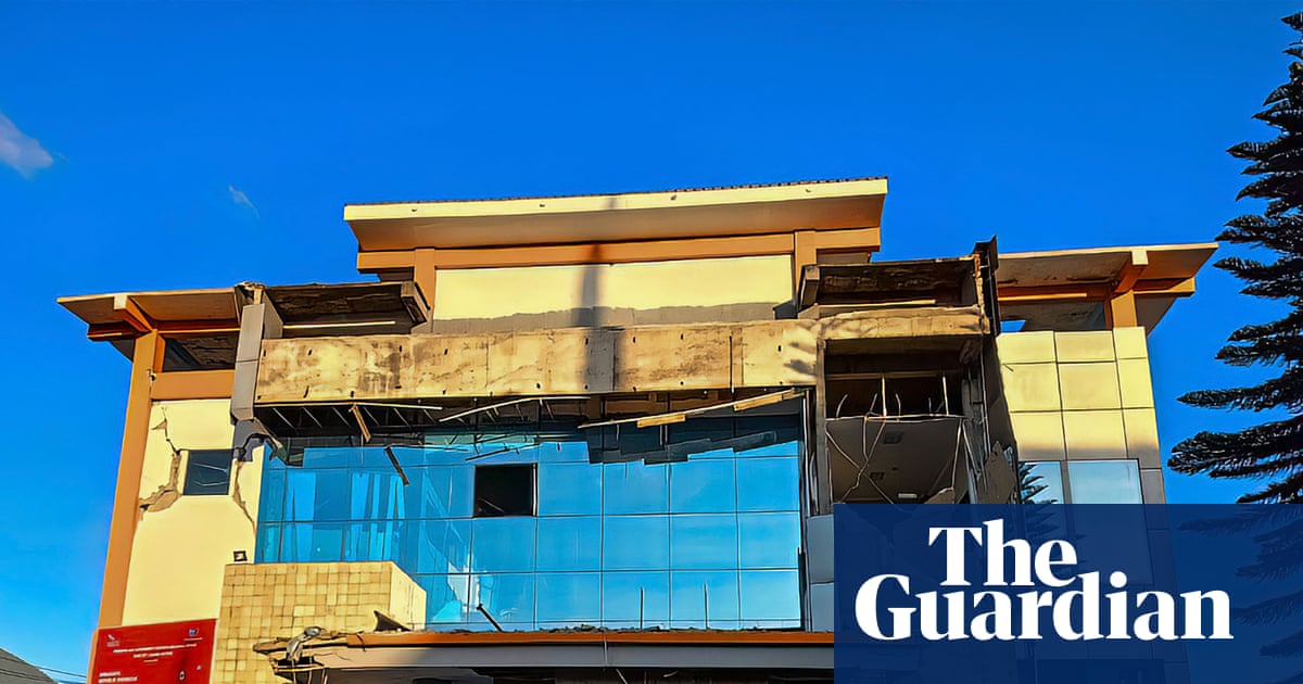
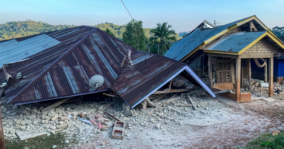
A powerful 7.7-magnitude earthquake struck off the coast of eastern Indonesia’s Flores region early Saturday, triggering a regional tsunami warning, damaging buildings, and sending panicked residents fleeing to higher ground. Authorities reported no immediate casualties following the shallow undersea tremor.
Impact Across Flores Island: Port Terminals and Seminary Roofs Collapse
The shallow quake struck at 5:58 a.m. local time on Saturday, according to the US Geological Survey. Its epicenter was located 68 kilometers north-northwest of Ende in East Nusa Tenggara province at a depth of 10 kilometers. The violent shaking was felt widely across Flores island, prompting residents to abandon homes and public facilities as structural damage emerged.
In the regency of Sikka, resident Yohanna Embu described widespread destruction as families rushed for elevated ground. Many buildings here were damaged … I saw that the waiting room at the Pelni port terminal in Maumere had collapsed,
she told NBC News. Video footage verified by Reuters captured parts of the Maumere port facility crumbling into dust and rubble amidst screaming crowds.

At St. Peter Major Seminary in Sikka, also known as Ritapiret Seminary, students attending morning Mass fled for safety as their assembly hall roof gave way. The rector, the Rev. Guidelbertus Tanga, detailed the chaotic scene.
“Our students and nuns ran out in panic beneath a collapsing roof,” Tanga said, “At least one priest suffered a broken leg after jumping from the second floor of a building during the quake.”
Rev. Guidelbertus Tanga, rector of Ritapiret Seminary
Hospital infrastructure also absorbed the blow. Medical personnel in the Ende district evacuated patients outdoors as major tremors rattled wards, Reuters. Lukas Lotar, a 31-year-old hospital customer service official, recounted the sudden onset. Suddenly it started to shake and I panicked,
he told AFP, adding that Patients also fled the hospital, the jolt was big. I saw some walls were cracked.
BMKG Tsunami Warning and Regional Risk Assessments
Indonesia’s Meteorology, Climatology and Geophysics Agency responded by issuing an urgent tsunami warning, instructing populations along vulnerable coastlines to steer clear of beaches and riverbanks while moving toward higher ground. BMKG earthquake and tsunami director Wijayanto noted that modeling predicted potential wave activity affecting East Nusa Tenggara, South Sulawesi, and West Nusa Tenggara. Initial warnings estimated potential waves ranging from 0.5 meters to 3 meters, with authorities later confirming minor tsunami waves between 19 and 30 centimeters detected via coastal tide gauges.
National disaster mitigation agency spokesperson Dodi Yuleova noted that while the tremor was felt strongly for about a minute in regions like Nagekeo and Bima, initial assessments showed no immediate reports of structural damage in those specific areas, according to Reuters. Meanwhile, international neighbors evaluated their own exposure; Australia’s tsunami warning center explicitly confirmed that the undersea event posed no tsunami threat to the Australian mainland, islands or territories,
as reported by NBC News.
Seismic Vulnerability Along the Pacific Ring of Fire
Saturday’s disaster underscores the persistent tectonic volatility facing the archipelago. Indonesia spans more than 17,000 islands positioned directly across the Pacific Basin’s Ring of Fire,
an arc characterized by frequent volcanic eruptions and intersecting fault lines, Sandiegouniontribune.
The region carries deep historical scars from similar seismic events. In December 1992, a magnitude 7 earthquake generated a destructive tsunami that killed approximately 2,500 people on the southeastern shores of Flores island.
Emergency services and disaster management teams remain deployed across East Nusa Tenggara to evaluate structural damage and monitor aftershocks, which included subsequent recorded movements of magnitude 6.1, as authorities continue checking affected coastal settlements.
Keep reading