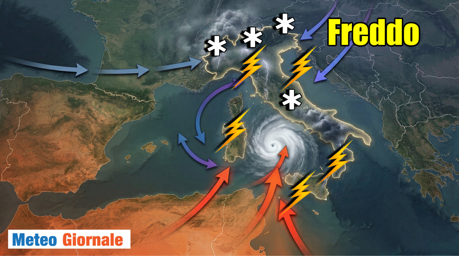
Italy is bracing for a period of intense atmospheric instability as an African cyclone Italy is currently sweeping across the peninsula, bringing with it a dramatic shift in weather patterns and a massive influx of Saharan sand. Starting Sunday, April 12, 2026, the region has transitioned from nearly summer-like conditions to a volatile phase of maltempo, characterized by leaden skies and plummeting temperatures.
The current meteorological event is driven by a vast Afro-Mediterranean depression that has triggered a series of disruptive phenomena. From the Alps in the north to the shores of Sicily in the south, the country is experiencing a combination of strong Scirocco winds, widespread rainfall and intense thunderstorms. This sudden shift follows a period of unseasonable warmth, leaving many regions unprepared for the rapid descent into chaotic weather.
Central to this event is the transport of enormous quantities of desert dust. As the cyclone moves, We see lifting sand from the Sahara and carrying it thousands of meters into the atmosphere, creating a milky, opaque haze that has already begun to reduce visibility and tint the sky in yellowish hues across several Italian regions. This atmospheric intrusion is not merely a visual curiosity but a precursor to more severe weather impacts expected throughout the early part of the week.
The Mechanics of the Saharan Sandstorm
The current weather crisis is the result of a specific meteorological mechanism centered in North Africa. According to verified reports, a cyclone formed between Morocco and Algeria, acting as a vacuum that pulled dust and sand from the Sahara desert into the air. The Saharan dust is being propelled toward the central Mediterranean by powerful Scirocco winds, which are lifting the particles to high altitudes before depositing them over Italy.
This phenomenon, often referred to as a “sandstorm” occurs when strong winds lift particulate matter into the atmosphere, where it is then transported over vast distances by high-altitude currents. For residents in Italy, this has resulted in a “milky” atmosphere and a filtered, yellow light that is characteristic of the most intense Saharan intrusions. The presence of these particles significantly alters the visual quality of the environment, creating a claustrophobic, opaque sky.
Impact Across the Italian Peninsula
The reach of this African cyclone is comprehensive, with the risk of severe weather extending from the northernmost peaks of the Alps to the southern tip of Sicily. While the entire country is under the influence of the system, certain areas are facing higher risks of intense phenomena. The cyclone is expected to hit Italy in full force starting April 12, bringing a cocktail of clouds, strong winds, and heavy precipitation.
The most intense rainfall and thunderstorm activity are projected to affect the North of Italy and the Tyrrhenian regions. These areas are particularly vulnerable to the “dirty rain” associated with the dust clouds, as the moisture from the cyclone mixes with the suspended Saharan particles. This combination is expected to create significant disruptions in visibility and potential hazards for transportation and outdoor activities.
The Phenomenon of “Dirty Rain”
One of the most striking effects of this event is the occurrence of “pioggia sporca,” or dirty rain. This happens when precipitation droplets encapsulate the desert dust particles as they fall through the atmosphere. The result is rain that takes on yellowish or reddish tones, leaving a layer of sandy residue on cars, balconies, and roads once the water evaporates.
This residue is a direct physical manifestation of the cyclone’s reach, bringing the geography of North Africa directly into the urban centers of Italy. The transition from clear, sunny skies to these muddy precipitates marks a sharp turn in the spring weather narrative for 2026.
A Pattern of Atmospheric Chaos
This latest surge of instability is not an isolated incident but part of a wider trend of weather volatility this spring. The arrival of the African cyclone comes shortly after the passage of Cyclone Erminio, which occurred before Easter. Damage assessments are still underway in the mid-lower Adriatic region following the excessive rainfall brought by Erminio.

The rapid oscillation between “almost summer” temperatures and intense, cold-core depressions suggests a highly unstable atmospheric setup for April 2026. The current event is characterized by a sharp thermal drop, ending the period of warmth and introducing a phase of intense maltempo that is expected to persist into the beginning of the coming week.
| Feature | Observed/Expected Effect | Primary Regions Affected |
|---|---|---|
| Atmospheric Color | Yellowish, opaque, milky haze | Widespread across Italy |
| Precipitation | “Dirty rain” (yellow/reddish) and intense storms | North and Tyrrhenian regions |
| Wind Patterns | Strong Scirocco winds | Mediterranean coastlines |
| Temperature | Sharp thermal drop | National |
Key Takeaways for Residents and Travelers
- Visibility: Expect reduced visibility due to suspended Saharan dust and leaden skies.
- Cleaning: Be prepared for sandy residues on outdoor surfaces following the “dirty rain” episodes.
- Weather Shifts: A significant drop in temperature is occurring; appropriate clothing for a sudden cold snap is advised.
- Alerts: Those in the North and Tyrrhenian areas should remain vigilant for intense thunderstorms and heavy rainfall.
As the African cyclone continues its trajectory, meteorologists are monitoring the movement of the depression to determine when the atmosphere will clear. For now, the “atmospheric chaos” remains the dominant theme of the Italian spring, with the Sahara’s influence leaving a literal and figurative mark on the landscape.
The next critical checkpoint for weather updates will be the reports issued early this coming week, which will determine if the intensity of the storms subsides or if further Saharan intrusions are likely. Stay tuned for official weather advisories and local civil protection alerts.
Do you have photos of the yellow skies or dirty rain in your area? Share your experiences in the comments below and let us know how the weather is affecting your region.